034. Amount of forests map
Amount of forests map
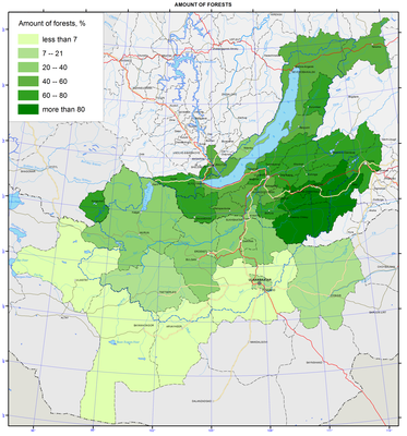
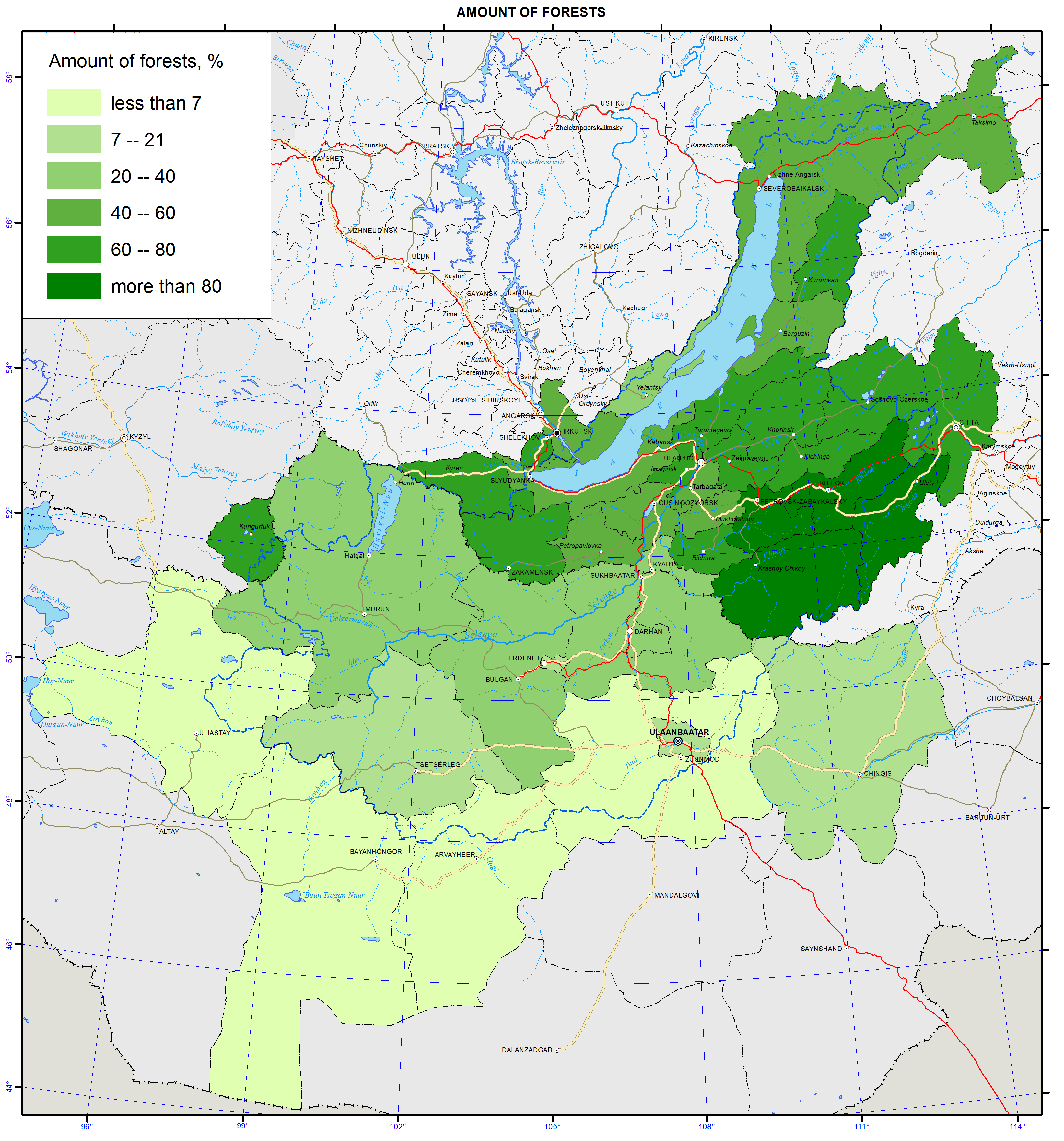
Forest cover
Forest cover is a parameter reflecting the ratio of the total forested area (on forest lands and lands of other categories where forests are located) to the area of the municipality (district or aimak). Forest cover is an important indicator characterizing the forest availability, and, consequently, the ecological security and the features of the socio-economic development of a territory.
Average forest cover of the Baikal basin within the Russian territory is 62.5 %. Forest cover fluctuates here from 26.4 % in Kyakhtinsky district, located in the steppe part of the Republic of Buryatia, to 82-89 % in Krasnochikoysky, Petrovsk-Zabaikalsky, Uletovsky, and Khiloksky districts of Zabaikalsky krai. In Mongolia, the average forest cover is significantly lower than in the Russian part of the basin amounting to 11.5 %, and it ranges from 0.75 % (Uverkhangay aimak) to 35.0 % (Darkhan aimak).
Over the last decade (2000-2010) a decrease in forest cover in the most developed parts of the Baikal watershed basin is registered. This is associated with the reduction of forested lands due to areas, subjected to fire, cutting, and insect pests.
