<?xml version="1.0" encoding="utf-8" ?>
<rdf:RDF xmlns:rdf="http://www.w3.org/1999/02/22-rdf-syntax-ns#" xmlns:dc="http://purl.org/dc/elements/1.1/" xmlns:syn="http://purl.org/rss/1.0/modules/syndication/" xmlns="http://purl.org/rss/1.0/">


<channel rdf:about="http://bic.iwlearn.org/search_rss">
  <title>Байкальский информационный центр</title>
  <link>http://bic.iwlearn.org</link>

  <description>
    
            These are the search results for the query, showing results 12 to 26.
        
  </description>


  <image rdf:resource="http://bic.iwlearn.org/logo.png"/>

  <items>
    <rdf:Seq>
      
        <rdf:li rdf:resource="http://bic.iwlearn.org/en/documents/state-of-the-environment-report-the-lake-baikal-basin-1/state-regulation-and-public-movement-of-environmental-protection-and-nature-management/5-5-environmental-education"/>
      
      
        <rdf:li rdf:resource="http://bic.iwlearn.org/en/documents/state-of-the-environment-report-the-lake-baikal-basin-1/state-regulation-and-public-movement-of-environmental-protection-and-nature-management/5-4-state-environmental-expertise"/>
      
      
        <rdf:li rdf:resource="http://bic.iwlearn.org/en/documents/state-of-the-environment-report-the-lake-baikal-basin-1/state-regulation-and-public-movement-of-environmental-protection-and-nature-management/5-3-the-system-of-state-environmental-supervision"/>
      
      
        <rdf:li rdf:resource="http://bic.iwlearn.org/en/documents/state-of-the-environment-report-the-lake-baikal-basin-1/state-regulation-and-public-movement-of-environmental-protection-and-nature-management/5-2-environmental-programs-plans-and-their-implementation"/>
      
      
        <rdf:li rdf:resource="http://bic.iwlearn.org/en/documents/state-of-the-environment-report-the-lake-baikal-basin-1/state-regulation-and-public-movement-of-environmental-protection-and-nature-management/5-1-legal-regulation-in-the-sphere-of-environmental-protection"/>
      
      
        <rdf:li rdf:resource="http://bic.iwlearn.org/en/documents/state-of-the-environment-report-the-lake-baikal-basin-1/ecological-conditions/4-4-dangerous-natural-phenomena-and-processes"/>
      
      
        <rdf:li rdf:resource="http://bic.iwlearn.org/en/documents/state-of-the-environment-report-the-lake-baikal-basin-1/ecological-conditions/4-3-anthropogenic-pollution-hotspots-and-their-impact-on-the-environment"/>
      
      
        <rdf:li rdf:resource="http://bic.iwlearn.org/en/documents/state-of-the-environment-report-the-lake-baikal-basin-1/ecological-conditions/4-2-water-pollution"/>
      
      
        <rdf:li rdf:resource="http://bic.iwlearn.org/en/documents/state-of-the-environment-report-the-lake-baikal-basin-1/ecological-conditions/4-1-air-pollution"/>
      
      
        <rdf:li rdf:resource="http://bic.iwlearn.org/en/documents/state-of-the-environment-report-the-lake-baikal-basin-1/socio-economic-conditions/3-5-recreational-resources"/>
      
      
        <rdf:li rdf:resource="http://bic.iwlearn.org/en/documents/state-of-the-environment-report-the-lake-baikal-basin-1/socio-economic-conditions/3-4-forest-resources"/>
      
      
        <rdf:li rdf:resource="http://bic.iwlearn.org/en/documents/state-of-the-environment-report-the-lake-baikal-basin-1/socio-economic-conditions/3-3-aquatic-biological-resources"/>
      
      
        <rdf:li rdf:resource="http://bic.iwlearn.org/en/documents/state-of-the-environment-report-the-lake-baikal-basin-1/socio-economic-conditions/3-2-land-resources"/>
      
      
        <rdf:li rdf:resource="http://bic.iwlearn.org/en/documents/state-of-the-environment-report-the-lake-baikal-basin-1/socio-economic-conditions/3-1-mineral-raw-resources"/>
      
      
        <rdf:li rdf:resource="http://bic.iwlearn.org/en/documents/state-of-the-environment-report-the-lake-baikal-basin-1/natural-conditions/2-4-animal-world"/>
      
    </rdf:Seq>
  </items>

</channel>


  <item rdf:about="http://bic.iwlearn.org/en/documents/state-of-the-environment-report-the-lake-baikal-basin-1/state-regulation-and-public-movement-of-environmental-protection-and-nature-management/5-5-environmental-education">
    <title>5.5 Environmental education</title>
    <link>http://bic.iwlearn.org/en/documents/state-of-the-environment-report-the-lake-baikal-basin-1/state-regulation-and-public-movement-of-environmental-protection-and-nature-management/5-5-environmental-education</link>
    <description></description>
    <content:encoded xmlns:content="http://purl.org/rss/1.0/modules/content/"><![CDATA[<p align="center"><b>5.5 Environmental education</b></p>
<p style="text-align: justify; ">Environmental education and information dissemination raise public awareness and facilitate public participation in tackling the issues of biodiversity conservation, natural resource management and sustainable development of Baikal region and depend entirely on the educational level of the society in general [3].</p>
<p style="text-align: justify; ">Environmental education and awareness-raising campaigns are aimed at solving the following tasks:</p>
<p style="text-align: justify; ">-  modification of study programs to include/enhance environmental education and publication of textbooks incorporating environmental education aspects;</p>
<p style="text-align: justify; ">-  organization of extracurricular activities, summer schools and conferences;</p>
<p style="text-align: justify; ">-  environmental awareness raising through mass media and publication of specialized journals;</p>
<p style="text-align: justify; ">-  information dissemination and educational activities (for example, festive events during the World Environment Day, World Day of Water Resource Protection, International Birds Day and Day of Baikal);</p>
<p style="text-align: justify; ">-  Training of teachers specializing in environment-related issues at the regional and municipal levels.</p>
<p style="text-align: justify; ">There are two UNESCO chairs in Baikal region (University Twinnings). The chair of water resources was set up according the agreement between the UN (UNESCO) and Irkutsk State University signed on March 30, 2001. This is the only chair for water resources in Russia. Savoy University of France acted as the foreign counterpart. Apart from the departments of Irkutsk State University, the chair cooperates with Buryat State University, Institute of Earth Crust SB RAS, Vinogradov Institute of Geochemistry SB RAS and Baikal Institute of Nature Management SB RAS (the head of the chair is Prof. Smirnov A.I.)</p>
<p style="text-align: justify; ">The research activities of the chair have the following directions:</p>
<p style="text-align: justify; ">-  study of the qualitative and quantitative composition of natural waters within the research area;</p>
<p style="text-align: justify; ">-  development of the theoretical and methodological basis for integrated management and rational use of water resources, research into the interconnectedness and interaction of the surface and underground layers of the hydrosphere;</p>
<p style="text-align: justify; ">-  expansion of the geopolitical analysis of water resources, a field of expertise of Savoy University;</p>
<p style="text-align: justify; ">-  creation of an open access database of water resources within the research area.</p>
<p style="text-align: justify; ">The international project «Water resource network» is considered one of the main ways of implementing the priority tasks. «Water resource network» has been established by Irkutsk State University and Savoy University with UNESCO support and now, besides the universities, includes Mongolian National University, several water resource departments in the Mediterranean region, Institute of Geochemistry SB RAS, Institute of Geography SB RAS, and Buryat State University. In 2009, an agreement on cooperation was signed by UNESCO and «Water resource network» within the frameworks of UNITWIN/UNESCO program.</p>
<p style="text-align: justify; ">In 2013, talks were held in Chambery city (France) regarding further development and expansion (both spatially and functionally) of «Water resource network». Furthermore, in August of 2013, Summer School was conducted at Biology station of Irkutsk State University in the village of Bolshie Koty, near Lake Baikal. During the event, meetings and talks took place over the future of the Network. A fundamental two-volume book «Baikalology» was prepared and published, which was among four best books in the field of natural sciences, technology and medicine at the All-Russian contest «Best books of 2012».</p>
<p style="text-align: justify; "><i>The UNESCO chair for environmental ethics </i>at the East-Siberian State University for Technology and Management («VSGUTU») in Ulan-Ude (Republic of Buryatia) was set up in April 2006 by the decision of UNESCO General Conference (the chair head is Prof. Saktoev V.E., the University President).</p>
<p style="text-align: justify; ">By now, the chair has delivered the following research output:</p>
<p style="text-align: justify; ">-  conceptual basis for the international UN-supported project «Baikal model territory of sustainable development»;</p>
<p style="text-align: justify; ">-  conceptual basis for socio-economic development strategy for the Republic of Buryatia;</p>
<p style="text-align: justify; ">-  Baikal declaration of environmental ethics;</p>
<p style="text-align: justify; ">-  concept of «moral» economy aimed at conservation of Lake Baikal Natural Territory;</p>
<p style="text-align: justify; ">-  conceptual basis for sustainable tourism development in Baikal region.</p>
<p style="text-align: justify; ">The research results are embedded into the educational process along the following directions:</p>
<p style="text-align: justify; ">-  a masters’ program in the field of sustainable development and environmental ethics was developed based on the expertise of the chair personnel and personality-oriented teaching approach;</p>
<p style="text-align: justify; ">-  the lecture course «Philosophy of sustainable development and science ethics in the information age» was developed to be taught to young scientists, Ph.D. and Master students of the East-Siberian State University for Technology and Management;</p>
<p style="text-align: justify; ">-  the club “Millennium” continued its fruitful work with grade 1-9 secondary school students.</p>
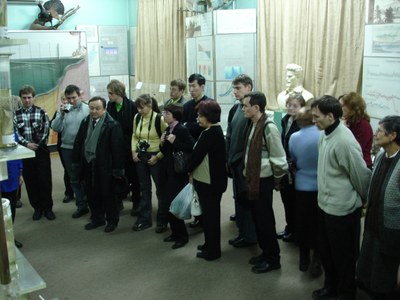
<p style="text-align: justify; "><b><i>Irkutsk Oblast.</i></b><i> </i>Baikal Museum of the Siberian Branch of the Russian Academy of Sciences located in the village of Listvyanka receives about 90 thousand visitors per year. The number includes school and university students, teachers, representatives of Russian and foreign companies, governments, and state organizations, and forum/conference participants (pic. 5.5.1).</p>
<p style="text-align: center; "><span> <img class="image-inline" src="../../../resolveuid/5961d63360a34f28bbcd369e3db33c26/@@images/image/preview" /></span></p>
<p align="center">Pic. 5.5.1 An excursion at the Baikal Museum</p>
<p style="text-align: justify; ">Research and educational activities of the Museum rely on 8 expositions and include the following regular events: Oblast-wide ecological summer school on Baikal studies, Day of Knowledge, «Baikal connoisseurs» competition, and an international competition in Baikal studies. In 2012, the Museum hosted 6 thematic expositions.</p>
<p style="text-align: justify; ">Environmental education center of the Museum is equipped with a computer room and the «microscope-computer» system consisting of 21 computers connected into one network, which makes possible interactive classes in ecology and Baikal studies for school and university students as well as makes the Museum resources available to the wide audience.</p>
<p style="text-align: justify; ">In 2013, Baikal museum and the association «Baikal-EcoNetwork» published a workbook «Outline maps of Lake Baikal for grade 5-6 students» as a supplementary teaching resource for teaching Baikal studies.</p>
<p style="text-align: justify; ">Environmental education in the schools of Irkutsk Oblast is realized through the introduction of such disciplines as «Ecology» and «Baikal studies» into curriculum, as well as through organization of integrated classes and extracurricular activities. Additional environmental classes are given as part of the non-mandatory and elective courses, work of children’s environmental associations, hosting of large-scale ecological development-oriented events and the involvement of school children in the activities of ecological summer camps.</p>
<p style="text-align: justify; ">In 2013, more than 23 thousand students in Irkutsk region were enrolled in elective and special courses in ecology, Baikal studies and natural sciences. In municipal institutions of general education, 448 circles of ecological/biological sciences engaging about 7 500 students were functioning. In municipal institutions of additional education of Irkutsk region, 1 055 associations devoted to environmental/natural sciences and engaging about 14 500 teenagers were functioning.  In Irkutsk region, 7 institutions of additional education devoted to environmental/natural sciences and engaging more than 10 thousand children were functioning.</p>
<p style="text-align: justify; ">In 2012, based on the intermediate results of a regional experiment on adapting educational resources to teaching Baikal studies, a new edition of the manual “Baikalology” (Live world of Lake Baikal. Man and Lake Baikal. 6 (7) grade) was published.</p>
<p style="text-align: justify; ">The most important activities included:</p>
<p style="text-align: justify; ">-  a region-wide children’s environmental festival “Baikal kaleidoscope” (March 28-29, 2012);</p>
<p style="text-align: justify; ">-  a region-wide convent of school forestry associations (June 22-26, 2012).</p>
<p style="text-align: justify; ">-  the first international competition among school students in Baikal studies (June 5-8, 2012). Twenty four teams from the educational institutions of Irkutsk Oblast, the Republic of Buryatia, Zabaikalsky Krai and Mongolia took part in the competition. The competition was hosted by Baikal Museum of the Irkutsk Scientific Center SB RAS. Results of the competition were announced during the work of the «Baikal-Huvsgul» creative workshop.</p>
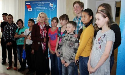
<p style="text-align: justify; ">-  the second international competition in Baikal studies «Let’s save Baikal» (June 5-8, 2013) took place in Baikal Museum of the Irkutsk Scientific Center SB RAS. More than 100 school children from Irkutsk Oblast, Zabaikalsky Krai and the Republic of Buryatia participated in the competition. For the first time school children from Korea and China took part in the competition [4, 6] (рис. 5.5.2).</p>
<p align="center"><img class="image-inline" src="../../../resolveuid/a96cb1000c9547bba1635ff433bf062d/@@images/image/preview" /></p>
<p align="center">Pic. 5.5.2. The winners of the 2<sup>nd</sup> International contest among schoolchildren in Baikal studies</p>
<p align="center">“Let’s save Baikal”.</p>
<p style="text-align: justify; "><b><i> Republic of Buryatia</i></b>. Ministry of Natural Resources of the Republic of Buryatia came up with «Strategy for the Development of Continuous Environmental Education and Formation of Ecological Culture on the Territory of the Republic of Buryatia in 2012-2016» (approved by the resolution of the Government of the Republic of Buryatia № 682 of December 21, 2011). The Strategy is implemented by the public environmental council chaired by the Deputy Head of the Government.</p>
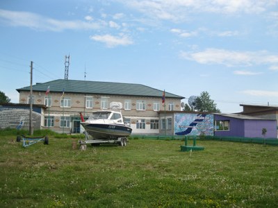
<p style="text-align: justify; ">International ecological and educational center «Istomino» of Baikal Institute of Nature Management, located in the Selenga river delta (Republic of Buryatia, village of Istomino), is one of the biggest in Siberia (pic. 5.5.3).</p>
<p align="center"><img class="image-inline" src="../../../resolveuid/42ad491c12bd45428b2a55df23fdc169/@@images/image/preview" /></p>
<p align="center">Pic. 5.5.3 The international ecological and educational center «Istomino»</p>
<p style="text-align: justify; "><span>Its major activities include:</span></p>
<p style="text-align: justify; ">-  scientific and material/technical support to the fundamental research into Lake Baikal ecosystem and the Selenga river delta as the indicator of anthropogenic impact and natural changes in Lake Baikal basin;</p>
<p style="text-align: justify; ">-   hosting scientific expeditions;</p>
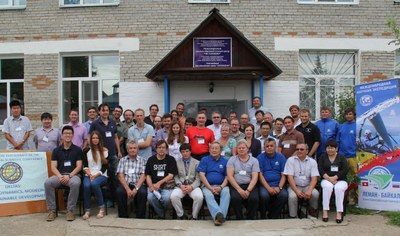
<p style="text-align: justify; ">-  hosting scientific meetings, conferences and workshops on the issues of sustainable development of Baikal region (pic. 5.5.4);</p>
<p style="text-align: justify; ">-  organization of specialized practical courses for science students and summer schools for gifted children in environmental studies, chemistry, physics and mathematics;</p>
<p style="text-align: justify; ">-  development of ecotourism; demonstration of organic farming and production of organic food with the use of renewable energy sources.</p>
<p style="text-align: center; "><span> <img class="image-inline" src="../../../resolveuid/a901cf112a434b33859ce5087c0f702e/@@images/image/preview" /></span></p>
<p align="center">Pic. 5.5.4 Participants of the International conference</p>
<p align="center">«Deltas: genesis, dynamics, modeling and sustainable development»</p>
<p style="text-align: justify; ">Activities:</p>
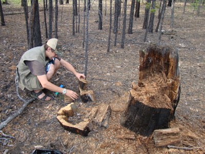
<p style="text-align: justify; ">- July 26 - August 10, 2012 – International dendroecological expedition in Western Zabaikalie (Republic of Buryatia) with the participation of researchers of the Siberian Federal University (Krasnoyarsk city) and the University of Arizona (USA) (pic. 5.5.5);</p>
<p align="center"><img class="image-inline" src="../../../resolveuid/e1c752e70ffc4001a16dcc8be3be4e11/@@images/image/preview" /></p>
<p align="center">Pic. 5.5.5 A participant of the International dendroecological expedition</p>
<p style="text-align: justify; ">-  July 27 – August 1, 2012 – International workshop with the participation of scientists from Mongolia (12 people) within the frameworks of the project «Study of the spatial-temporal trends in the interaction between landscape and natural-economic complexes in the northern Central Asia under conditions of the contemporary desertification processes»;</p>
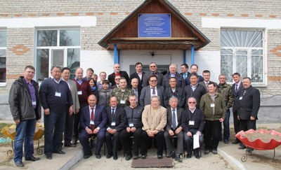
<p style="text-align: justify; ">- April 18 – April 20, 2013 – Meeting of the heads of the municipal districts of Pribaikalie and the administration of specially protected natural territories within the frameworks of the Federal target program «Protection of Lake Baikal and socio-economic development of the natural territory in 2012-2020» under the support of the Ministry of Natural Resources of the Republic of Buryatia (pic. 5.5.6);</p>
<p align="center"><img class="image-inline" src="../../../resolveuid/a4c64f6e34d040dc99367eeb5d500d03/@@images/image/preview" /></p>
<p align="center">Pic. 5.5.6 Participants of the Meeting of the heads of the municipal districts of Pribaikalie and the administration of specially protected natural territories</p>
<p style="text-align: justify; ">- June 26 – June 30, 2013 – VII school-seminar of young scientists «The issues of sustainable development in Russian regions»;</p>
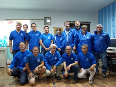
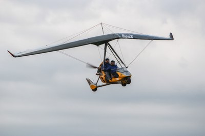
<p style="text-align: justify; ">- June 25 – August 08, 2013 – international expedition within frameworks of the project «Trans-Eurasian Flight Leman-Baikal» with the participation of scholars from France and Switzerland (pic. 5.5.7, pic. 5.5.8);</p>
<p align="center"><img class="image-inline" src="../../../resolveuid/35df1362e9304d90a6a854e15c403e84/@@images/image/preview" /></p>
<p align="center">Pic. 5.5.7 Participants of the international expedition within frameworks of the project «Trans-Eurasian Flight Leman-Baikal»</p>
<p align="center"><img class="image-inline" src="../../../resolveuid/26dc0aeb7358452c97beb7398779f740/@@images/image/preview" /></p>
<p align="center">Pic. 5.5.8 An ultralight trike in the sky</p>
<p style="text-align: justify; ">- July 30 – August 2, 2013 – Workshop «Environmental issues within Lake Baikal basin and the role of «green economy» in their resolution» with the participation of specialists from Mongolia, including officials from the Ministry of Ecology, Green Development and Tourism, and Agency for civil supervision of police, and the Republic of Buryatia was represented by officials from Forest Agency and Burprirodnadzor.</p>
<p style="text-align: justify; ">The educational work of «Ecological and biological center of the Ministry of education and science of the Republic of Buryatia» was realized in 2012-2013 through the activities devoted to raising environmental awareness and reviving environment protection traditions of the people of the Republic – «Preserve forest for the future generations» campaign, ethno-ecological festival «Sagalgan», «Meet birds with love» campaign, «Ecological month» and «Young naturalist» ecological camp.</p>
<p style="text-align: justify; ">The traditional exhibition of children’s works «Live, the Earth» provides an opportunity to more than 500 gifted students from the Republic to display their works on the annual basis. The conference «Earth – our home» was meant to reveal and provide assistance to the talented and gifted children in their further career paths.</p>
<p style="text-align: justify; ">In 2012, as part of the established tradition, students participated in the following activities:</p>
<p style="text-align: justify; ">-  an all-Russian scientific ecological-biological contest in the sphere of children’s additional education;</p>
<p style="text-align: justify; ">-  the international all-Russian children’s ecological forum «Green planet»;</p>
<p style="text-align: justify; ">-  the competition in memory of  Vernadsky V.I.;</p>
<p style="text-align: justify; ">-  the all-Russian forestry competition «Young Growth»;</p>
<p style="text-align: justify; ">-  an all-Russian contest of water-related projects among senior school students;</p>
<p style="text-align: justify; ">-  the all-Russian contest «My smaller homeland: nature, culture and ethnos»;</p>
<p style="text-align: justify; ">-  an all-Russian contest of interdisciplinary projects and programs in environmental and local lore studies.</p>
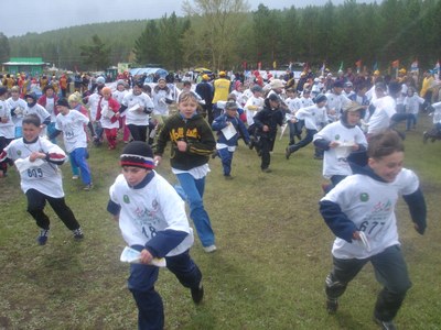
<p style="text-align: justify; ">Orienteering Federation of the Republic of Buryatia (Chairman E.Y. Osipov, <a href="http://www.fso.sdep.ru/">www.fso.sdep.ru</a>) conducts significant educational work among the younger generation. In 2012-2013, the Federation held mass events in Ulan-Ude city, town of Gusinoozersk, in the village of Sagan-Nur and on Lake Schuschiye, attended by more than 600 schoolchildren (pic. 5.5.9).</p>
<p style="text-align: center; "><span> <img class="image-inline" src="../../../resolveuid/c4b7200c9d084fedb10b623da65e2905/@@images/image/preview" /></span></p>
<p style="text-align: center; ">Fig. 5.5.9 All-Russia competitions in orienteering – «Russian azimuth»</p>
<p style="text-align: justify; ">Within the frameworks of celebrating «Year of forests» students organized «Preserve forests from fires» campaign. On May 12, the Day of National Forest Planting, the students of the Center together with the representatives of the Federal Forest Agency (Rosleskhoz), bodies of the executive and legislative power of the Republic of Buryatia planted about 960 pine trees in Izhir, not far from Todokhta village of Zaigraevsky district. In addition to that, within the framework of the international year of forests the roundtable «Promotion of school forest associations in the Republic of Buryatia» was organized by the city forestry association and secondary school № 49.</p>
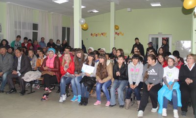
<p style="text-align: justify; ">On September 27-29, 2013, the 9<sup>th</sup> interregional competition in Baikal studies was held in Ulan-Ude city. 20 teams from 11 districts of the Republic of Buryatia took part in the competition.  The competition had 4 categories – «Baikal flora», «Baikal fauna», «Limnology» and «Environmental monitoring» (pic. 5.5.10). The finalists represented the Republic at the 1<sup>st</sup> All-Russian Youth Conference of the Russian Geographic Society held in Kaluzhskaya Oblast on November 2-6, 2013.</p>
<p align="center"><img class="image-inline" src="../../../resolveuid/ed186c0bde5a486781a1ba0205291e5a/@@images/image/preview" /></p>
<p align="center">Pic. 5.5.10 Participants of the 9<sup>th</sup> interregional competition in Baikal studies</p>
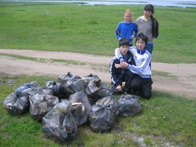
<p style="text-align: justify; "><span>On September 27-28, 2013, the 5</span><sup>th</sup><span> Baikal educational forum of the environmental movement leaders devoted to the Year of Environmental Protection and the Year of Tourism was held in Ulan-Ude city by the school «ECOS» with the support from the Ministry of Natural Resources of the Republic of Buryatia. The forum participants were 8-11 grade students, school teachers and teachers of institutions of additional education of Ulan-Ude city. The following activities were conducted within the framework of the forum: an intellectual Internet-marathon, a photo vernissage «My Baikal», «Antiwaste» campaign (pic. 5.5.11), and «Environmental footprint on Earth» campaign.</span></p>
<p align="center"><img class="image-inline" src="../../../resolveuid/044b21651032432f822fcb54d6571fa4/@@images/image/preview" /></p>
<p align="center">Pic. 5.5.11 Participants of the «Antiwaste» campaign</p>
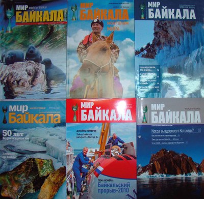
<p style="text-align: justify; ">Since 2004, the journal «World of Baikal» has been published under the aegis of the Ministry of Natural Resources and Baikal Institute of Nature Management SB RAS. Till the end of 2013, 40 issues of the journal have been published [8] (pic. 5.5.12).</p>
<p align="center"><img class="image-inline" src="../../../resolveuid/c9a966504b464fe29330d6ebcf02a13c/@@images/image/preview" /></p>
<p align="center">Pic. 5.5.12  Issues of the journal «World of Baikal»</p>
<p style="text-align: justify; "><b><i>Zabaikalsky Krai. </i></b>In accordance with the regional action plan for implementation of the Strategy for developing the system of environmental education and formation of ecological culture in Zabaikalsly Krai in the period till 2020 approved by the Resolution of the Government of Zabaikalsky Krai № 673-r on October 20, 2009, the funding for activities related to environmental education and formation of «ecological» culture is allocated from municipal budgets. Diverse regional level environmental campaigns, competitions, meetings and expeditions were organized in 2012 – 2013.</p>
<p style="text-align: justify; ">As a way to fulfill the order of the Ministry of Education, Science and Youth Policies of Zabaikalsky Krai № 509а of June 21, 2012, the Center for education quality assessment introduced indicators of environmental education. These indicators will be considered while determining the efficiency ratings of municipal formations.</p>
<p style="text-align: justify; ">The laboratory of environmental education of Zabaikalsky State University in collaboration with pedagogues, education specialists and scientists of Zabaikalsky Krai and other regions of Russia provide scientific support to the system of environmental education, including the development of diverse teaching materials in electronic format, teaching manuals in accordance with the new state standard. The following materials were published: the workbook «My native Zabaikalie: I learn to ask questions» (authors – E.A. Igumnova, I.V. Barakhoeva), a practical manual for organizing independent work of students – «Regional ecology» (authors – E.A. Igumnova, O.V. Korsun), the manuals «Ecological excursions to the nature of Zabaikalie» (author – O.V. Korsun), and the popular science book «Basin of the Amur River in Zabaikalie» (edited by N.V. Pomazkova).</p>
<p style="text-align: justify; ">Annually, on April 22, educational and environmental institutions set up the environmental campaign «To protect nature means to love Homeland». In 2012, 140 organizations participated in the campaign.</p>
<p style="text-align: justify; ">The website «Nature of Zabaikalie» («Zabaikalie is splendid») has been maintained as an innovative information-sharing and educational Internet-resource in Russian and English languages [9].</p>
<p style="text-align: justify; ">The Krai-level ecological newspaper «Preserve the natural environment» is published with the circulation of 999 papers.</p>
<p style="text-align: justify; ">The chair for ecology and environmental education of Zabaikalsky State University, established jointly by the Chernyshevsky Zabaikalsky State Pedagogical University and the local institute of the Russian Academy of Sciences, is functioning in the region.</p>
<p style="text-align: justify; ">A team of secondary school students from Novaya Kuka village representing the club «Young Excursion Guide» took part in the 1<sup>st</sup> International Competition in Baikal studies (2012). The team of Zabaikalsky Krai was awarded the first prize for the project «Lake Kotokel – Gaff disease – Lake Baikal – Lake Kenon».</p>
<p style="text-align: justify; ">On April 18-19, 2013, the 3<sup>rd</sup> regional competition in Baikal studies «Baikal is in my heart» was held.  83 school students from 16 districts of Zabaikalsky Krai and students of the Ecology and Biology Center of Ulan-Ude city, the Republic of Buryatia took part in the competition</p>
<p style="text-align: justify; ">On May 23, 2013, a waste collection campaign was conducted in the Ivano-Arakhleisky natural landscape sanctuary. The campaign was timed to commemorate the international day of biodiversity. Students and teachers of secondary school № 33 of Chita city, staff of «Ecologiya» Ltd. and the sanctuary took part in the campaign.</p>
<p style="text-align: justify; ">In <b>Mongolia</b>, several trainings in environmental protection, environmental awareness raising and dissemination of information were organized during 2012-2014 [10]. The Institute of Teachers’ Professional Development and Mongolian Education Alliance organized the training course «Sustainable development – Eco school on November 18-19, 2013.  The activity was funded by Swiss Development Agency. 20 teachers learned the methods of incorporating environmental studies into various academic subjects. In addition, «Participating community - Eco school» training course to prepare teachers for module training was held on January 27-28, 2014, and it also focused on reflecting the idea of «sustainable development» in each lesson.</p>
<p style="text-align: justify; ">The Institute of Teachers’ Professional Development organized «Professional training for the chemistry teachers who are in their  first year of teaching» during February 4-13, 2014 and «Professional training for the biology teachers who are in their fifth or sixth year of teaching» on May 2-9, 2014. The 115 teachers who participated in the above trainings have also participated in an outdoor training course organized by the freshwater resource agency of the Ministry of Environment and Green development (MEGD) and have listened to lectures and have seen documentary films and museum expositions devoted to environmental pollution and proper utilization of water resources. As a result of these training courses the teachers were introduced to the concepts of sustainable development and environmental education, learned instruction techniques adjusted to children’s age, and learned new teaching approaches overall. The institute conducted 21 training sessions attended by 1270 teachers during 2013-2014.</p>
<p style="text-align: justify; ">In December 2012, UN general assembly announced 2013 as a «Year of Global Water Partnership». Within the framework of the year celebrations, the Ministry of Environment and Green Development focused its attention on water supply services, distribution of water, increasing water demand and usage, and organized awareness raising and advertising campaigns in order to expand international and inter-sectorial partnership and enhance comprehensive cooperation for addressing water management challenges. Moreover, the meeting «Water policy-integrated action» was held on January 29, 2013 in Ulaanbaatar city with the purpose of  facilitating information exchange, enhancing transboundary cooperation over water management issues, defining national and international legal frameworks and consistency with the Millennium Development Goals. Totally, 95 representatives from government and non-governmental institutions participated.</p>
<p style="text-align: justify; ">The seminar «The multi-stake-holder council for improving social involvement in addressing environmental challenges and promoting cooperation by collective decision-making» was held on March 29, 2013 with the objectives of intensifying the work of the multilateral council, promoting the rational and responsible use of natural resources, promoting the overall idea if environmental protection. More than 100 people participated in this seminar and exchanged their opinions.</p>
<p style="text-align: justify; ">The environmental law package adopted during the spring session of State Great Khural in 2012 created the legal framework for implementing Integrated Water Resource Management. 29 river basin authorities were established all over the country. Therefore, the training on «Legal framework for implementing Integrated Water Resource Management in river basins» was organized on April 25, 2013 in Darkhan-Uul aimag. The purpose of the training was to deliver information on specific provisions of the laws and to enhance legal awareness of the local decision makers, water users, and law enforcement agencies. Totally, there were 72 participants, who were mainly officials of the Environment and Tourism Agencies of Orkhon, Selenge, Tuv, and Bulgan aimags and officials of the basin councils for the rivers Eruu and Selenga in Selenge aimag.</p>
<p style="text-align: justify; ">The seminar «Environmental and economic assessment of natural resource and ecosystem services to support the development of an ecosystem based adaptation strategy» was held on October 4, 2012 and was attended by 64 participants from various organizations, including national consultant teams, project implementation units, science institutions, NGOs, universities and project implementation aimags. The purpose of the seminar was consultations over the draft methodology of economic evaluation of climate change-related multilateral arrangements, improving the capacity of national consultant team who will carry out the economic assessment through collecting knowledge and information on best practices in economical assessment model development.</p>
<p style="text-align: justify; ">The seminar «Reformation of rules and regulations following the adoption of a package of environmental laws» was organized on November 28-29, 2012, and was attended by about 100 people. The purpose of the seminar was the discussion of the required changes in laws and regulations for harmonizing the whole body of legislation and implementation of the adopted law package.</p>]]></content:encoded>
    <dc:publisher>No publisher</dc:publisher>
    <dc:creator>Zorigma</dc:creator>
    <dc:rights></dc:rights>
    <dc:date>2015-04-24T07:09:47Z</dc:date>
    <dc:type>Page</dc:type>
  </item>


  <item rdf:about="http://bic.iwlearn.org/en/documents/state-of-the-environment-report-the-lake-baikal-basin-1/state-regulation-and-public-movement-of-environmental-protection-and-nature-management/5-4-state-environmental-expertise">
    <title>5.4 State environmental expertise</title>
    <link>http://bic.iwlearn.org/en/documents/state-of-the-environment-report-the-lake-baikal-basin-1/state-regulation-and-public-movement-of-environmental-protection-and-nature-management/5-4-state-environmental-expertise</link>
    <description></description>
    <content:encoded xmlns:content="http://purl.org/rss/1.0/modules/content/"><![CDATA[<p align="center"><b>5.4 State environmental expertise</b></p>
<p style="text-align: justify; "><b> </b> The system of state environmental expertise (SEE) is regulated by the Federal Law № 174-FL of November 23, 1995 «On environmental expertise». The objects of state environmental expertise of the federal level, including project documentation for construction within specially protected natural territories, are listed in Article 11, while the objects of state environmental expertise of the regional level are listed in Article 12.</p>
<p style="text-align: justify; ">Within Lake Baikal Natural Territory, the branches of Federal Agency for Supervision in the Sphere of Nature Management («Rosprirodnadzor») in Irkutsk Oblast, the Republic of Buryatia and Zabaikalsky Krai jointly with the bodies of executive power are implementing the state policies in the field of environmental expertise [4, 6].</p>
<p style="text-align: justify; ">The central unit of Federal Agency for Supervision in the Sphere of Nature Management conducted state environmental expertise of the entities located within BNT based on the following documents:</p>
<p style="text-align: justify; ">-  documentation substantiating the total permissible catch of aquatic bio-resources in Lake Baikal and its tributaries Barguzin, Selenga, Upper and Angara in 2013 (including the environment impact assessment). The expertise was ordered by Rosrybolovstvo and FSA VNIRO (2012).</p>
<p style="text-align: justify; ">-  remediation of the closed facility of mercury cell electrolysis in the town of Usolye-Sibirskoe (project documentation). The commissioner was Ministry of Natural Resources and Ecology of Irkutsk region  (2013)</p>
<p style="text-align: justify; ">-  documentation substantiating the total permissible catch of aquatic bio-resources in Lake Baikal and its tributaries Barguzin, Selenga, Upper and Angara in 2014. The expertise was ordered by Rosrybolovstvo<b> </b>(2013).<b> </b></p>
<p style="text-align: justify; "><b><i> </i></b><b><i>Irkutsk Oblast. </i></b>In 2012, the branch of Federal Agency for Supervision in the Sphere of Nature Management («Rosprirodnadzor») in Irkutsk Oblast conducted state environmental expertise of 2 entities located within Lake Baikal Natural Territory:</p>
<p style="text-align: justify; ">- documentation substantiating the total permissible catch of aquatic bio-resources in fresh-water bodies of Irkutsk Oblast in 2013;</p>
<p style="text-align: justify; ">- project documentation for «Reconstruction of ferry boat harbor facilities in the village of Sakhyurta, Olkhon Island in Olkhonsky district of Irkutsk Oblast».</p>
<p style="text-align: justify; ">The state environmental expertise approved both the above projects. A negative assessment was given to the project documentation on «Modifications to the design of solid waste landline in the village of Markovo», based on the state environmental expertise conducted in 2011.</p>
<p style="text-align: justify; ">In 2013, state environmental expertise was conducted for one entity:</p>
<p style="text-align: justify; ">- documentation substantiating the maximum permissible catch of aquatic bio-resources in fresh-water bodies of Irkutsk region in 2014-2018. Approval was issued.</p>
<p style="text-align: justify; ">In 2012, Ministry of Natural Resources and Ecology of Irkutsk region conducted the environmental expertise of 2 entities within Lake Baikal Natural Territory, including:</p>
<p style="text-align: justify; ">-  documentation substantiating the limit of procurement of wild hoofed animals, bear and fur-bearing animals during 2012-2013;</p>
<p style="text-align: justify; ">-  documents of complex environmental investigation of the parts of state natural sanctuary «Okunaisky» (Swan lakes) substantiating granting of the legal status of a specially protected natural territory to the sanctuary. State environmental expertise resulted in positive assessments of the above proposals.</p>
<p style="text-align: justify; ">In 2013, regional level state environmental expertise was conducted for the following:</p>
<p style="text-align: justify; ">-  documentation substantiating the limits (quotas) for procurement of animal resources within Irkutsk region during the hunting season from August 1, 2013 to August 1, 2014;</p>
<p style="text-align: justify; ">-  documentation substantiating the introduction of changes into the limits (quotas) for procurement of animal resources within Irkutsk region in the period till August 1, 2014, approved by the order of the Governor of Irkutsk region №264-GO of July 31, 2013;</p>
<p style="text-align: justify; ">-  documentation on complex environmental examination of the territories substantiating granting of the legal status of a specially protected natural territory to “Ulsetskaya Grove” (Batorova Grove) in Alarsky district of Irkutsk region;</p>
<p style="text-align: justify; ">-  documentation substantiating the creation of an area of traditional environmental management in Kachugsky district of Irkutsk region. All the above proposals received positive reviews and were approved.</p>
<p style="text-align: justify; "><b><i>Republic of Buryatia.</i></b><i> </i>In 2012, the branch of Federal Agency for Supervision in the Sphere of Nature Management («Rosprirodnadzor») in the Republic of Buryatia organized and conducted state environmental expertise of 4 entities, 2 of which were located within a specially protected natural territory of the federal level («Tunkinsky national park»):</p>
<p style="text-align: justify; ">-  design documentation for «Construction of an inter-municipal landline for municipal solid waste in the village of Toltoy, Tunkinsky district».</p>
<p style="text-align: justify; ">-  documentation substantiating the amount of total permissible catch of aquatic bio-resources in water bodies of the Republic of Buryatia in 2012;</p>
<p style="text-align: justify; ">-  documentation substantiating the quotas for hunting within «Tunkinsky national park» during the hunting season of 2012-2013;</p>
<p style="text-align: justify; ">-  design documentation for «Constriction of a landline for municipal solid waste in Severobaikalsk city of the Republic of Buryatia». All the proposals received positive assessments.</p>
<p style="text-align: justify; ">In 2013, the branch of Federal Agency for Supervision in the Sphere of Nature Management («Rosprirodnadzor») in the Republic of Buryatia conducted the state environmental expertise of 3 entities within Lake Baikal Natural Territory:</p>
<p style="text-align: justify; ">-  documentation substantiating the amounts of total permissible catch of aquatic bio-resources in water bodies of the Republic of Buryatia in 2014;</p>
<p style="text-align: justify; ">-  documentation substantiating the limits and quotas for hunting within the area of the national park «Tunkinsky», where sport and amateur hunting is allowed, during the hunting season of 2013-2014;</p>
<p style="text-align: justify; ">-  design documentation for «Fire fighting and chemical station of 2<sup>nd</sup> type in Zabaikalsky national park». All the above proposals received positive reviews.</p>
<p style="text-align: justify; ">Ministry of Environment of the Republic of Buryatia conducted the state environmental expertise of 3 regional level entities:</p>
<p style="text-align: justify; ">-  design documentation for «Renovation of housing quarters of the camp «Rovesnik» in the village of Maksimikha»;</p>
<p style="text-align: justify; ">-  documentation substantiating the limits and quotas for hunting within the Republic of Buryatia during the hunting season of 2013-2014;</p>
<p style="text-align: justify; ">-  design documentation for «Reconstruction of the road connecting the main road Shergino – Oymur – Zarechie and the village of Noviy Enkhaluk in Kabansk district of the Republic of Buryatia». The projects received positive assessments.</p>
<p style="text-align: justify; "><b><i> Zabaikalsky Krai</i></b>. In 2012-2013, the branch of Federal Agency for Supervision in the Sphere of Nature Management (“Rosprirodnadzor”) in Zabaikalsky Krai did not receive applications for state environmental expertise.</p>
<p style="text-align: justify; "><i> </i></p>
<p style="text-align: justify; "><b>Environmental monitoring. </b>In 2012-2013, environmental monitoring was carried out by the departments of Rosgydromet, Rosprirodnadzor, Rosvodresursy, Rosnedra, Rosreyestr as well as the competent authorities of the three federation subjects – the Republic of Buryatia, Irkutsk Oblast and Zabaikalksy Krai. In addition to that, the data of Rospotrebnadzor, Rostransnadzor, Rosstat, Rostehnadzor, Ministry of Emergency Situations were used for conducting the monitoring [4,6].</p>
<p style="text-align: justify; ">In 2013, the resolution of the Government of Russian Federation № 681 of August 9, 2013 introduced the Regulations regarding the state environmental monitoring and the data obtained through environmental monitoring. The Regulations establish procedures for meeting the requirements of the Articles 63.1 and 63.2 of the Federal Law №7-FL of January 10, 2002 «On environmental protection» (in its 2011 revision, № 331-FL dated November 21, 2011).</p>
<p style="text-align: justify; ">Creation and maintenance of observation networks and information resources within subsystems of the unified monitoring system is the responsibility of the Federal Agency for Hydrometeorology and Environmental Monitoring, with the help of the federal institutions of executive power authorized to conduct environmental monitoring and the regional institutions of executive power in accordance with their mandate defined by legislation of the Russian Federation.</p>
<p style="text-align: justify; ">According to the Regulations, «State fund is the federal information system ensuring collection, processing and analysis of data», and it includes:</p>
<p style="text-align: justify; ">а) data contained in the databases of the subsystems of the unified monitoring system;</p>
<p style="text-align: justify; ">б) data obtained through industrial monitoring and state environmental supervision;</p>
<p style="text-align: justify; ">в) data of the state register of entities having negative impact on the environment.</p>
<p style="text-align: justify; ">Annex of the Regulations regarding the state environmental monitoring and the data obtained through environmental monitoring contains the List of the types of information to be included into the state fund of environmental monitoring data.</p>
<p style="text-align: justify; ">A type of information included in the list is the data obtained through state environmental monitoring of the unique ecosystem of Lake Baikal as one of the 15 subsystems of the unified system of state environmental monitoring.</p>
<p style="text-align: justify; ">In 2013, the resolution of the Government of the Russian Federation №477 approved the Regulations regarding state monitoring of the environment. The Regulations define the procedures for conducting the state environmental monitoring as well the procedures for establishing a state system of environmental observation.</p>
<p style="text-align: justify; ">The Regulations state that atmospheric air, soils, surface waters, ozone layer, ionosphere and circumterrestrial space are the objects of state environmental monitoring. The state environmental monitoring is organized and conducted by the Federal Agency for Hydrometeorology and Environmental Monitoring, with the help of the federal and regional institutions of executive power in accordance with their mandate.</p>
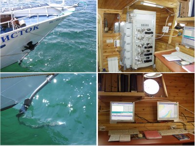
<p style="text-align: justify; ">In 2012-2013, the special monitoring of Lake Baikal water with respect to hydrochemical and hydrophysicochemical parameters was conducted by «Vostsibregionvodkhoz» of Rosvodresursi. The monitoring was carried out using the measurement complex «Akvatoria-Baikal» installed on the research steam-boat «Istok» (pic. 5.4.1).</p>
<p align="center"><span><img class="image-inline" src="../../../resolveuid/baab6390c6f44357b75e3bfa1fba9865/@@images/image/preview" /> </span></p>
<p align="center">Pic. 5.4.1 The onboard measurement complex «Akvatoria-Baikal»</p>
<p style="text-align: justify; "><span>The conducted comparative analysis of 2012-2013 data and the data acquired in the previous years showed that Lake Baikal is generally clean and that the lake’s water, even in the southern part of the lake, has not experienced the impact leading to irreversible changes. Based on the results of the monitoring, «Analytical report on the results of observations on the state of water bodies within the zone of «Vostsiberregionvodkhoz» activities in 2012» and «Analytical report on the results of observations on the state of water bodies within the zone of «Vostsiberregionvodkhoz» activities in 2013» were compiled. The results of the monitoring were published on the official website of «Vostsiberregionvodkhoz» (</span><a href="http://www.vodhoz38.com/">www.vodhoz38.com</a><span>).</span></p>
<p style="text-align: justify; ">The monitoring results obtained using the measurement complex «Akvatoria-Baikal 2» for 15 most informative sites for Lake Baikal protection (1 – Baikal pulp-and-paper mill, 2 – Slyudyanka, Kultuk, 3- the Selenga delta, 4 – Chivyrkuyski bay, 5 – Yarki islands, Nizheangarsk, 6 – Severobaikalsk, 7 – Zama, 8 – Maloe More, 9 – Mukhor and Olkhon Gate Bay, 10 – Anga, 11 – Buguldeika, 12 – Peschanaya, 13 – Goloustnue, 14 – Listvyanka and Port Baikal, 15 – Irkutsk water reservoir) during 2003-2007 are presented on the official website of the Ministry of Natural Resources of the Russian Federation – «Protection of Lake Baikal»  (<a href="http://www.geol.irk.ru/baikal">www.geol.irk.ru/baikal</a>).</p>
<p style="text-align: justify; ">Space observations of Baikal natural territory in 2012 were continued by «Rosgeolfond» using the equipment capable of receiving information directly from the space apparatus intended for environmental purposes. Since 2002, the results of space observations have been published on the official website of the Ministry of Natural Resources – «Protection of Lake Baikal» (www.geol.irk.ru/baikal) in the section on Space monitoring of Lake Baikal Natural Territory. In 2013, 11 984 information products (11 659 in 2012) were prepared based on the monitoring of Lake Baikal Natural Territory, including 6172 products (6152 in 2012) for loading in GIS.</p>
<p style="text-align: justify; ">Since 2013, a new information product – Lake Baikal surface water temperature [7]. Data for the information product come from the satellites TERRA and AQUA and are processed using the software package IMAPP (International MODIS/AIRS Processing Package).</p>
<p style="text-align: justify; ">An important result of space monitoring is the continued formation of temporary data sets for studying the dynamics of natural conditions and solving scientific and applied tasks.</p>]]></content:encoded>
    <dc:publisher>No publisher</dc:publisher>
    <dc:creator>Zorigma</dc:creator>
    <dc:rights></dc:rights>
    <dc:date>2015-04-24T06:56:54Z</dc:date>
    <dc:type>Page</dc:type>
  </item>


  <item rdf:about="http://bic.iwlearn.org/en/documents/state-of-the-environment-report-the-lake-baikal-basin-1/state-regulation-and-public-movement-of-environmental-protection-and-nature-management/5-3-the-system-of-state-environmental-supervision">
    <title>5.3 The system of state environmental supervision</title>
    <link>http://bic.iwlearn.org/en/documents/state-of-the-environment-report-the-lake-baikal-basin-1/state-regulation-and-public-movement-of-environmental-protection-and-nature-management/5-3-the-system-of-state-environmental-supervision</link>
    <description></description>
    <content:encoded xmlns:content="http://purl.org/rss/1.0/modules/content/"><![CDATA[<p align="center"><b>5.3 The system of state environmental supervision</b></p>
<p><b> </b></p>
<p style="text-align: justify; ">In 2011, according to the Federal law № 242-FL of July 18, 2011 «On the introduction of changes to the separate legislation acts of the Russian Federation on the issues of exercising state control (supervision) and municipal control» changes were introduced to article 65 «State environmental supervision» of the Federal law №7-FL of January 10, 2002 «On environmental protection» [6].</p>
<p style="text-align: justify; ">According to the new edition, the objective of environmental supervision is the organization and conducting of checks, adopting measures stipulated by the legislation for prevention and (or) annihilation of consequences of violations, and systematic observations of compliance with the compulsory requirements.</p>
<p style="text-align: justify; ">State ecological supervision includes:</p>
<p style="text-align: justify; ">- state supervision of geological research, rational use and protection of mineral resources;</p>
<p style="text-align: justify; ">- state supervision in the area of land use;</p>
<p style="text-align: justify; ">- state supervision in the area of waste management;</p>
<p style="text-align: justify; ">- state supervision in the area of atmospheric air;</p>
<p style="text-align: justify; ">- state supervision in the area of use and protection of water objects;</p>
<p style="text-align: justify; ">- state ecological supervision on the continental shelf of the Russian Federation;</p>
<p style="text-align: justify; ">-state environmental supervision in the domestic sees and territorial waters;</p>
<p style="text-align: justify; ">-state environmental supervision in the exclusive ecological zone of the Russian Federation;</p>
<p style="text-align: justify; ">- state environmental supervision in Lake Baikal protection;</p>
<p style="text-align: justify; ">- federal state forest supervision;</p>
<p style="text-align: justify; ">-federal state supervision in the area of protection, reproduction and use of animal world resources and their habitats;</p>
<p style="text-align: justify; ">-federal state supervision in the area of fishing and protection of aquatic bio-resources;</p>
<p style="text-align: justify; ">-federal state hunting supervision;</p>
<p style="text-align: justify; ">- state supervision in the area of protection and use of specially protected natural territories.</p>
<p style="text-align: justify; ">According to Article 19 «State ecological supervision in the area of Lake Baikal protection» of the Federal law № 94-FL of May 1, 1999 «On protection of Lake Baikal», state environmental supervision is performed by the federal bodies of executive power and the bodies of executive power of the Republic of Buryatia, Zabaikalsky Krai and Irkutsk Oblast, based on the legislation of the Russian Federation and the legislation of the respective federation subjects [4, 6].</p>
<p style="text-align: justify; ">In 2013, the number of enterprises under state environmental supervision slightly reduced. There were 551 enterprises (623 in 2012) within Lake Baikal Natural Territory, including 171 (195 in 2012) within the central ecological zone, 101 (112 in 2012) within the zone of atmospheric impact, and 279 (316 n 2012) within the buffer zone. Within Lake Baikal basin there were 511 enterprises. In total, within Lake Baikal Natural Territory there were 2847 units under environmental supervision, among them 1459 in the Republic of Buryatia, 767 in Irkutsk region and 621 in Zabaikalsky Krai.</p>
<p style="text-align: justify; ">In 2012-2013, the federal environmental supervision included 727 inspections (416 in 2012) within Lake Baikal Natural Territory with the purpose of enforcing environmental legislation, including:</p>
<p style="text-align: justify; ">-  state supervision of geological research, rational use and protection of mineral resources – 116 inspections (62 in 2012);</p>
<p style="text-align: justify; ">-  state supervision of land use – 124 inspections (71 in 2012);</p>
<p style="text-align: justify; ">-  state supervision in the area of waste management – 184 inspections (109 in 2012);</p>
<p style="text-align: justify; ">-  state supervision in the area of atmospheric air – 132 inspections (74 in 2012);</p>
<p style="text-align: justify; ">-  state supervision in the area of use and protection of water bodies – 126 inspections (68 in 2012);</p>
<p style="text-align: justify; ">-  federal state supervision of forestry within specially protected natural territories – 23 inspections (11 in 2012);</p>
<p style="text-align: justify; ">-  state supervision in the area of use and protection of specially protected natural territories – 19 inspections (21 in 2012).</p>
<p style="text-align: justify; "> </p>
<p style="text-align: justify; ">As a result of the inspections, 619 violations were identified in 2013, which was 61% more than was recorded in 2012 (385 violations). In 496 violation cases, precepts and fines were issued amounting to 12002.8 thousand rubles (6931 thousand rubles in 2012).  6576.6 thousand rubles of fines were paid (4132 thousand rubles in 2012). 237 individuals were called to administrative responsibility (186 individuals in 2012).</p>
<p style="text-align: justify; ">In 2013, 639 inspections were conducted within the frameworks of regional environmental supervision, the number was 20% less than that in 2012 (794 inspections). The number of identified violations was 599, which was 48% less than in 2012 (1144 violations). In 401 violation cases, legal percepts and fines were issued amounting to 10214 thousand rubles (9 075.4 thousand rubles in 2012), 5 183 thousand rubles of which (5 083.4 thousand rubles in 2012) were paid. 485 individuals (765 individuals in 2012) were called to administrative responsibility.</p>
<p style="text-align: justify; ">In 2012-2013, state control over domestic water transport was performed by East-Siberian branch of the state river supervision service of Rostransnadzor. During the navigation period of 2012-2013, inspections of 169 vessels (161 vessels in 2012) on Lake Baikal were conducted and 642 violations (430 in 2012) of safety standards were identified. 95 percepts (68 in 2012) ordering rectification of the violations were issued, 27 vessels were banned from operating until the violations are eliminated; 14 legal entities and 20 officials (108 in 2012) were fined for a total of 1 054800 rubles (175 200 rubles in 2012).</p>]]></content:encoded>
    <dc:publisher>No publisher</dc:publisher>
    <dc:creator>Zorigma</dc:creator>
    <dc:rights></dc:rights>
    <dc:date>2015-04-24T06:54:31Z</dc:date>
    <dc:type>Page</dc:type>
  </item>


  <item rdf:about="http://bic.iwlearn.org/en/documents/state-of-the-environment-report-the-lake-baikal-basin-1/state-regulation-and-public-movement-of-environmental-protection-and-nature-management/5-2-environmental-programs-plans-and-their-implementation">
    <title>5.2 Environmental programs, plans and their implementation</title>
    <link>http://bic.iwlearn.org/en/documents/state-of-the-environment-report-the-lake-baikal-basin-1/state-regulation-and-public-movement-of-environmental-protection-and-nature-management/5-2-environmental-programs-plans-and-their-implementation</link>
    <description></description>
    <content:encoded xmlns:content="http://purl.org/rss/1.0/modules/content/"><![CDATA[<p style="text-align: center; "><b>5.2 Environmental programs, plans and their implementation </b></p>
<p><b> </b></p>
<p style="text-align: justify; ">In 2012, for the first time after the suspension of financing of the federal target program «Ecology and natural resources of Russia (2002-2010)», including the sub-Program «Protection of Lake Baikal and Lake Baikal Natural Territory», the Federal target program «Protection of Lake Baikal and socio-economic development of Lake Baikal Natural Territory in 2012-2014» was approved by the resolution of the Russian Government № 847 on August 21, 2012 [4].</p>
<p style="text-align: justify; ">The Program states that the objective of protecting the lake, a UNESCO world heritage site, with the achievement of high economic standards as part of the sustainable development strategy is in agreement with the priority tasks of socio-economic development of the Russian Federation. The problems existing within Lake Baikal Natural Territory require an integrated solution. Such a solution would be achieved through the use of program-target method, based on the interrelationship of tasks and objectives, the complex character and unified approaches to the problem resolution.</p>
<p style="text-align: justify; ">The Program includes a set of measures for conducting environmental assessment, developing and implementing the mechanisms of state support to environmental damage mitigation activities, and for developing a system of specially protected natural territories of the federal level.</p>
<p style="text-align: justify; ">Conservation of the unique ecosystem of Lake Baikal is a state mission, therefore funding for the Program is to be provided from the federal budget and the budgets of the Russian Federation subjects.</p>
<p style="text-align: justify; ">The objective of the Program is the protection of Lake Baikal and Lake Baikal Natural Territory from the negative impact of anthropogenic, technogenic and natural factors.</p>
<p style="text-align: justify; ">The total amount of the Program funding for 2012-2020 is 58 158.5 million rubles in the prices of the respective years, including:</p>
<p style="text-align: justify; ">-  funding from the federal budget – 83.2 % (48 381.1 million rubles, including expenditures for capital assets – 33 513  million rubles; scientific research – 464.1 million rubles; other needs – 14 404 million rubles);</p>
<p style="text-align: justify; ">-  funding from consolidated budgets of the subjects of the Russian Federation – 14.4 % (8 374.9 million rubles );</p>
<p style="text-align: justify; ">-  funding from non-budget sources – 2.4 % (1 402.5 million rubles).</p>
<p style="text-align: justify; ">The financing will be allocated to the three regions – Irkutsk region, Republic of Buryatia and Zabaikalsky Krai. This can help to resolve up to 80% of all the environmental problems within Lake Baikal Natural Territory.</p>
<p style="text-align: justify; ">The state commissioner-coordinator of the Program is Ministry of Natural Resources and Ecology of the Russian Federation. The state commissioners of the Program are Ministry of Regional Development, Federal Subsurface Management Agency, Federal Agency for Water Resources, Federal Agency for Fishing, Federal Agency for Supervision in the Sphere of Nature Management, Federal Agency for Hydrometeorology and Environmental Monitoring.</p>
<p style="text-align: justify; ">To achieve the outlined goal, the following tasks are to be realized:</p>
<p style="text-align: justify; ">-  reduction of contaminant discharges into water bodies within Lake Baikal Natural Territory;</p>
<p style="text-align: justify; ">-  reduction of waste volumes and waste-derived pollution within the territory, particularly through remediation of the lands exposed to high and extremely high pollution;</p>
<p style="text-align: justify; ">-  efficient utilization of the recreational potential of specially protected natural territories;</p>
<p style="text-align: justify; ">-  conservation and restoration of biological resources within the territory;</p>
<p style="text-align: justify; ">-  development of the state environmental monitoring within the territory;</p>
<p style="text-align: justify; ">-  development of a shore reinforcement system for Lake Baikal and other water bodies within the territory.</p>
<p style="text-align: justify; ">The Program will be implemented in two stages during 2012-2020. During the stage I (2012-2015), the highest priority tasks will be implemented. As a result of the stage I implementation, approaches for the implementation of environmental protection measures will be designed. During the stage II (2016-2020) it is planned to complete the priority projects as well as widen the scope of environmental activities within Lake Baikal Natural Territory.</p>
<p style="text-align: justify; ">To provide the legal basis for the Program implementation, the Ministry of natural resources issued the following orders in 2012:</p>
<p style="text-align: justify; ">1)                      № 296 issued on September 27, 2012 - «On the format of an agreement on granting subsidies to the subjects of the Russian Federation from the federal budget for co-funding environmental activities, as stipulated by the federal target program “Protection of Lake Baikal and socio-economic development of Lake Baikal Natural Territory during 2012-2020”. The order defined the agreement format, including the procedures and conditions of granting subsidies, rights and duties of the parties;</p>
<p style="text-align: justify; ">2) № 403 issued on November 28, 2012 – «On the approval of Regulations on the management of the federal target program «Protection of Lake Baikal and socio-economic development of Lake Baikal Natural Territory during 2012-2020» approved by the resolution of the Government of the Russian Federation № 847 issued on August 21, 2012».</p>
<p style="text-align: justify; ">The Regulations define:</p>
<p style="text-align: justify; ">- modalities of the Program management and cooperation of state commissioners;</p>
<p style="text-align: justify; ">- modalities of planning activities and budget for the Program implementation;</p>
<p style="text-align: justify; ">- mechanisms for correcting/revising the planned activities and provision of resources for the activities during the course of the Program implementation;</p>
<p style="text-align: justify; ">- procedures for ensuring public access to (openness of) the information on target indicators and parameters, results of the Program implementation monitoring, the Program activities and conditions on which executing agencies take part in them, as well as on tenders/competitions held and their criteria.</p>
<p style="text-align: justify; ">With the purpose of enhancing the efficiency of the Program implementation, on December 26, 2013 the Government of the Russian Federation adopted the Resolution №1295 «On the introduction of changes into the federal target program «Protection of Lake Baikal and socio-economic development of Lake Baikal Natural Territory during 2012-2020». The changes touched upon the program budget [4].</p>
<p style="text-align: justify; ">The program was designed to achieve such targets as up to 50% reduction of pollutant discharges into Lake Baikal and remediation of up to 80% of the polluted lands within Lake Baikal Natural Territory. Besides, it is planned to implement measures aimed at reducing the current negative impact and improving the system of environmental monitoring of Lake Baikal Natural Territory [3].</p>
<p style="text-align: justify; ">Apart from that, the Program includes a set of measures for conservation of biodiversity, minimization of natural hazards characteristic to the region, and development of ecotourism. The Program makes provisions for a set of priority measures to be funded from the federal budget, including the measures aimed at developing the specially protected natural territories and implementing nature protection measures at the site of the former Dzhidinsky plant in the Republic of Buryatia, Baikalsk Pulp and Paper Mill and other sites.</p>
<p style="text-align: justify; ">In 2013, 1 182.2 million rubles were allocated for the Program implementation (including 992.9 million rubles from the federal budget, 49.3 million rubles from the consolidated budget of federation subjects, and 140 million rubles from non-budget sources). The actual expenditures for the Program implementation amounted to 104%. The expenditures covered by the federal budget were 98 %, and expenditures covered by other, non-budget, sources were 144 % (140 million rubles were planned to be spent, but 201.36 million rubles were actually spent). At the cost of non-budget means, 473.6 thousand tons of waste of Dzhidinsky tungsten-molybdenum plant were processed [4].</p>
<p style="text-align: justify; ">In 2013, Lake Baikal protection activities received additional funding, besides the federal target program, of 205.70 million rubles (156.58 million rubles in 2012) from the federal budget.</p>
<p style="text-align: justify; ">The institutions of executive power of the subjects of the Russian Federation located within Lake Baikal Natural Territory provided 62.582 million rubles in 2012 and 235.08 million rubles in 2013 for the following regional activities:</p>
<p style="text-align: justify; ">- Target program «Environmental safety in the Republic of Buryatia during the period till 2017» – the funding provided was 23.823 million rubles in 2012 and 33.264 million rubles in 2013;</p>
<p style="text-align: justify; ">- Long-term target program «Protection of the environment in Irkutsk region in 2011-2015» - 36.639 million rubles were allocated in 2012 and 206.623 million rubles in 2013.</p>
<p style="text-align: justify; ">In <b><i>Zabaikalsky Krai</i></b>, major building renewals were underway in the town of Khilok in 2012-2013. The works were funded from the federal budget, while 2.12 million rubles in 2012 and 1.463 million rubles in 2013 were allocated from the regional budget in co-funding.</p>
<p style="text-align: justify; ">The Republic of Buryatia allocated 112.3 million rubles from its budget for funding environmental activities, 56.1% of that was co-funding for the federal target program «Protection of Lake Baikal and socio-economic development of Lake Baikal Natural Territory during 2012-2020» [4].</p>
<p style="text-align: justify; ">The UNDP-GEF project «Integrated natural resource management of Lake Baikal transboundary ecosystem» is being realized in Russia and Mongolia since 2011. Based on the several decade-long bilateral cooperation between Russia and Mongolia over transboundary water resources and the economic rise of mining and tourism sectors, the support from GEF is catalyzing the development and implementation of the Strategic Action Plan for management and conservation of the transboundary ecosystem of Lake Baikal basin.</p>
<p style="text-align: justify; ">The project supports the efforts of the governments and civil society of both countries to include environment protection measures into their policies and practices with the purpose of protecting and rational use of the unique transboundary ecosystem of the Lake Baikal basin.</p>
<p style="text-align: justify; ">The main aim of the project is to facilitate integrated management of natural resources of Lake Khuvsgul and Lake Baikal for achieving ecosystem resilience and sustaining water quality within the wider context of sustainable development. Since 2012, 65 tenders were organized within the project frameworks, i.e. 65 contracts were signed for implementation of a range of activities in Russia and Mongolia.</p>]]></content:encoded>
    <dc:publisher>No publisher</dc:publisher>
    <dc:creator>Zorigma</dc:creator>
    <dc:rights></dc:rights>
    <dc:date>2015-04-24T06:52:59Z</dc:date>
    <dc:type>Page</dc:type>
  </item>


  <item rdf:about="http://bic.iwlearn.org/en/documents/state-of-the-environment-report-the-lake-baikal-basin-1/state-regulation-and-public-movement-of-environmental-protection-and-nature-management/5-1-legal-regulation-in-the-sphere-of-environmental-protection">
    <title>5.1 Legal regulation in the sphere of environmental protection</title>
    <link>http://bic.iwlearn.org/en/documents/state-of-the-environment-report-the-lake-baikal-basin-1/state-regulation-and-public-movement-of-environmental-protection-and-nature-management/5-1-legal-regulation-in-the-sphere-of-environmental-protection</link>
    <description></description>
    <content:encoded xmlns:content="http://purl.org/rss/1.0/modules/content/"><![CDATA[<p class="Default" style="text-align: justify; ">As far as transboundary cooperation in the field of environmental protection is concerned, the Russian Federation and Mongolia abide by international and state conventions and agreements. Both states signed Convention on Biological Diversity. Mongolia ratified the Convention in 1993 [1], while Russia ratified it in 1995 [2]. Mongolia is also a party to the Cartagena Protocol on Biosafety. Both countries have developed their national biodiversity strategies and roadmaps for biodiversity conservation [3].</p>
<p class="Default" style="text-align: justify; ">In 1996, Lake Baikal was granted the status of a World Heritage site. The cultural landscape of the Orkhon river valley acquired the status in 2000. In accordance with the Convention concerning the protection of World Cultural and Natural Heritage, the states ascertained that these sites belong to the entire humanity, and all the counties must collaborate for their protection (paragraph 1, Article 6 of the Convention).</p>
<p class="Default" style="text-align: justify; ">Cooperation on the issues of ecological safety and environmental protection began with the signing of the Agreement on the rational use and protection of the Selenga river basin in 1974. In 1988, both countries signed the Agreement on cooperation in water resource management on transboundary territories. In 1994, an agreement on cooperation in the field of environmental protection was signed by the governments of the Russian Federation and Mongolia.  In 1995, the two countries signed the bilateral Agreement on the use and protection of transboundary waters, which replaced the two previous documents and regulating the following aspects [4]:</p>
<p style="text-align: justify; ">-  environmentally safe use of water resources, prevention of pollution and water level decline;</p>
<p style="text-align: justify; ">-  hydrochemical, hydrobiological investigations and river channel research;</p>
<p style="text-align: justify; ">-  joint flood control activities - research, assessment and planning;</p>
<p style="text-align: justify; ">-  joint water monitoring and pollution prevention;</p>
<p style="text-align: justify; ">-  maintaining conditions necessary for natural migration of fish and other aquatic fauna;</p>
<p style="text-align: justify; ">-  development of the conceptual grounds for the management of water resources in river basins;</p>
<p style="text-align: justify; ">-  development of common standards and procedures for pollution monitoring;</p>
<p style="text-align: justify; ">-  information exchange on the planned measures in water resource management;</p>
<p style="text-align: justify; ">-  joint financing of transboundary activities and attraction of international investment;</p>
<p style="text-align: justify; ">-  prevention/mitigation of the negative impact on transboundary water basins on national territories.</p>
<p style="text-align: justify; ">Both countries have set up a joint working group on transboundary management of Lake Baikal basin under the leadership of the heads of state water resources departments. In 2006, the members of the working group met to discuss in detail joint activities for management of river basins. The Selenga river basin was proposed as the territory for a pilot project.</p>
<p style="text-align: justify; ">In 2008, an extended list of polluting substances was compiled, discharges of the substances were to be controlled by both states (heavy metals, oil products and mercury). In addition to that, an agreement was signed dealing with the bilateral assessment of transboundary areas of the Selenga river, its tributaries and health risks in Russia and Mongolia. Both countries undertake hydrological and hydrochemical monitoring, however their national data protocols are different.</p>
<p style="text-align: justify; ">In 2011, at a meeting held within framework of the Agreement on the protection and use of transboundary water channels both sides signed the final Protocol on bilateral cooperation. The joint working group discussed the issues of regular information exchange, cooperation on the Agreement implementation and adjustment of monitoring methods between the two countries as well as the list of regulated contaminating substances and water quality standards.</p>
<p class="Default" style="text-align: justify; ">In 2013, meetings of the joint Russian-Mongolian working group (August 1-2, Irkutsk city) and the joint Russian-Mongolian commission (October 28th, Moscow city) were held within the frameworks of the bilateral Agreement. Progress in fulfilling the commitments made by parties, water protection and management measures for transboundary water bodies were discussed. Special attention was given to the prospects of developing a water management complex in the Selenga River basin. Joint initiatives of Mongolia and Russia have been mainly focused on the management of water resources of the Selenga River and the improvement of its water quality. Future management and cooperation should be based on the ecosystem model, uniting land and water components within the whole basin of Lake Baikal and henceforth aiming at the priority issues [3].</p>
<p> </p>
<p align="center"><strong>5.1 </strong><strong>Legal regulation in the sphere of environmental protection</strong><strong> </strong></p>
<p style="text-align: justify; ">The institutions involved in <i>environmental regulation </i>in Russia and Mongolia are the Ministry of Natural Resources and Ecology of the Russian Federation and the Ministry of Nature, Environment and Tourism of Mongolia. In 2002, the Government of Russian Federation set up a federal agency for protection of Lake Baikal environment (since 2012 renamed as the Territorial department for water resources of the Yenisei basin administration) in charge of coordinating cooperation with Mongolia on the issues of transboundary water resources [5].</p>
<p style="text-align: justify; ">In Russia, the Ministry of Natural Resources and Ecology is the federal body of executive power responsible for developing policies and regulations pertaining to the issues of environmental protection and monitoring. The Federal Agency for Supervision in the Sphere of Nature Management (Rosprirodnadzor) is the federal body of executive power exercising state supervision of Lake Baikal protection. Monitoring activities are also conducted by the Federal Agency for Hydrometeorology and Environment Monitoring (Roshydromet). The Federal Agency for Water Resources (Rosvodresursy) coordinates the use and protection of water resources and conducts water quality monitoring [3].</p>
<p style="text-align: justify; ">In 2007, the State Duma established the Interdepartmental Committee for Lake Baikal Protection which included representatives from the Russian Ministry of Natural Resources and Ecology, Rosprirodnadzor, representatives of Irkutsk region, the Republic of Buryatia, Zabaikalsky Krai, six federal ministries (for agriculture, economic development, emergency situations, industry and trade, energy and foreign affairs) and the Siberian Branch of the Russian Academy of Sciences. The mission of the Committee is the development and coordination of state policies for Lake Baikal protection. The Committee is also responsible for the implementation of legal documents in the field of environmental protection and rational management of natural resources within Lake Baikal Natural Territory, ecosystem monitoring and fulfilling the obligations of protecting the lake as a UNESCO world heritage site. During 2009-2012, the Committee held five sessions [3].</p>
<p style="text-align: justify; ">In 2013, two sessions of the newly composed Interdepartmental Committee were held (the new composition of the committee was announced by the order of the Ministry of Natural Resources and Ecology №148 dated April 18, 2013) (pic. 5.5.1) [4].</p>
<p align="center"><img class="image-inline" src="../../../resolveuid/0a266018d7db4b128c52ebbf93f2e16d/@@images/image/preview" /></p>
<p align="center">Pic. 5.1.1 A meeting of the Interdepartmental Committee for Lake Baikal Protection with the participation of the Minister of Natural Reesources and Ecology Donskoy S.E. (July 29, 2013, Ulan-Ude).</p>
<p style="text-align: justify; ">In 2013, as a result of the committee’s work, the following activities were excluded from the List of activities prohibited within the Central Economic Zone of the Lake Baikal Natural Territory:</p>
<p style="text-align: justify; ">- bottling the lake’s water;</p>
<p style="text-align: justify; ">- processing of wild plants, and vegetables, fruits and berries from individual households and farming enterprises;</p>
<p style="text-align: justify; ">- production of plant-based medicinal preparations.</p>
<p style="text-align: justify; "><i> </i></p>
<p style="text-align: justify; "><strong><i>Major legal documents of Russia.</i></strong></p>
<p style="text-align: justify; "><strong>Law on Lake Baikal Protection</strong> (1999, amendments were made in 2004, 2006, 2008 and 2011). This law is the only federal law, regulating the issues of water protection and use of natural resources in a particular region. The law includes 4 major sections:</p>
<p style="text-align: justify; ">1)                      major provisions defining Lake Baikal Natural Territory, including the Central Ecological Zone, the Buffer Zone covering the lake basin area within the Russian Federation, and the Zone of Atmospheric Impact;</p>
<p style="text-align: justify; ">2)                      protection regime of Lake Baikal Natural Territory, prohibiting or restricting certain types of economic activities, identifying the ways of protecting endemic animals and plants, managing the land and forest resources, and organizing tourism and recreation (pic. 5.1.2);</p>
<p style="text-align: justify; ">3)                      thresholds of maximum permissible impact on the unique ecological system of the lake and Lake Baikal Natural Territory;</p>
<p style="text-align: justify; ">4)                      state regulation in the area of Lake Baikal protection, making provisions for the development of integrated approaches to the use and protection of natural resources of Lake Baikal Natural Territory, the environmental certification of economic activities, the prohibition or conversion of the most dangerous activities, and conducting the state environmental supervision and monitoring.</p>
<p style="text-align: justify; ">The law provides the basis and coordination structure for the protection of Lake Baikal. The implementation of the law is based on and regulated by the adopted by-laws [3].</p>
<p align="center"><img class="image-inline" src="../../../resolveuid/d62c25eba1724d12bec0e8ca3da02926/@@images/image/preview" /></p>
<p align="center">Рис. 5.1.2 A banner with a description of the prohibited activities <span>within the water protection zone</span></p>
<p style="text-align: justify; "><span>The Government of the Russian Federation passed a number of resolutions: Decision № 643 of 2001 on the legal regulation of nature management; Decision № 1641 of 2006 on the demarcation of ecological zone boundaries within LBNT; Decision № 234 of 2001 on the regulation of Lake Baikal water level by Irkutsk hydro-electric power station. The Decision of the Government of the Russian Federation № 67 of 2002 established the guidelines for catching endemic aquatic species and gathering endemic species of aquatic plants.</span></p>
<p style="text-align: justify; ">Environmental regulation arising out of the government decisions restricts the scope and character of natural resource use, imposing high requirements towards the industrial processes and water treatment facilities, towards the development and implementation of the respective measures, requiring additional material and financial resources  [5].</p>
<p style="text-align: justify; "><strong>Law on environmental protection </strong>(2002) defines the legal basis for state policies in the field of environmental protection on the basis of the balanced environmental and social-economic development. The law identifies key notions, mechanisms, instruments and priorities for protection of the environment, including surface and ground waters, forests, vegetation, and biodiversity. One of the provisions of the law stipulates that the Russian environmental legislation is based on the Constitution of the Russian Federation and comprises a set of federal laws and strategies as well as regional laws.</p>
<p style="text-align: justify; "><strong>Law on the animal world </strong>(2004)<strong> </strong>regulates the relations in the area of animal world protection, including preservation and restoration of the natural habitats with the purpose of maintaining biological diversity, sustainable use of all components of the ecosystems. The animal world is the state property in the Russian Federation. Considered federal property are the rare and disappearing species recorded in the Red Book of the Russian Federation as well as the species inhabiting specially protected natural territories of the federal level (pic. 5.1.3).</p>
<p style="text-align: center; "><img class="image-inline" src="../../../resolveuid/62035311bda948d4b0029fb973ca9104/@@images/image/preview" /></p>
<p align="center">Pic. 5.1.3  The website “Red book of the Republic of Buryatia”</p>
<p style="text-align: justify; "><strong>Water code</strong> (2006) regulates protection of coastal territories and land around water bodies. Modern water resource management should be based on the use of a basin-wide approach. Lake Baikal is part of the Angara-Baikal water basin (pic. 5.1.4). The code stipulates the sphere and degree of responsibility of government agencies in water resource management.</p>
<p align="center"><img class="image-inline" src="../../../resolveuid/b78e61d7e5c74b7fa73f24227ae67928/@@images/image/preview" /></p>
<p align="center">Pic. 5.1.4 A meeting of the Yenisei river basin council (April 3, 2014; Ulan-Ude city).</p>
<p style="text-align: justify; "><strong>Forest code </strong><span>(2007) regulates protection of forests, conservation of their biological diversity, use of forest resources taking into account their global ecological significance, forest reproduction, improvement their quality and productivity, preservation of forest’s environment-forming, water-protecting, sanitary and recuperative functions. The use, protection and restoration of forests are carried out based on the idea of forest as an ecological system or a natural resource. The code makes provisions for establishment of a legal regime for the forests located within specially protected territories and water-protection zones.</span></p>
<p style="text-align: justify; "><strong>Law on fishing and protection of aquatic bio-resources (2004)</strong> regulates the establishment of water quality standards for water bodies important for fishing and sets the requirements for water bodies. The law also facilitates the protection of water bodies with the purpose of conserving valuable species of fish and other aquatic bio-resources. For this purpose, the Law allows for the establishment of specially protected territories with respect to fish species. The implementation of the Law is impeded by the absence of special legal norms for the establishment of such territories.</p>
<p style="text-align: justify; "><strong>Law on specially protected natural territories </strong>(1995, with 2008 amendments) introduces permanent federal control over specially protected natural territories, identifies categories of specially protected natural territories, and delineates the competencies of federal and regional authorities. The law sets up the legal frameworks for the establishment and management of specially protected natural territories with the purpose of protecting biological diversity.</p>
<p style="text-align: justify; "><span>In 1999,</span><i> the Government of Mongolia </i><span>approved National Water Program and, in 2000, set up the National Water Committee, which is in charge of the implementation, regulation and control of the program, and coordination and control over implementation of water-related policies.</span></p>
<p style="text-align: justify; ">National Water Committee upholds the implementation of water-related policies for the rational use of water resources, their restoration, conservation, pollution prevention and the provision of consumers with the sufficient amount of drinking water. National Water Committee plays the role of an interdepartmental coordination center for the respective ministries and fragmented sector of water resource management. National Water Committee administers the National Program for protection of water sources developed by the Ministry of Environment and Green Development.</p>
<p style="text-align: justify; ">From 2012, National Water Committee is subordinate to the administration of the prime minister. Ministry of Environment and Green Development is responsible for the coordination of all the ministries dealing with water resources, such as the Ministry of civil engineering, Ministry of industry and agriculture, and Agency for special control, which establishes environmental and water quality standards and identifies law violations [3].</p>
<p style="text-align: justify; "><strong><i>Legislation basis of Mongolia</i></strong><i> </i><span>[5].</span></p>
<p style="text-align: justify; "><strong>Law on water</strong> (2004, replaced by the new Law on Water in 2012) regulates the relationships arising out of the regular use, protection and restoration of water resources and water-catchment areas. In accordance with Article 19, councils for river basins or water-catchment areas are established as a way to involve the local population in water resource management with the purpose of protection, sustainable use and restoration of water resources.</p>
<p style="text-align: justify; "><strong>Law on specially protected territories </strong>(1994) puts into place the system of protected territories at the national and local levels and sets up administrative norms for the national specially protected territories. The law regulates the use and acquisition of land for the protection and conservation of valuable resources having biological, landscape and scientific value.</p>
<p style="text-align: justify; "><strong>Law on environmental protection </strong>(1995 г.) aims at the protection, sustainable development and restoration of natural resources. It identifies the right over natural resources stating that «land, its natural resources, forests, water, animals, plants and other natural resources are protected by the state and are considered property of the state unless they constitute the property of Mongolian citizens».</p>
<p style="text-align: justify; "><strong>Law on forests</strong> (2007<strong>) </strong>regulates protection, possession and reproduction of forests. Any activities are prohibited within the protected forests «with the exception of construction of the required infrastructure, forest restoration, purification and use of non-woody resources».</p>
<p style="text-align: justify; "><strong>Law on </strong><strong>raw materials</strong> (1997) regulates the exploration and mining activities in Mongolia. Article 30 of the law identifies the area of responsibility of proprietors in the field of environment protection, mining licenses, including the requirement for conducting environmental impact assessment and designing environmental management plan. Such responsibility includes specific measures for mitigating detrimental impact on the natural environment.</p>
<p style="text-align: justify; "><strong>Law on the prohibition of rock mining in the upper reaches of rivers, protection zones of water objects and forests </strong>(2009). This law restricts mining in the watershed area and revokes licenses from the enterprises hitherto functioning on the territories.</p>
<p style="text-align: justify; ">There are eight other laws related to the water resource management, including the Law on sanitation and hygiene, the Law on industrial and domestic wastes, and the Law on urban water supply and sewage systems. On the whole, the body of laws incorporates more than 40 rules and standards related to water [3].</p>]]></content:encoded>
    <dc:publisher>No publisher</dc:publisher>
    <dc:creator>Zorigma</dc:creator>
    <dc:rights></dc:rights>
    <dc:date>2015-04-24T06:51:11Z</dc:date>
    <dc:type>Page</dc:type>
  </item>


  <item rdf:about="http://bic.iwlearn.org/en/documents/state-of-the-environment-report-the-lake-baikal-basin-1/ecological-conditions/4-4-dangerous-natural-phenomena-and-processes">
    <title>4.4 Dangerous natural phenomena and processes</title>
    <link>http://bic.iwlearn.org/en/documents/state-of-the-environment-report-the-lake-baikal-basin-1/ecological-conditions/4-4-dangerous-natural-phenomena-and-processes</link>
    <description></description>
    <content:encoded xmlns:content="http://purl.org/rss/1.0/modules/content/"><![CDATA[<p align="center"><strong>4.4 </strong><strong>Dangerous natural phenomena and processes</strong></p>
<p align="center"><strong> </strong></p>
<p style="text-align: justify; "><strong>Earthquakes. </strong>Lake Baikal basin belongs to the seismically active Mongolian-Baikal seismic belt. The area is characterized by «very frequent» earthquakes of magnitude 2-3, «moderately rare» earthquakes of magnitude 6-7 and «rare» earthquakes of magnitude 9-10 [10]. Based on seismic zoning, the basin area is part of the Baikal rift zone and Transbaikal zone (pic. 4.4.1). The former is characterized by the maximum seismic activity of magnitude 9-10, while the latter by moderate seismic activity and «transits» from Baikal and northern Mongolia of magnitude up to 8. In addition, statistics show that even moderate earthquakes activate exogenous processes, and are often accompanied by landslides, rockslides, glacier movements and lead to the formation of mudflows, avalanches, etc.</p>
<p align="center"><img class="image-inline" src="../../../resolveuid/3ac9084e51024483bd93909c201998fe/@@images/image/preview" /></p>
<p align="center"><a href="http://bic.iwlearn.org/en/documents/photos/4.4.1e.png" class="internal-link">Open full size</a></p>
<p align="center">Pic. 4.4.1 Seismic risk zoning of Baikal basin [3]</p>
<p style="text-align: justify; ">Most of the earthquake epicenters are located in Lake Baikal and the Selenga River delta. Catastrophic consequences of earthquakes of magnitude 9-10 that took place in the area are well documented in archives and chronicles. Tremors of magnitude 6-7 were recorded in southern Buryatia as a result of two strong earthquakes of magnitude 11 and 12 that took place in Mongolia on July 7<sup>th</sup> and 23<sup>rd</sup> in 1905, respectively. They were felt even in the village f Kabansk. In a village of Kultuk, 500 km away from the epicenter, two railroad tunnels were damaged due to displacement of rock masses. A number of other earthquake can be mentioned: 1) the ridge Dzhidinskiy in Northern Mongolia (06/02/1957), magnitude 9; 2) Mogot on the river Orkhon in Northern Mongolia (1/5/1967), magnitude 10; 3) Northern Mongolia, near Zakamensk (17.01.1984), magnitude 7-8; 4) Orongoy, Buryatia (02.10.1980), magnitude 7; 5) the interfluve of the rivers Selenga and Zheltura (05.13.89), magnitude 7.</p>
<p style="text-align: justify; ">Tsagan earthquake (01/12/1862) is particularly noteworthy. Due to the earthquake, a portion of steppe between Harauz channel and the Enkhaluk river - a tectonic block with a surface area of 260 km<sup>2</sup> - dropped to a depth of 7-8 m. 203 km<sup>2</sup> of the land was inundated by the lake, forming Proval Bay. The earthquake was of magnitude 10. Tremors of magnitude 8 were felt at distances of 170-180 km from the epicenter. The earthquake was felt on the area of 2 million km<sup>2</sup>, large rock slides were recoded within 400 km <sup>2</sup> around the epicenter.</p>
<p style="text-align: justify; ">The intensity of earthquakes with epicenters in Lake Baikal and Mongolia can reach magnitude 6-7 and even 8, while the frequency of such earthquakes is 0.028-0.049. Earthquakes with epicenters in Mongolia and within the zone of Dzhida-Vitim fault pose greater threat to settlements in Zakamenskiy, Dzhidinskiy and Kyahtinskiy districts of the Republic of Buryatia. Earthquakes with epicenters in Lake Baikal endanger population of Kabanskiy, Pribaikalskiy, Ivolginskiy, Tarbagatayskiy and Zaigraevskiy districts and Ulan-Ude city.</p>
<p style="text-align: justify; ">More than 40 earthquakes of magnitude 6 or more took place in Mongolia during the last two decades. Most of the earthquakes occur in the areas of the mountain ranges Altai, Khangai, Khovsgol and Bulnai. There were 4 earthquakes of magnitude above 8 during the 20<sup>th</sup> century – in Zavkhan aimag (1905), Arkhangai aimag, in the Mongolian Altai mountains (1931) and Gobi-Altai (1957).</p>
<p style="text-align: justify; "><strong>Floods. </strong>Archival, literary and historical documents provide evidence of frequent catastrophic floods within the basin [10]. According to available statistical data on water levels in the Selenga river during 1936-2012, a number of major floods (above 400 cm) took place on the following dates: 06/11/1936; 08/05/1940; 08/05/1971; and 29/07/1973. Besides, a series of smaller floods (above 300 cm) took place in 1938, 1942 and 1990s. The driving factors of floods are frequent cyclones during the second half of summer bringing heavy rainfall, as well as large masses of snow accumulated in mountains during the preceding winter, and the local landscape characterized by mountains and hollows (pic. 4.4.2).</p>
<p align="center"><img class="image-inline" src="../../../resolveuid/d6f99f09688541dc844da8984259da9d/@@images/image/preview" /></p>
<p align="center"><a href="http://bic.iwlearn.org/en/documents/photos/4.4.2e.png" class="internal-link">Open full size</a></p>
<p align="center">Pic. 4.4.2 Floods of Baikal basin [3]<span> </span></p>
<p style="text-align: justify; ">Within the basin, 61–90% of floods are flash floods caused by rainfalls or snow meltwater, while only 10% are riverine floods. The Uda river is an exception with 31% of floods being riverine due to water input from the mountainous rivers Kurba and Ona flowing into it.</p>
<p style="text-align: justify; ">Flash floods can cause serious damage as, in some areas, the water level may rise by more than 400 cm. The basin’s mountainous relief and well branched river networks facilitate rapid collection and rise of water in rivers. During the largest flooding event in 70 years on the Dzhida river (1971), water level rose by 4.57 m/day (Khamnei monitoring station) and 2.79 m/day (Dzhida monitoring station). During a flood on the Chikoy river (1973), water level rose by 1.88 m/day (Povorot monitoring station) and 1.19 m/day (Cheremhovo monitoring station). Similarly, water level rose by 1.1 m/day during a flood on the Uda river (1991). The decline is slower, averaging 0.3-0.5 m/day. Rapid rise of water levels in mountainous tributaries (the rivers Khamnei, Kurba, Ona, etc.) is also associated with their location in permafrost zones, where soil infiltration is significantly reduced.</p>
<p style="text-align: justify; ">Duration of floods typically ranges between 10-15 days or more on the rivers Dzhida, Chikoy and Khilok, and 20-25 days on the Selenga river, but may reach 38 days (Ulan-Ude, 1936).</p>
<p style="text-align: justify; "><strong>Forest fires. </strong>Typically arid conditions during spring-summer period and prevalence of pine, which has higher flammability than other trees, create fire-prone environments. Majority of forest fires have human causes [10].</p>
<p style="text-align: justify; ">Over the last decade, 431-1224 fire incidents were registered each year. The fires affected 6617 to 100 000 hectares and caused huge losses. Besides, the negative consequences of forest fires include smoke emissions and associated human health risks, altered water balance and disturbed natural habitats of wildlife. The forest fires occurring near settlements pose the greatest threat. According to statistical data, up to 140 fires break out every year around the city of Ulan-Ude, putting at risk its inhabitants (pic. 4.4.3).</p>
<p align="center"><img class="image-inline" src="../../../resolveuid/88b6ebddb8424b29ad7901e79ca0c36d/@@images/image/preview" /></p>
<p align="center">Pic. 4.4.3 Forest fires in the suburbs of Ulan-Ude city.</p>
<p style="text-align: justify; ">Till now the situation remains quite grave. For example, 1533 fires over the total area of 89630 hectares were registered in 2011, which was 731 incidents more than in 2010. The area affected by fires in 2011 also increased by 53 708.99 hectares compared with 2010. Significant numbers of fire break-outs were reported in the following districts: Pribaikalskiy – 148 fires over 16 408.54 ha; Zakamenskiy – 68 fires over 11 671.4 ha; Kizhinginskiy – 101 fires over 7356.75 ha; Zaigraevskiy – 208 fires over 4750.35 ha; Tarbagataiskiy – 131 fires over 7175.20 ha; Khorinskiy – 120 fires over 7557.82 ha; Ulan-Ude city – 134 fires over 406.78 hectares (MES RB). According to experts, the main reasons of fire break-outs were 1) burning initiated for agricultural purposes but left uncontrolled or gone out of control (52.8% of all fires); 2) other human causes – arson, accidents, etc. (45.7%); and 3) natural causes - dry thunderstorms, spontaneous ignition (0.8%).</p>
<p style="text-align: justify; "><strong>Mudflows. </strong>Tectonic activity of the Baikal rift, deep faults that cause fracture and fragmentation of rocks, and weathering processes lead to accumulation of debris on mountain slopes, that gradually drifts down the slopes [10].</p>
<p style="text-align: justify; ">During prolonged rainfall (0.1-0.2 mm/min), short-term heavy showers (1.5-2.0 mm/min), and in the presence of permafrost (pic. 4.4.4), the rainwater flows down mountain slopes carrying along surface soil and debris. The mixture enters mountain rivers further gaining speed and mass. Mudflows incorporate and carry along large amounts of mud, rock debris, water, plant material, etc. The rivers and temporary river beds in the mountain ridges Hangarulskiy, Dzhidinskiy, Hamar-Daban and Ulan-Burgasy are prone to mudflow formation. Numerous mudflows were recorded for upper and middle reaches of the Dzhida river and the mountainous rivers Modonkul, Khamney, Zun-Naryn, Tsakirka, Ulyatuy, Borgoy and others.</p>
<p align="center"><img class="image-inline" src="../../../resolveuid/c0674f60fd0945469b87e4ed0c77dd2d/@@images/image/preview" /></p>
<p align="center"><a href="http://bic.iwlearn.org/en/documents/photos/4.4.4e.png" class="internal-link">Open full size</a></p>
<p align="center">Pic. 4.4.4 Permafrost zoning of Baikal basin [3]</p>
<p style="text-align: justify; "><span>In the Southern Baikal region (the slopes of Hamar-Daban ridge), mudflows of varied intensities were recorded in 1863, 1889, 1903, 1910, 1915, 1921, 1927, 1932, 1934, 1938, 1952, 1960, 1962, 1965 and 1971. Mudflows were observed for small rivers in the Selenga midlands, for example the rivers Kuytunka and Tarbagatay in 1914, 1950 and 1961. Strong mudflows that caused significant damage took place along the rivers Borgoy (in 1965) and Gryaznukha (in 1968).  In addition, there is evidence of mudflows in different parts of the basin in 1960-1962.</span></p>
<p style="text-align: justify; ">Thus, the small rivers of the basin – Kuytunka, Tarbagatayka, Sukhara, Savva and Kyahtinka – are prone to mudflow formation. Mountain slopes formed by loose sand and sandy loams and areas with gully erosion in Tarbagatajsky, Mukhorshibir, Bichursk and Kyakhtinsky districts are especially vulnerable with respect to mudflow formation. The probability of a mudflow formation in the areas is equal to 0.08-0.2.</p>
<p style="text-align: justify; "><strong>Erosion-accumulative processes. </strong>With the development of gully and river erosion, the erosion products are washed off into rivers, form sediments and contribute to silting and shallowing of small and medium-size rivers, that, in turn, contributes to the development of channel deformations [10]. Natural conditions within the basin, contribute to the high predisposition to the development of erosion processes (gully erosion and deflation). At the same time, intensive land use has led to the widespread erosion of hollows and slopes. Eolian processes are the processes of relief formation due to wind. During strong winds, dust storms take place that facilitate redeposition/redistribution of soil and changes in the microrelief. The processes actively proceed in areas with loose sand and disturbed soil and vegetation layer. The processes are widespread on the northern slopes of the mountain ridges Zaganskiy, Hudunskiy and Tsagaan-Daban, as well as in the interfluve area of the rivers Selenga and Chikoy. In some parts of the areas, zones of exposed moving sand are observed. The average index of deflation is equal to 0.01-0.5 (pic. 4.4.5).</p>
<p align="center"><img class="image-inline" src="../../../resolveuid/a0160377cf98475dae73ce0fe1978374/@@images/image/preview" /></p>
<p align="center"><a href="http://bic.iwlearn.org/en/documents/photos/4.4.5e.png" class="internal-link">Open full size</a></p>
<p align="center">Pic. 4.4.5 Modern exogenous processes of  morphogenesis of Baikal basin [3]</p>
<p style="text-align: justify; "><span>Erosion processes are ubiquitous in the basin and are observed in valleys of the rivers Selenga, Uda, Dzhida, Khilok and Chicoy. Active development of the processes is noticed in the steppe areas of the ridges Tsagaan-Daban, Malhanskiy, Zaganskiy and in the areas cleared of the forest. The density of gully erosion networks reaches 12 km/km</span><sup>2 </sup><span>in some areas. Currently, there are 1.2 thousand gullies in the basin that are longer than 400 m. The total length of all the gullies is equal to 1.9 thousand km. The total area of erosion-affected land is in the range of 1-13 / 100 km / km </span><sup>2</sup><span> , on average it is 5/100 km / km </span><sup>2</sup><span> , and the density of gully networks is 0,03-0,19 km / km </span><sup>2</sup><span> (0.08 km / km </span><sup>2</sup><span> ). In areas with thick layers of loess deposits, gullies reach a length of 5-7 km and a depth of 40 m. Borgoy, Gusinoozersk, Tugnui and Uda valleys are affected by erosion to a lesser extent (0.3-1 km/km</span><sup>2</sup><span>). On the slopes of the ridges Malhanskiy, Zaganskiy, Kudunskiy, and Kurbinskiy, linear erosion occurs in the areas cleared of the forest. The growth rate of gullies and ravines reach 0.5-26 m/year.</span></p>
<p style="text-align: justify; ">Within the basin, a high incidence of <strong>anthrax </strong>cases was recorded. As a result of an outbreak of anthrax in Kyakhtinskiy district (1999), 14 people fell ill and one died. Based on data from government agencies, there were 161 anthrax outbreak zones in Buryatia, among the areas at risk are Kabanskiy, Selenginskiyi, Zaigraevsky and Kyakhtinskiy districts. Diseases such as brucellosis, tuberculosis, leptospirosis, rabies, and foot and mouth disease also pose risks [10].</p>
<p style="text-align: justify; ">In <strong>Mongolia</strong>, the frequency of natural disasters has increased during the last decades. The increased frequency is often linked with and explained by climate change. The following natural disasters occur frequently: earthquakes (pic. 4.4.1), blizzards, heavy snowfalls, dust storms, “zuds” (harsh winters), flush floods (pic. 4.4.2), mud flows (pic. 4.4.5), wildfires, droughts, and desertification processes [2,9].</p>
<p style="text-align: justify; ">In 2008, natural disasters resulted in 82 human casualties, loss of 414918 heads of livestock, and economic damage of 3.5 billion tugrik. In 2009, there were 47 human casualties, 446402 heads of livestock lost, and 12.4 billion tugrik of economic damage sustained. In 2010 (the year of zud), the country sustained huge damages due to an unusually harsh winter resulting in loss of 9.7 million heads of livestock, 52.7 billion tugrik of damages and 8 human casualties.  In 2011, there were 11 human casualties, 1100 heads of livestock lost and 2.8 billion tugrik of economic damage sustained.</p>
<p style="text-align: center; ">Table 4.4.1 Damages caused by natural disasters during2010-2012</p>
<p style="text-align: center; "><img class="image-inline" src="../../../resolveuid/c5e416ddfa68404ea9a2870ec0ddacd1/@@images/image/preview" /></p>
<p style="text-align: center; "><a href="http://bic.iwlearn.org/en/documents/photos/copy12_of_1.jpg" class="internal-link">Open full size</a></p>
<p style="text-align: justify; ">The following natural disasters took place in 2012: storms (13 events), heavy rainfall (2 events), extremely hot weather (2 events) and extremely cold weather (9 events). The conditions all together accounted for 1 human casualty and 6555 heads of livestock lost. Besides, roofs of 36 houses broke, 17 gers crashed and 58 electricity poles fell down.</p>
<p style="text-align: justify; ">Dzud is a Mongolian term for a severe winter in which large numbers of livestock die from starvation, cold or lack of water. There are various kinds of zuds, one of which is a white zud - an extremely snowy winter when livestock are unable to graze due to the tick snow cover. Another type of zud is a black zud, which is a cold snowless winter often preceded by draught conditions during summer. During a black zud, livestock dies primarily due to the lack of water, as well as starvation and cold. The most recent zud happened during winter of 2009-2010. 175 soums is 18 aimags were affected, 9.7 million heads of livestock died and the total economic damage sustained was estimated at 526.8 billion tugrik.</p>
<p style="text-align: justify; "><strong>Droughts. </strong>With the prevailing arid and semi-arid conditions, Mongolia is a drought-prone country [2]. Most of the country’s territory regularly experiences droughts. Drought takes place once in 10 years in the country’s forest steppe and steppe zone, whereas in the desert zone the frequency is once in 2 years.</p>
<p style="text-align: justify; "> </p>
<p style="text-align: justify; "><strong>Bibliography</strong></p>
<p style="text-align: justify; "><strong> </strong><span>1. State report “On the state of Lake Baikal and measures for its conservation in 2013” - Irkutsk. Siberian branch of “Rosgeolfond”,  2014. - pp. 462. </span><a href="http://www.mnr.gov.ru/regulatory/list.php?part=1258">http://www.mnr.gov.ru/regulatory/list.php?part=1258</a><span> (in Russian)</span></p>
<p style="text-align: justify; ">2. State of the Environment in Mongolia, 2011-2012 (<a href="http://www.tsag-agaar.gov.mn/index.php/observation/environment">www.tsag-agaar.gov.mn/index.php/observation/environment</a>)</p>
<p style="text-align: justify; ">3. Ecological atlas of the Lake Baikal basin – Irkutsk: Institute of Geography SB RAS. 2014. <a href="http://bic.iwlearn.org/en/ru/atlas/atlas">http://bic.iwlearn.org/ru/atlas/atlas</a></p>
<p style="text-align: justify; ">4. База данных Всемирной организации здравоохранения <a href="http://www.who.int/collaboratingcentres/database/ru/">http://www.who.int/collaboratingcentres/database/ru/</a></p>
<p style="text-align: justify; ">5. Timoshkin О.А., Malnik V.V., Sakirko M.V., Boedeker K. Ecological crisis on Lake Baikal: Scientists make a diagnosis// Nauka is pervyh ruk. № 5 (59), 2014</p>
<p style="text-align: justify; ">6. (<a href="http://estandard.mn/filebase/files/4943-2011.pdf)">http://estandard.mn/filebase/files/4943-2011.pdf)</a></p>
<p style="text-align: justify; ">7. Khamnaeva G.G., Kulikov A.I., Tsydypov B.Z. On the current state of the environment in the town of Zakamensk and adjacent areas // Bulletin of BSAA - 2013. - №3. - p. 79-85.</p>
<p style="text-align: justify; ">8. Water Quality of the Kharaa River Basin, Mongolia: Pollution threats and hotspots assessment report, 2013</p>
<p style="text-align: justify; "><span>9. MEGD, «Strengthening Integrated Water Resource Management in Mongolia» project,  «Integrated Water Management Assessment Report, Volume I», </span><a href="http://www.tuulgol.mn/dmdocuments/reports/national_report_volume1_english.pdf">http://www.tuulgol.mn/dmdocuments/reports/national_report_volume1_english.pdf</a></p>
<p style="text-align: justify; ">10.  Borisova T.A. Natural and anthropogenic risks within the Lake Baikal basin. Novosibirsk: "Geo", 2013. - 126 p.</p>
<p style="text-align: justify; ">11.  State report “On the state of the environment and its proptection in the Republic of Buryataia in 2012”.  <a href="http://minpriroda-rb.ru/upload/iblock/9cb/frmoytmrq2013.pdf">http://minpriroda-rb.ru/upload/iblock/9cb/frmoytmrq2013.pdf</a> (in Russian)</p>
<p style="text-align: justify; ">State report “On the state of the environment and its proptection in the Republic of Buryataia in 2013”.  <a href="http://minpriroda-rb.ru/upload/iblock/26b/gocdoclad_2013.pdf">http://minpriroda-rb.ru/upload/iblock/26b/gocdoclad_2013.pdf</a> (in Russian)</p>]]></content:encoded>
    <dc:publisher>No publisher</dc:publisher>
    <dc:creator>Zorigma</dc:creator>
    <dc:rights></dc:rights>
    <dc:date>2015-04-24T06:39:11Z</dc:date>
    <dc:type>Page</dc:type>
  </item>


  <item rdf:about="http://bic.iwlearn.org/en/documents/state-of-the-environment-report-the-lake-baikal-basin-1/ecological-conditions/4-3-anthropogenic-pollution-hotspots-and-their-impact-on-the-environment">
    <title>4.3 Anthropogenic pollution hotspots and their impact on the environment</title>
    <link>http://bic.iwlearn.org/en/documents/state-of-the-environment-report-the-lake-baikal-basin-1/ecological-conditions/4-3-anthropogenic-pollution-hotspots-and-their-impact-on-the-environment</link>
    <description></description>
    <content:encoded xmlns:content="http://purl.org/rss/1.0/modules/content/"><![CDATA[<p align="center"><strong>4.3 Anthropogenic pollution hotspots and their impact on the environment</strong><span> </span></p>
<p style="text-align: justify; "><strong>Severobaikalsk industrial hub </strong>covers part of the district Severobaykalsky and stretches in the latitudinal direction along the Baikal-Amur Mainline (BAM) (pic. 4.3.1). The region has been developed since 1974. Around the time, Severobaykalsk was built on the northern coast of Lake Baikal, and the large settlements New Uoyan, Angoya and Yanchukan were built to the east of it. In the district, 176 quarries have been developed and only 30% of them are partially remediated. Construction of BAM has led to the rapid population growth in the region (from 6.5 to 80 thousand). Construction of the settlements has often preceded construction of wastewater treatment facilities, landfills for industrial waste and dry garbage, etc. Currently, permanent residents of the settlements Nizhneangarsk, Dushchakan, Holodnoe and Uoyan are facing environmental issues and a lack of adequate waste treatment infrastructure [1].</p>
<p align="center"><img class="image-inline" src="../../../resolveuid/2dd1917324cd4a0e9fbe4ae43ddf211e/@@images/image/preview" /></p>
<p align="center">Pic. 4.3.1 Severobaikalsk industrial hub (Google)</p>
<p style="text-align: justify; ">In Severobaykalsk, the major air polluters are construction industry enterprises «Nizhneangarskstroy», «LenBAMstroy» and a plant producing asphalt and cement. Only 3% of all emissions by the plants is caught and contained, the rest is emitted into the environment. A considerable input to atmospheric pollution comes from 26 heating stations. Annually, 2.5 thousand tons of ash, 0.5 thousand tons of sulfur dioxide and 2.3 thousand tons of nitrogen oxides are emitted into the atmosphere (pic. 4.3.2). The contribution of transport to air pollution is approximately 26%. In recent years, emissions from stationary and mobile sources are continuously increasing. As a consequence, air pollution over Lake Baikal is worsening [1].</p>
<p align="center"><img class="image-inline" src="../../../resolveuid/3e95a529207f4728ba49f9a19068382c/@@images/image/preview" /></p>
<p align="center"><a href="http://bic.iwlearn.org/en/documents/photos/4.3.2e.png" class="internal-link">Open full size</a></p>
<p align="center">Pic. 4.3.2  Industries and their environmental impact of Baikal basin [3]</p>
<p style="text-align: justify; ">In the town of Nizhneangarsk, the total pollutant emissions have stabilized in recent years and are about 3 thousand tons per year. During winter, 22 coal-fired heating stations work in the village. With the annual consumption of about 18 thousand tons of coal, the stations emit 5.3 tons of ash, 2.5 tons of carbon monoxide and 1.3 tons of sulfur dioxide into the atmosphere every day. Thus, a zone of emission and dispersal of atmospheric pollutants forms over the northern shore of Lake Baikal. The zone stretches along Lake Baikal and its area for Severobaikalsk is approximately 100 km<sup>2</sup>, while for Nizhneangarsk it is 26 km<sup>2</sup>.</p>
<p style="text-align: justify; "><strong>Nizhneselenginsk industrial hub </strong>is located in the western part of the district Kabansky of the Republic of Buryatia and stretches along the left bank of the Selenga river. There are major industrial centers in the towns of Selenginsk and Kamensk and the village of Kabansk (pic. 4.3.3). Among the major industrial polluters are Selenginsk Pulp and Paper Mill (SPPM) and Timlyuysky cement plant (TCP) [1].</p>
<p align="center"><img class="image-inline" src="../../../resolveuid/72f2910da76d43d7bf8604eb615cca1c/@@images/image/preview" /></p>
<p align="center">Pic. 4.3.3 Nizhneselenginsk industrial hub (Google)</p>
<p style="text-align: justify; ">During last year, emissions of SPPM amounted to 30.6 thousand tons. The share of solids was 23%, while liquid and gas emissions together accounted for about 77%. Carbon oxides were the main «ingredients» of the gaseous emissions of SPPM, constituting about 92% of the total amount of gaseous substances. The harmful sulfur compounds accounted for 4.9%, including 1.5% of sulfur dioxide. Nitrogen oxides accounted for 0.6% only [1].</p>
<p style="text-align: justify; ">In the village of Kamensk there are several enterprises, including Timlyuysky cement plant, a plant producing asbestos and cement, a brunch of electricity distributing company «Baikal electricity networks», and motor carrier enterprises. The greatest input to particulate matter emissions into the atmosphere comes from Timlyuysky cement plant. Out of the total emissions of the plant estimated to be 9287.1 tons, particulate matter accounted for 77.7% (i.e., 7189 tons). Overall, the main pollutants were benzopyrene (4.5 MPC), carbon disulfide and formaldehyde (2.0 MPC), particulate matter (1.3 MPC).</p>
<p style="text-align: justify; ">For cement production, limestone mined in Tarakanovskiy field, near the village of Kamensk, and loam from Timlyuyskiy field are used. The impact of the mining operations on the air quality has not been evaluated. The quarry dumps accumulated exposed rocks of a total volume of 190 thousand cubic meters. The mining operations covered 925 hectares, out of which 12 hectares only have been recultivated (pic. 4.3.4).  The issue of safe disposal of mining waste has not been resolved.</p>
<p align="center"><img class="image-inline" src="../../../resolveuid/30766dd943a1431c8b452c84d00664a5/@@images/image/preview" /></p>
<p align="center"><a href="http://bic.iwlearn.org/en/documents/photos/4.3.4e.png" class="internal-link">Open full size</a></p>
<p align="center">Pic. 4.3.4  The technogenic impact of mining on the environment of Baikal basin [3]<span> </span></p>
<p style="text-align: justify; "><strong>Ulan-Ude industrial hub </strong>is the largest in terms of population and occupying territory. In the city, there are 67 industrial and 36 motor carrier companies, and 162 heating stations (including 112 industrial and 50 small heating stations). There are an estimated 6043 sources of harmful emissions into the atmosphere, of which 1784 (61%) sources are equipped with emission filters and/or emission containment equipment [1].</p>
<p style="text-align: justify; ">The main contribution to total emissions comes from the city’s Central Heating Plants (41.9%), Aviation Plant (12.2%), and motor vehicles. Central Heating Plants emit annually more than 54 tons of harmful substances, including over 30 tons of soot. According to Buryat Center of Hydrometeorology, exceedances of established thresholds were observed for particulate matter, phenol, formaldehyde (2 MPCs), nitrogen dioxide (1.5 MPCs), and benzopyrene (12 MPCs). Emissions into the air from stationary pollution sources amounted to 47.36 thousand tons, while emissions from vehicles were an estimated 40.88 thousand tons (46.3% of the total emissions in the city). The emissions from stationary sources were mainly accounted for by particulate matter (23.56 thousand tons), sulfur dioxide (12.62 thousand tons), and carbon monoxide (7.30 thousand tons). The priority pollutants were benzopyrene (6.8 MPC), formaldehyde (2.3 MPC), phenol (2.0 MPC) and nitrogen dioxide (1.5 MPC). Compared with the previous year, pollution levels by benzopyrene, formaldehyde and sulfur dioxide have decreased. However, the emissions of other pollutants remained unchanged [1].</p>
<p style="text-align: justify; ">Ulan-Ude city is surrounded by numerous organized and unorganized landfills, dumps and quarries of mining enterprises, specializing in production, transportation and processing of nonmetallic minerals used as building materials. Another growing concern is public health protection from possibly harmful impact of noise, vibration and electromagnetic fields.</p>
<p style="text-align: justify; "><strong>Gusinoozersk industrial hub </strong>covers the area around Lake Gusinoe in the central part of Selenginskiy district of the Republic of Buryatia. Gusinoozersk city is the center of both the industrial hub and the district (pic. 4.3.5). The main industries are coal mining and electric and thermal power generation. Environmental situation in the area remains grave. The largest enterprises, which account for most of the pollution, are Gusinoozersk coal mine, Holboldzhinskiy coal opencast, and Gusinoozersk electric and thermal power plant.</p>
<p align="center"><img class="image-inline" src="../../../resolveuid/917b11c56ffe4c47b72851fef654b869/@@images/image/preview" /></p>
<p align="center">Pic. 4.3.5 Gusinoozersk industrial hub (Google)</p>
<p style="text-align: justify; ">In Gusinozersk mine’s waste heaps, a total of 72 thousand m<sup>3</sup> of solid waste is accumulated. The mine’s lease area is 350 hectares, of which 100 hectares have been recultivated. In Holboldzhinsk opencast mine, which is the largest enterprise of its type in the Republic, 220 million m<sup>3</sup> of waste rock are accumulated in dumps. The total area affected by mining is 900 hectares, of which 45 hectares have been reclaimed and 620 hectares are occupied by dumps (pic. 4.3.6).</p>
<p align="center"><img class="image-inline" src="../../../resolveuid/6227e02acf284764a0dbb808e3616a8f/@@images/image/preview" /></p>
<p align="center">Pic. 4.3.6 Gusinozersk mine’s waste heaps (Google)</p>
<p style="text-align: justify; ">Within the industrial hub, Lake Gusinoe is the only source of drinking and industrial water supply to the city and nearby communities. One of the main sources of pollution is Gusinoozersk power plant, which uses the lake as a natural cooling facility. During winter, a polynya of more than 2 km<sup>2</sup> in diameter forms in the lake. In the zone subjected to the thermal influence, the water temperature exceeds background levels by 13-14 °C, which is 1.5 - 2 times higher than the normal temperature. Thermal waters contribute to algal bloom and ecosystem changes in the lake. Every day the lake receives 15-16 thousand m<sup>3</sup> of inadequately treated water from the city and the power plant’s treatment facilities; 2 thousand m<sup>3</sup> of water from industrial settling tanks; and 2 million m<sup>3</sup> of thermal water after cooling the turbines.</p>
<p style="text-align: justify; ">Emissions into the air from stationary pollution sources amounted to 29.01 thousand tons, while vehicle emissions were 2.49 thousand tons. The emissions from stationary sources were accounted for mainly by particulate matter (10.37 thousand tons) and sulfur dioxide (13.48 thousand tons). In recent years, air pollution by particulate matter, sulfur dioxide, carbon monoxide tends to decrease, while there is a slight increase in nitrogen dioxide levels [1].</p>
<p style="text-align: justify; "><strong>Kyahta industrial hub </strong>stretches along the border with Mongolia. Three settlements – Kyahta, Naushki and Horonhoy – are part of the hub. The biggest polluter in the area is Kyahta fluorspar mine located near Horonhoy, a station along the railway connecting Ulan-Ude and Ulan-Bator [1]. The main target product of the mine is fluorite concentrate. Annual capacity of the mine is 165 thousand tons per year. The mine has a tail dumping area of 60 hectares, of which 46 hectares are used. The volume of accumulated waste in the dump is 1900 thousand m<sup>3</sup>. The tailings are composed of fluorite (12.8%), silica (55-60%), calcium (1.5%) and clay (7-10%).</p>
<p style="text-align: justify; ">The town of Kyahta is among the most contaminated locations in Buryatia (4.3.7). Sources of surface water pollution are inadequately treated sewage of a cantonment and spinning-knitting factory, discharges of untreated municipal wastewater, as well as disorganized storage of slag and coal by heating stations, poor municipal solid waste management within the Kyahtinka river basin.</p>
<p align="center"><img class="image-inline" src="../../../resolveuid/8a7da26ee95d4a28a63e648958128e03/@@images/image/preview" /></p>
<p align="center">Pic. 4.3.7 The towns of Kyahta (Russia) and Altanbulag (Mongolia) (Google)</p>
<p style="text-align: justify; ">Emissions into the air of the city from stationary sources totaled 4.75 thousand tons, while emissions from vehicles amounted to 1.67 thousand tons. The emissions from stationary sources were accounted for by mainly particulate matter (2.38 thousand tons), carbon oxide (1.53 thousand tons) and sulfur dioxide (0.67 thousand tons). The levels of other regulated pollutants did not exceed the MPCs [1].</p>
<p style="text-align: justify; "><strong>Zakamensk industrial hub </strong>covers the central part of Zakamensky district along the banks of the Dzhida River. The hub has formed due to exploration and mining of mineral resources in the area. The largest enterprise in the hub was Dzhida tungsten-molybdenum plant that conducted open cast mining of Inkurskiy and Holtosonskiy complex ore deposits. The plant operated for over sixty years and ceased operations in 1996. The closure of the plant was not done according to sanitary and environmental guidelines, i.e. remediation of affected land was not conducted, discharges of contaminated mine water into surface water bodies were not managed, environment protection measures designed for the plant were not implemented (pic. 4.3.8). All these led to a situation when with the plant closure the negative impact of its waste on the environment and the population has not decreased, but increased significantly [7].<span> </span></p>
<p align="center"><img class="image-inline" src="../../../resolveuid/582fda1a1abd4be58adbda6dfa6e854c/@@images/image/preview" /></p>
<p align="center">Pic. 4.3.8 Zakamensk industrial hub</p>
<p style="text-align: justify; ">For many years, the situation at the former plant remained environmentally disadvantaged. Environmental protection measures for the affected area were planned in the federal program «Ecology and Natural Resources of Russia in 2002-2010» but have remained unfulfilled. Only in 2011, the first stage of work on reclamation of 600 hectares of land occupied by man-made sand was carried out. The work was done by «Acropol Group» Ltd. through its subsidiary JSC «Zakamensk» - the owner of these man-made deposits. The work included relocation of 3.2 million tons of sand from the Modonkul river valley into a former hydraulic dump of the beneficiation department of the plant (pic. 4.3.9). The work was funded from the federal budget, and 500 million rubles were allocated.</p>
<p align="center"><img class="image-inline" src="../../../resolveuid/9cba8dc07c4b45e48efc0940cf8d6691/@@images/image/preview" /></p>
<p align="center">Pic. 4.3.9 Relocation of sand from the Modonkul river valley <span>into a former hydraulic dump.</span></p>
<p style="text-align: justify; ">To provide jobs and develop infrastructure, mining industry has been encouraged in the area. Currently, mining and processing of limestone, volcanic ash, clay, sand and gravel are conducted. Small-scale industries producing concrete, bricks, and lime are operating. Electricity is provided by Bayangolskaya thermal power plant, for which open cast mining of the brown coal deposit «Sangino» has been going on. «Sangino» has accumulated 194 thousand m<sup>3</sup> of tails and host rocks. The area of affected land is 1135 ha, of which 70 ha is occupied by tail dumps.</p>
<p style="text-align: justify; ">In general, the environmental situation within Zakamensk industrial hub is grave and may adversely affect public health and the environment.</p>
<p style="text-align: justify; "><strong>South Baikal industrial hub</strong> covers the south-western coast of the lake Baikal along the Trans-Siberian railway. The major transportation hubs and industrial sites are located there; those are the towns of Baykalsk and Sludyanka, and several smaller settlements and railway stations [1].</p>
<p style="text-align: justify; ">Baikalsk Pulp and Paper Mill (BPPM) was the biggest polluter in the area until recently. It ceased operations in December 2013. During its active years, airborne emissions of BPPM spread up to 160 km north-east along the coast of Lake Baikal, entering the territory of the Baikalsk Nature Reserve, and up to 40 - 50 km or more to the west, reaching Slyudyanka and Kultuk. The main sources of emissions are small heating stations using solid fuel. Pollutant trapping/removal efficiency on some of the enterprises is less than 50%, and emissions from food industry and transport are released into the atmosphere without any treatment.</p>
<p style="text-align: justify; ">The town of Sludyanka is located on the southwestern shore of Lake Baikal (pic. 4.3.10). A major railway station, many small heating stations and individual houses with their wood-burning stoves are the stationary sources of air pollution in the town. Mobile sources of pollution are motor vehicles. Maximum one-time concentrations of particulate matter, nitrogen oxides and soot exceeded the MPCs by 1.8-2, 2.5-4.0, and 3.5-5.0 times, respectively.</p>
<p align="center"><span> <img class="image-inline" src="../../../resolveuid/5e7fd17fff154badbc189bcd922d918a/@@images/image/preview" /></span></p>
<p align="center">Pic. 4.3.10 The town of Sludyanka and the settlement of Kultuk (Google)</p>
<p style="text-align: justify; ">East Siberian Railway contributes significantly to the environmental pollution along its route between the towns of Sludyanka and Vidrino. Concentrations of petrochemicals, methanol, formaldehyde, total organic chlorine at monitoring stations exceeded MPCs by 2-4 times. From the railroad tracks contaminants are washed off into Lake Baikal by atmospheric precipitation and surface runoff.</p>
<p style="text-align: justify; ">Within a controlled zone in the vicinity of the town of Baikalsk, the area of polluted snow cover remains largely unchanged. During winter of 2012-2013, the area was around 270 km<sup>2</sup> (it was 350 km<sup>2</sup> during winter of 2011-2012).</p>
<p style="text-align: justify; ">In 2013, contamination of atmospheric precipitation reduced for the stations of Baikalsk, Khamar-Daban and Khuzhir by 25%, 33% and 11% (for the sum of monitored substances), respectively, compared with 2012.</p>
<p style="text-align: justify; ">The results of snow cover pollution monitoring in 2013 showed the reduced precipitation of suspended matter onto the lake and coastal areas of its southern part [1]. However, there were increased inputs of chromium, lead, zinc, nickel, copper, and iron near the town of Slyudyanka, the village of Kultuk and along the stretch between the village of Kabansk and the town of Baikalsk.</p>
<p style="text-align: justify; ">In 2013, the stationary sources of pollution within the Southern Baikal and Northern Baikal industrial hubs emitted 10.2 thousand tons of pollutants into the atmosphere (10 thousand tons in 2012), discharged 21.7 million m<sup>3</sup> of wastewater (40.2 million m<sup>3</sup> in 2012), generated 829.4 thousand tons of solid waste (974.1 thousand tons in 2012).</p>
<p style="text-align: justify; ">Within the <strong>Petrovsk-Zabaikalskiy industrial hub,</strong><i> </i>the major air and water polluters are the town of Petrovsk-Zabaikalskiy, Tugnuiskiy coal mine (pic. 4.3.11) and a railway complex [1]. A metallurgical plant located in Petrovsk-Zabaikalskiy emits almost 90% of the total emissions in the district – dust, sulfur dioxide, carbon monoxide, nitrogen oxide and hydrocarbons. Among hydrocarbons, benzopyrene emissions significantly exceeded the MPC – by 10 times.</p>
<p align="center"><img class="image-inline" src="../../../resolveuid/fb7487fab73046c59653141b4125bbdd/@@images/image/preview" /></p>
<p align="center">Pic. 4.3.11 Tugnuiskiy coal mine (Google)</p>
<p style="text-align: justify; ">Agriculture too contributes to environmental pollution. Stationary livestock farms and summer farms, usually located near water bodies, are of special concern. Water discharges from irrigation systems and run off from fields with an excess of fertilizers negatively impact the environment. Many municipalities still do not have wastewater treatment facilities, the available treatment facilities either do not work or work with a very low treatment efficiency.</p>
<p class="Default" style="text-align: justify; ">The largest sources of environmental pollution within the <strong>Mongolia </strong>are sewage treatment plants of the big cities - Ulaanbaatar, Darkhan (pic. 4.3.2 and pic. 4.3.12) and Erdenet (pic. 4.3.13), mining and ore processing enterprises (pic. 4.3.4), and light industry enterprises (particularly skin and wool processing facilities) [2,8].</p>
<p align="center" class="Default"><img class="image-inline" src="../../../resolveuid/0a8d54c12ee142e4a000436d84fe4d8e/@@images/image/preview" /></p>
<p align="center" class="Default">Pic. 4.3.12 Darkhan city (Google)</p>
<p align="center" class="Default"><img class="image-inline" src="../../../resolveuid/041aec29668f4401bcf352a91414459b/@@images/image/preview" /></p>
<p align="center" class="Default">Pic. 4.3.13 Erdenet city (Google)</p>
<p class="Default" style="text-align: justify; ">Within the frameworks of the project «Integrated natural resource management in the Baikal Basin transboundary system», a survey of pollution hotspots within the Selenga River basin was carried out by the non-governmental organization «Mongolian water forum – Water discussion» [9].</p>
<p style="text-align: justify; "><strong>Waste generation and disposal.</strong> The volume of waste generated within the BNT increased by 31.9% in 2013 compared with the previous year (110.0 million tons in 2013, 83.5 million tons in 2012). This was associated with an increase in volumes of overburden rock in the Republic of Buryatia (Fig. 4.3.14) [1,11].</p>
<p align="center"><img class="image-inline" src="../../../resolveuid/09a0356c786c46648a708c6621ee367f/@@images/image/preview" /></p>
<p align="center"><a href="http://bic.iwlearn.org/en/documents/photos/4.3.14e.jpg" class="internal-link">Open full size</a></p>
<p align="center">Fig. 4.3.14. The ratios of waste volumes in 2012-2013.</p>
<p style="text-align: justify; ">In general, 59.1 million tons of waste were generated in the Republic of Buryatia in 2013, which was two times more than in the previous year (Table. 4.3.1) [12].</p>
<p style="text-align: justify; ">Table 4.3.1 Waste generation within the Republic of Buryatia by type of economic activity in 2010 - 2013 (million tons).</p>
<p style="text-align: center; "><span> <img class="image-inline" src="../../../resolveuid/4c90f03cf6c64ba9bba0329957f10d66/@@images/image/preview" /></span></p>
<p style="text-align: center; "><span><a href="http://bic.iwlearn.org/en/documents/photos/copy11_of_1.jpg" class="internal-link">Open full size</a></span></p>
<p style="text-align: justify; ">The increase in waste volumes in 2010-2013 was directly related to the extraction of coal, e.g. in Mukhorshibirsky district (JSC “Razrez Tugnuisky”) 17.96 million tons of waste were generated in 2013 (0.006 million tons in 2012), while in Selenginsky district (JSC “Coal Company “Bain-Zurhe”) 24.3 million tons of waste were generated in 2013 (7.0 million tons in 2012).</p>
<p style="text-align: justify; ">The bulk of the generated waste is waste of the hazard class 5. A total of 0.49 million tons of waste were disposed of at waste disposal sites (sanctioned landfills), while 2.06 million tons of waste were disposed of within the industrial facilities, where the waste was generated. Within the Republic of Buryatia there were 304 waste disposal sites, including 7 landfills for municipal solid waste, 294 sanctioned dump sites, 1 landfill for municipal solid and liquid waste, 1 dump site for forest waste and 1 reinforced concrete reservoir for temporary storage of industrial waste. As of January 1, 2014, in the Republic of Buryatia there were 147 illegal dump sites over a total area of 69 hectares. In 2013, 1191 illegal dumps were identified, and 1282 illegal sites were cleaned up.</p>]]></content:encoded>
    <dc:publisher>No publisher</dc:publisher>
    <dc:creator>Zorigma</dc:creator>
    <dc:rights></dc:rights>
    <dc:date>2015-04-24T04:53:45Z</dc:date>
    <dc:type>Page</dc:type>
  </item>


  <item rdf:about="http://bic.iwlearn.org/en/documents/state-of-the-environment-report-the-lake-baikal-basin-1/ecological-conditions/4-2-water-pollution">
    <title>4.2 Water pollution</title>
    <link>http://bic.iwlearn.org/en/documents/state-of-the-environment-report-the-lake-baikal-basin-1/ecological-conditions/4-2-water-pollution</link>
    <description></description>
    <content:encoded xmlns:content="http://purl.org/rss/1.0/modules/content/"><![CDATA[<p align="center"><strong>4.2 Water pollution</strong></p>
<p style="text-align: justify; ">Within the Russian part of the Lake Baikal basin, surface water pollution is monitored at 41 established monitoring stations in 34 locations covering 24 rivers and one lake. The hydrochemical monitoring network covers the major tributaries of Lake Baikal, i.e. the rivers Selenga, Upper Angara, Barguzin and Turka, and the smaller rivers Tyya, Maksimikha, Kika, Davsha and Bolshaya Rechka (4.2.1).</p>
<p style="text-align: center; "><img class="image-inline" src="../../../resolveuid/48d72e9d51fb48edb45e5d19f2e78fcf/@@images/image/preview" /></p>
<p style="text-align: center; "><a href="http://bic.iwlearn.org/en/documents/photos/4.2.1e.png" class="internal-link">Open full size</a></p>
<p align="center">Pic. 4.2.1 The quality of surface water of Baikal basin [3]</p>
<p style="text-align: justify; "><span>In 2013, concentrations of the following pollutants in Lake Baikal water occasionally exceeded water quality standards:</span></p>
<p style="text-align: justify; ">- chloride ions (up to 1.2 MPC in March and August);</p>
<p style="text-align: justify; ">- suspended matter (up to 1.1 MPC in January);</p>
<p style="text-align: justify; ">- volatile phenols (2-3 MPC continuously during the period from January to September).</p>
<p style="text-align: justify; ">In 2013, pollution by non-sulfate sulfur in Lake Baikal water declined significantly compared with 2012 – the maximum concentration was 0.23 mg/l (observed in January), while the maximum concentration in 2012 was 0.53 mg/l (observed in February). As compared with 2012, the pollutant concentrations were lower and the number of MPC exceedances was less during 2013. Volatile phenols were an exception with 5 times more MPC exceedances in 2013 than in 2012. In 2013, thus the quality of Lake Baikal water was found to have improved compared with 2012.</p>
<p style="text-align: justify; ">In 2013, the input of easily oxidizable substances and oxidation-resistant substances into the lake decreased compared with 2012, concurrently with decreases in water levels on large rivers. The input of volatile phenols, synthetic surfactants and copper into the lake decreased significantly. The input of dissolved mineral substances, suspended matter and petrochemicals increased by 12 %, 24 % and 31%, respectively [1].</p>
<p style="text-align: justify; ">An expedition of Limnological Institute SB RAS to the northern part of Lake Baikal in 2013 discovered an excessive proliferation of filamentous macroalgae of the genus <i>Spirogyra</i> unusual to Lake Baikal [5]. Waves hitting the shores threw out black-green mass of dead algae, which formed long foul-smelling heaps stretching for hundreds of meters (pic. 4.2.2).</p>
<p align="center"><img class="image-inline" src="../../../resolveuid/83759d83ee534749bd29006a1f44251c/@@images/image/preview" /></p>
<p align="center">Pic. 4.2.2  Filamentous macroalgae of the genus <i>Spirogyra</i> deposited on the shore of northern Lake Baikal (photo by V. Korotkoruchko)</p>
<p style="text-align: justify; "><span>An expedition conducted in September 2014 discovered water blooming along the entire perimeter of Lake Baikal. At some places, the weight of the decaying algae deposited on the shore reached 100 kg/m</span><sup>2</sup><span>. The large algae clusters were accompanied by «cemeteries» of thousands of gastropod shells (pic. 4.2.3). Incidents of epidemics and mass mortality of Baikal sponges – unique water-filtering organisms – have been recorded previously.</span></p>
<p align="center"><img class="image-inline" src="../../../resolveuid/c6720c03e7274ce39e5856442665cfd5/@@images/image/preview" /></p>
<p align="center">Pic. 4.2.3  Dead gastropods on the shore of northern Lake Baikal.</p>
<p align="center">(photo by V. Korotkoruchko)</p>
<p style="text-align: justify; ">This phenomenon was observed throughout Lake Baikal. It was found that the sponges were infected by cyanobacteria of the genus <i>Formidium</i> that infects weak organisms.</p>
<p style="text-align: justify; ">Scientists established that the reason for the algae proliferation was the long-term discharge of untreated or inadequately treated sewage rich in nitrogen and phosphorus into the lake. The sources of sewage discharge are the sewage treatment facilities of the coastal settlements, many of which were built during the Soviet times. Furthermore, in many of the locations where tourism-related infrastructure has been or is being built, sewage treatment facilities are non-existent. Other sources of sewage are the numerous ships cruising Lake Baikal [5].</p>
<p style="text-align: justify; ">The results of water quality monitoring in 2013 are described below.</p>
<p style="text-align: justify; "><strong>Rivers of the Baikal-Amur Mainline Area.</strong> In 2012, water in the rivers was slightly alkaline with pH ranging between 7.52 and 7.79. Dissolved oxygen content in the rivers was satisfactory during all phases of the hydrological regime. The minimum recorded oxygen saturation was 75%. During the year, water in the rivers had a low salinity in winter and very a low salinity in summer, satisfactory oxygen content, and slightly alkaline pH. The rivers Tyya and Upper Angara showed the highest salinity with the amount of ions ranging from 42.7 to 142 mg/dm<sup>3 </sup>depending on the season, while the Goudzhekit river had the lowest salinity (10.2-24.6 mg/dm<sup>3</sup>). Organochlorine pesticides were not detected. Synthetic surfactants and petrochemicals were detected at concentrations not exceeding the MPCs. Nutrient content was low. MPC exceedances were recorded for copper, zinc, iron, and phenols. No cases of high pollution or extremely high pollution were recorded. Discharges of wastewater into the rivers Tyya and Upper Angara were taking place in the towns of Severobaikalsk and Uoyan, respectively [1].</p>
<p style="text-align: justify; ">Compared with the preceding five-year period, in 2012-2013 an unfavorable trend of increasing concentrations of  mineral nitrogen, phosphate phosphors and total phosphorus was noted for the Tyya river (a small tributary of the lake) at a monitoring station 1 km downstream of the town of Severobaikalsk.  In 2013, the input of total phosphorus increased to 0.05 thousand tons, while before the average annual input was 0.022 thousand tons. The input of mineral nitrogen increased to 0.26 thousand tons (the average annual input was 0.12 thousand tons). The estimates provide evidence of the increased load of mineral nitrogen, phosphate and total phosphorus into the ecosystem of the Tyya river downstream of the town of Severobaikalsk in 2013 [1].</p>
<p style="text-align: justify; ">Monitoring of the Upper Angara River covered its stretch between the settlements Uoyan and Upper Zaimka. Salinity of the river water varied during the year from 45.9 mg/dm<sup>3</sup> to 125.0 mg/dm<sup>3</sup>. The maximum salinity was recorded near Upper Zaimka. MPC exceedances were observed for 5 monitored pollutants. Based on frequency of MPC exceedances, the river pollution by total iron, copper and zinc was defined as «characteristic», while pollution by oxidation-resistant organic substances and phenols was defined as «unstable». The highest concentrations of several pollutants were recorded near Upper Zaimka, i.e. total iron concentration reached 4.6 MPC (May 23), copper concentration reached 6.0 MPC (Oct. 26), zinc concentration reached 1.6 MPC (Oct. 26), and concentration of oxidation-resistant organic substances reached 1.2 MPC (May 23).</p>
<p style="text-align: justify; ">Water quality monitoring of the <strong>Barguzine</strong><strong> River</strong> was done at three monitoring sites, covering the section of the river between village of Mogoyto (background site) and the river mouth in the village of Ust-Barguzin. Water in the river had satisfactory oxygen content throughout the monitoring period. pH values varied from neutral to slightly alkaline. Salinity of water varied from low to medium during different phases of hydrological regime. Overall, MPC exceedances were recorded for total iron, copper, zinc, oxidation-resistant organic substances, phenols, and petrochemicals in 100%, 90.0%, 59.1%, 36.4%, 18.2%, and 13.6% of samples, respectively. Based on integrated pollution indicators, pollution by total iron, copper and zinc was defined as «characteristic», pollution by oxidation-resistant organic substances was defined as «persistent», and pollution by phenols and petrochemicals was defined as «unstable». The maximum concentrations of total iron (10.5 MPC) and copper (4.6 MPC) were registered in Mogoyto on May 31<sup>st</sup>, during the period of spring flooding., maximum  In samples taken at the monitoring site in Barguzin, the maximum concentrations exceeding MPCs were recorded for petrochemicals (1.4 MPC on Sep. 14) and oxidation-resistant organic substances (2.3 MPC on May 28). Near the village of Ust-Barguzin the maximum concentration of phenols (3 MPC) was recorded on June 30. Wastewater was not discharged into the river in any of the locations [1].</p>
<p style="text-align: justify; "><strong>The rivers Turka, Maksimikha and Kika</strong> are tributaries of Lake Baikal. Throughout the monitoring period, the rivers had satisfactory oxygen content and low salinity levels. During the year, pH varied from neutral to slightly alkaline. Among the rivers, Maksimikha had the highest salinity (pic. 4.2.4). For the river, MPC exceedances were observed for 5 out of 13 monitored pollutants. Based on integrated pollution indicators, the pollution by total iron, copper, zinc and oxidation-resistant organic substances was defined as «characteristic», while pollution by phenols as «unstable». High concentrations exceeding MPCs were recorded for zinc (1.5 MPC on Oct. 29), total iron (8.1 MPC on Jul. 30), phenols (2 MPC on May 29), copper (6.7 MPC on Oct. 29), and oxidation-resistant organic substances (3 MPC on May 29).</p>
<p align="center"><img class="image-inline" src="../../../resolveuid/fe432826d08a4e02a88ff44aa345b7b5/@@images/image/preview" /></p>
<p align="center">Pic. 4.2.4 Estuary of the Maksimikha River</p>
<p style="text-align: justify; ">For the Turka River, PMC exceedances were recorded for 6 (for 7 in 2011) monitored pollutants (pic. 4.2.5). Concentrations exceeding MPCs were recorded for total iron, copper, phenols, zinc and oxidation-resistant organic substances in 100%, 66.7%, 44.4%, 33.3%, and 11% of the samples, respectively. The maximum concentrations recorded were 1.4 MPC for easily oxidizable organic matter (Apr. 24), 2.1 MPC for oxidation-resistant organic substances (Apr. 24), 5.7 MPC for total iron (Jun. 6), 7.0 MPC for copper (Jun. 6), 1.4 MPC for zinc (Dec. 19) and 3 MPC for phenols (Jul. 10).</p>
<p align="center"><img class="image-inline" src="../../../resolveuid/2194b38fef2c46c69325589dc76a54d1/@@images/image/preview" /></p>
<p align="center">Pic. 4.2.5 Estuary of the Turka River</p>
<p style="text-align: justify; ">In water samples from the Kika River, total iron, copper, phenols, easily oxidizable organic substances and oxidation-resistant organic substances were detected in concentrations exceeding the MPCs. Exceedances of MPCs were recorded for 5 out of 13 monitored pollutants. The maximum concentrations recorded were the following: 1.4 MPC for oxidation-resistant organic substances (May 15), 2.5 MPC for total iron (May 15), 3.8 MPC for copper (May 15), 1.1 MPC for easily oxidizable organic substances (Oct. 3), and 2 MPC for phenols (Mar. 26, May 15, Jul. 10) [1].</p>
<p style="text-align: justify; "><strong>The Selenga River</strong>. Monitoring of water quality of the Selenga River, the main tributary of Lake Baikal, was conducted at 9 monitoring stations located between the village of Naushki, which is on the border with Mongolia, and the village of Murzino in the river delta (pic. 4.2.6). Throughout the monitoring period, the river water had satisfactory oxygen regime. Oxygen saturation varied in the range of 45-106%. The minimum oxygen saturation was noted at Kabansk monitoring station (0.5 km downstream of the village of Kabansk). Water pH varied from neutral to alkaline during the year.</p>
<p align="center"><img class="image-inline" src="../../../resolveuid/3d0d93649a934715a34811000fe8fa8d/@@images/image/preview" /></p>
<p align="center">Pic. 4.2.6 Delta of the Selenga river (Landsat)</p>
<p style="text-align: justify; ">At the Naushki monitoring station, MPC exceedances were recorded for 9 out of 17 monitored pollutants. In addition, fluorides, aluminum, manganese and nickel were also detected. MPC exceedances were observed for manganese in 100% of the collected samples, while levels of copper, total iron, and zinc exceeded the PMCs in 77.8%, 71.4% and of 55.6% of the samples, respectively. For these pollutants, water pollution was defined as «characteristic». Contamination by oxidation-resistant substances was defined as “stable”, while contamination by nickel, aluminum, phenols and petrochemicals as “unstable”. The maximum concentrations recorded were the following: 21.38 MPC for total iron (Jul. 24), 4.0 MPC for copper (Sep. 23), 1.3 MPC for zinc (Dec. 4), 1.5 MPC for nickel (May 17), 9.1 MPC for manganese (Dec. 4), 1.7 MPC for oxidation-resistant organic substances (Aug. 20), 2.0 MPC for phenols (Sep. 23), 1.2 MPC for petrochemicals (Feb. 20, Jun. 20). Compared with the last year, there was an increase in maximum concentrations of total iron, zinc and nickel. Concentrations of oxidation-resistant organic substances, copper, aluminum, manganese, and petrochemicals have reduced.</p>
<p style="text-align: justify; ">At a monitoring station near the village of Novoselenginsk, MPC exceedances were observed for 6 (7 in 2011) pollutants out of 13 monitored. Based on the frequency of MPC exceedances, the water pollution by total iron and copper was defined as «characteristic», the pollution by zinc and oxidation-resistant organic substances was defined as “stable”, and the pollution by easily oxidizable organic substances and phenols as «unstable». The maximum concentrations recorded were the following: 1.5 MPC for zinc (Dec. 6), 23.5 MPC for total iron (Jun. 27), 2 MPC for phenols (Apr. 26, May 22), 7.0 MPC for copper (Jul. 25), 1.9 MPC for oxidation-resistant organic substances (Jul. 25), and 1.3 MPC for easily oxidizable organic substances (May 22) [1].</p>
<p style="text-align: justify; ">Around Ulan-Ude city, the Selenga river water quality was monitored at 3 monitoring stations: 1) 2 km upstream of the city (background site); 2) 1 km downstream of the city (control site); and 3) near Mostovay railway station. Wastewater discharges were carried out by the municipal sewage treatment plant «Vodokanal», namely by its treatment facilities located on both banks of the river. The discharged wastewater was graded as «insufficiently treated». The effect of sewage on the quality of the Selenga river water was indicated by concentrations of<strong> </strong>suspended solids, sulfates, nutrients and some metals. Out of 17 monitored pollutants, guideline threshold exceedances were observed for 8 pollutants at the background site, 10 pollutants at the control site and 9 pollutants at Mostovaya monitoring station. Water pollution by total iron, copper, zinc, and manganese was defined as «characteristic», while pollution by aluminum, phenols, oxidation-resistant and easily oxidizable organic substances was defined as «unstable». The maximum concentration of easily oxidizable organic substances (1.4 MPC) was detected at a monitoring station upstream of the city on November 20. The maximum concentrations of nitrite nitrogen (2.2 MPC on Feb. 20), manganese (10 MPC on Feb. 20), copper (5.6 MPC on Dec. 20), aluminum (1.7 MPC on Jul. 19), and petrochemicals (1.6 MPC on May 21) were detected downstream of Ulan-Ude city. At the monitoring station near Mostovaya railway station, the maximum concentrations of total iron (9.5 MPC) and oxidation-resistant organic substances (2.2 MPC) were detected on May 22, during a spring flooding, while maximum zinc concentrations (2.4 MPC) were recorded on April 20 [1].</p>
<p style="text-align: justify; ">Near the village of Kabansk, monitoring was done at three monitoring stations: 1) 23.5 km upstream of the village (background site); 2) 19.7 km upstream of the village (control site); and 3) 0.5 km downstream of the village (river gauge). Sewage was discharged into the river by a local utilities department. MPC exceedances were recorded for 6 out of 13 monitored pollutants at the background site, for 7 pollutants at the control site, and 9 pollutants at the monitoring station near the river gauge. Based on frequency of MPC exceedances, the water pollution by oxidation-resistant organic substances, total iron, zinc, copper and manganese was defined as «characteristic», pollution by easily-oxidizable organic substances as «resistant», and by nickel, aluminum and phenol – «unstable».</p>
<p style="text-align: justify; ">The Selenga River remained the major supplier of controlled substances into the lake. In 2013, the river brought 87.6% of suspended solids, and 78.0% each of dissolved minerals, oxidation-resistant and easily oxidizable organic substances [1].</p>
<p style="text-align: justify; "><strong>The Dzhida</strong> <strong>River </strong>was surveyed at two sites near the villages of Khamney and Dzhida. Water hardness varied from soft to moderately hard, while salinity varied from low to medium [1]. The maximum salinity was observed in winter near Khamney (pic. 4.2.7). pH was slightly alkaline, and oxygen regime was satisfactory throughout. Based on MPC exceedance frequency, pollution by copper was graded as «characteristic», by iron and zinc as «stable», by easily oxidizable and oxidation resistant organic substances and petrochemicals as «unstable». The maximum concentrations of oxidation-resistant organic substances (1.2 MPC on Aug. 24), easily oxidizable organic substances (1.1 MPC on Aug. 24), total iron (1.9 MPC on Dec.21), zinc (1.3 MPC Dec. 21), and petrochemicals (2.6 MPC on Mar. 21) were recorded near Dzhida village. The highest copper concentration (3.6 MPC) was recorded near Khamney on June 17.</p>
<p align="center"><img class="image-inline" src="../../../resolveuid/137b7fb20745484484b871e11eaaf082/@@images/image/preview" /></p>
<p align="center">Fig. 4.2.7 The middle reaches of the Dzhida river</p>
<p style="text-align: justify; "><strong>The Chikoy River </strong><span>was surveyed at two sites within Buryatia, near the villages of Chikoy and Povorot (pic. 4.2.8). Oxygen regime was satisfactory, the river water had a low salinity [1]. The maximum salinity was observed in the winter period near Chikoy. At both the monitoring sites, MPC exceedances were observed for 6 pollutants out of 13 monitored. MPC exceedances were observed for total iron, zinc, copper, phenols, easily oxidizable organic substances, petrochemicals, and oxidation-resistant organic substances. Based on frequency of MPC exceedances, pollution by iron, copper and oxidation-resistant organic substances was defined as «characteristic», by zinc and phenols as «stable», and by easily oxidizable organic substances as «unstable». The maximum concentrations of zinc (1.6 MPC on Oct. 28) and petrochemicals (1.4 MPC on Sep. 20) were recorded near Chikoy village. The maximum concentrations of oxidation-resistant organic substances (2.6 MPC on May 22), total iron (15.4 MPC on May 22), easily oxidizable organic substances (1.4 MPC on Oct. 22), copper (7.4 MPC on Jul. 25), and phenols (3 MPC on Apr. 27, May 22) were recorded near Povorot  [1].</span></p>
<p align="center"><img class="image-inline" src="../../../resolveuid/931cf754ec4c4467bd883ea08cc8ecee/@@images/image/preview" /></p>
<p align="center">Pic. 4.2.8 The Chikoy river near the village of Povorot</p>
<p style="text-align: justify; "><strong>The Khilok River </strong>was<strong> </strong>surveyed within the Republic of Buryatia in its mouth area near the village of Haylastuy. The river water had a low salinity. Threshold exceedances were observed for 6 pollutants (7 in 2011). Pollution by total iron, oxidation-resistant organic substances, copper and phenols was «characteristic». Moreover, total iron concentrations exceeded the MPC in 100% of the samples. Pollution by easily oxidizable organic substances and zinc was graded as «stable». The maximum recorded concentrations of pollutants were the following: 3.3 MPC for oxidation-resistant organic substances (May 24), 1.5 MPC for easily oxidizable organic substances (Sep. 13), 16.6 MPC for total iron (May 24), 4.9 MPC for copper (Jul. 26), 1.5 MPC for zinc (Sep. 13), and 2 MPC for phenols (Feb. 15, May 24, Jun. 28, Sep. 13) [1].</p>
<p style="text-align: justify; "><strong>The Uda River </strong>water quality monitoring was carried out at two sites around Ulan-Ude city: 1 km upstream of the city (background site) and 1.5 km upstream of the river mouth (control site). The river receives wastewater discharges from the wastewater treatment facility of Ulan-Ude Central Heating Plant (pic. 4.2.9). The river had satisfactory oxygen regime throughout the observation period. pH varied from neutral to slightly alkaline. Water salinity was moderate during all phases of the hydrological regime, the maximum salinity values were observed in winter. Cases of high or extremely high water pollution were not registered.</p>
<p align="center"><img class="image-inline" src="../../../resolveuid/21c1328a69d64330b2c91077b3dbcf6c/@@images/image/preview" /></p>
<p align="center">Pic. 4.2.9 The wastewater treatment facility of Ulan-Ude Central Heating Plant</p>
<p style="text-align: justify; ">MPC exceedances were observed for 11 pollutants (7 in 2011). The water quality was generally better at the background site than at another site located downstream. Similar to the previous year, concentrations of iron and manganese consistently exceeded the MPCs in 100% of samples. Water pollution by total iron, manganese, copper and zinc was defined as «characteristic». The maximum concentrations recorded were: 6.6 MPC for total iron (Apr. 20), 4.1 MPC for copper (Sep. 20), 2.3 MPC for zinc (Apr. 20), 2.4 MPC for oxidation-resistant organic substances (May 21), 1.5 MPC for nickel (Oct. 19), 1.3 MPC for aluminum (Apr. 20), 8.7 MPC for manganese (Apr. 20), 1.2 MPC for petrochemicals (Mar. 21). Downstream of the city, water pollution by copper, zinc, iron and manganese was «characteristic», by phenols – «stable», by easily oxidizable and oxidation-resistant organic substances, nickel, aluminum and fluoride – «unstable». The maximum concentrations recorded were: 5.8 MPC for iron (May 21), 4.1 MPC for copper (Aug. 21), 2.3 MPC for zinc (Apr. 20), 2.5 MPC for oxidation-resistant organic substances (May 21), 1 4 MPC for nickel (Oct. 19), 1.1 MPC for aluminum (Jul. 19), 7.7 MPC for manganese (Apr. 20), 1.8 MPC for petrochemicals (Mar. 21), and 1.3 MPC for fluoride (Feb. 20).</p>
<p style="text-align: justify; "><strong>Lake Gusinoe. </strong>Observations were made near the railway station Gusinoe Ozero. The lake water salinity was average during the year, with the highest values recorded during winter [1]. The total hardness of water varied from soft to moderately hard. The lake had satisfactory oxygen regime throughout the observation period. pH was slightly alkaline. MPC exceedances were observed for total iron and easily oxidizable organic substances. Water pollution by the pollutants was defined as «characteristic». The maximum concentrations recorded were: 2.1 MPC for oxidation-resistant organic substances (Mar. 19), 1.5 MPC for easily oxidizable organic substances (Jun. 14), 1.6 MPC for total iron (Jun 14), 4.0 MPC for copper (Dec. 20), 1.3 MPC for zinc (Oct. 10), 2.0 MPC for phenols (Jun. 14, Oct. 10), and 3.2 MPC for petrochemicals (Mar. 19).</p>
<p class="Default" style="text-align: justify; ">In 2013, no significant changes were observed in the underground hydrosphere of the Lake Baikal basin compared with 2012 [1]. In 2013, increased concentrations of petrochemicals were recorded within Ivolga-Uda basin and in the Selenga river valley. Significant sources of pollution continue to exist within the Ulan-Ude industrial hub, those that present a particularly high risk are the sedimentation reservoir of the locomotive and carriage repair plant (pic. 4.2.10), petroleum storage depots in Steklozavod neighborhood and facilities of aviation plant. Within the frameworks of the Federal Target Program «Lake Baikal protection and socio-economic development of Baikal Natural Territory during 2012-2020», the implementation of the activity no.8 «The elimination of subsoil accumulation of petrochemicals polluting the Selenga river in the vicinity of Steklozavod, Ulan-Ude city – remediation of the polluted lands, protection of the surface water and groundwater» began in 2013.</p>
<p align="center" class="Default"><img class="image-inline" src="../../../resolveuid/33dbafcadb784d98b1e67133eb3f6355/@@images/image/preview" /></p>
<p align="center" class="Default">Pic. 4.2.10 The sedimentation reservoir of the locomotive and carriage repair plant (Google)</p>
<p style="text-align: justify; ">Within Irkutsk region, groundwater quality remained largely in its natural state. Within the impact zone of human settlements, groundwater might be contaminated by nitrogen compounds. Groundwater pollution, including pollution by petrochemicals, was observed at Kultuk petroleum storage depot, below its storehouse for light petroleum products. In 2013, concentrations of petrochemicals were the lowest during the entire observation period and did not exceed 0.08 mg/l (in 2012, the maximum concentration was 0.15 mg/l). Thermal and chemical pollution of groundwater by the facilities of the former Baikalsk Pulp and Paper Mill (production sites, manufacturing workshops, lignin landfills, etc.) remained significant.</p>
<p style="text-align: justify; ">Within the Khilok river basin in Zabaikalsky Krai, water quality in groundwater wells of the town of Petrovsk-Zabaikalsky remained unsatisfactory, with nitrate concentrations exceeding the MPC for water for drinking and household needs.</p>
<p class="Default" style="text-align: justify; ">The Lake Baikal basin in <strong>Mongolia </strong>covers the most economically developed northern and central regions of the country. About 70% of the country’s population lives in within the Lake Baikal basin [2]. Furthermore, about 80% of industrial and 60% of agricultural output comes from the area. About 34% of all the entire livestock population (11 million heads) live and graze within the basin area.</p>
<p class="Default" style="text-align: justify; ">Sources of water pollution within the Lake Baikal basin in Mongolia are waste waters from a number of enterprises belonging to the three large industrial hubs around the biggest settlements – Ulaanbaatar, Erdenet and Darkhan (pic. 4.2.1).</p>
<p class="Default" style="text-align: justify; ">In recent years, the development of mining sector and livestock product processing sector lead to increased wastewater discharges by the industries (pic. 4.2.11). Untreated or inadequately treated sewage is another source of pollutants. Sewage treatment facilities of Ulaanbaatar (5 sewage treatment plants), Erdenet and Darkhan discharge treated sewage into the Selenga River. Over the last decades, the loads of pollutants have increased and for some pollutants the concentrations exceed the thresholds defined in the national water quality standard MNS 4586:1998 [6].</p>
<p align="center" class="Default"><img class="image-inline" src="../../../resolveuid/7111d73620424e83aef40558bccf0e8d/@@images/image/preview" /></p>
<p align="center">Pic. 4.2.11 Tail dumps and wastewater discharge point of a goldmining enterprise</p>
<p align="center">(Zamaar soum, Tuv aimag)</p>
<p style="text-align: justify; ">Water pollution monitoring is routinely conducted by National Agency for Meteorology, Hydrology and Environmental Monitoring [2]. The monitoring results are published in annual reports on the state of the environment. Water pollution index is estimated based on measured concentrations of dissolved oxygen, easily oxidizable organic substances, mineral nitrogen, phosphorus, chromium and copper. In 2012, water pollution index was estimated for 85 rivers and 13 lakes based on monitoring data measured at 120 monitoring posts (Table 4.2.1 and 4.2.2)</p>
<p style="text-align: center; ">Table 4.2.1 Surface water quality characteristics for the rivers within Lake Baikal basin in Mongolia</p>
<p style="text-align: center; "><img class="image-inline" src="../../../resolveuid/994abc6f7c78454c99b306a695d85cba/@@images/image/preview" /></p>
<p style="text-align: center; "><a href="http://bic.iwlearn.org/en/documents/photos/copy10_of_1.jpg" class="internal-link">Open full size</a></p>
<p><strong><i> </i></strong></p>
<p style="text-align: center; ">Table 4.2.2 Pollution of the rivers within Lake Baikal basin in Mongolia</p>
<p style="text-align: center; "><img class="image-inline" src="../../../resolveuid/c53c25bd2eb14ec6911938221b64c052/@@images/image/preview" /></p>
<p style="text-align: center; "><a href="http://bic.iwlearn.org/en/documents/photos/copy10_of_2.jpg" class="internal-link">Open full size</a></p>
<p><strong> </strong></p>
<p style="text-align: justify; ">In the country, there are more than 120 sewage treatment facilities operating. However, most of them have been in operation for several decades and use outdated equipment and technologies (pic. 4.2.12). The facilities produce inadequately treated effluents that are discharged into rivers. The national standard MNS 4943:2011 defines criteria for treated sewage discharged into the environment [6].</p>
<p style="text-align: center; "><img class="image-inline" src="../../../resolveuid/8ad8ff590910468b81bcf2a7ed0b9966/@@images/image/preview" /></p>
<p align="center" class="Default"><span> </span></p>
<p align="center">Pic. 4.2.12 Sedementation reservoirs of the enterprise “Erdenet”, Erdenet city</p>
<p style="text-align: justify; ">Garbage collection campaigns are organized around lakes, rivers and creeks during autumn and spring. In 2011, such campaigns were conducted in 21 aimags and involved 1409 water bodies and wells. In 2012, the number of water bodies was 1107. In 2013, the campaigns were organized in 10 aimag and 988 water bodies were covered in the activity (323 rivers, 31 lakes and ponds, 388 springs, 13 mineral water springs, 233 wells).</p>]]></content:encoded>
    <dc:publisher>No publisher</dc:publisher>
    <dc:creator>Zorigma</dc:creator>
    <dc:rights></dc:rights>
    <dc:date>2015-04-24T04:30:14Z</dc:date>
    <dc:type>Page</dc:type>
  </item>


  <item rdf:about="http://bic.iwlearn.org/en/documents/state-of-the-environment-report-the-lake-baikal-basin-1/ecological-conditions/4-1-air-pollution">
    <title>4.1 Air pollution</title>
    <link>http://bic.iwlearn.org/en/documents/state-of-the-environment-report-the-lake-baikal-basin-1/ecological-conditions/4-1-air-pollution</link>
    <description></description>
    <content:encoded xmlns:content="http://purl.org/rss/1.0/modules/content/"><![CDATA[<p align="center"><strong>4.1 Air pollution</strong></p>
<p style="text-align: justify; ">The status of atmospheric air pollution over the Russian part of the Lake Baikal basin is defined by the regional/transboundary transfer and redistribution of pollutants, as well as the impact of anthropogenic emission sources [1,2]. Industries and transport of Irkutsk-Cheremhovo industrial hub have the main impact on the air quality within the Irkutsk part of the Lake Baikal basin (pic. 4.1.1).</p>
<p align="center"><img class="image-inline" src="../../../resolveuid/e66faa135f814ddd9f29f96053556090/@@images/image/preview" /></p>
<p align="center"><a href="http://bic.iwlearn.org/en/documents/photos/4.1.1e.png" class="internal-link">Open full size</a></p>
<p align="center">Pic. 4.1.1 Atmospheric air condition [3]</p>
<p style="text-align: justify; ">Climatic and geographical features of the region, i.e. its continental location, frequent anti-cyclones in winter, low temperatures and low precipitation during winter, significantly reduce the ability of the atmosphere to clean itself.</p>
<p align="center"><img class="image-inline" src="../../../resolveuid/fda226d4ce7d44f2a22aa8111a2dcf3b/@@images/image/preview" /></p>
<p align="center"><a href="http://bic.iwlearn.org/en/documents/photos/4.1.2e.png" class="internal-link">Open full size</a></p>
<p align="center">Pic. 4.1.2  Self-purification capacity of the atmosphere of Baikal basin [3]<span> </span></p>
<p style="text-align: justify; ">The indicators characterizing the speed of dispersal of impurities over the basin area are 2-3 times lower than the same indicators, for example, for European Russia. Frequent recurrences of adverse situations characterize the cold half of the year, when strong temperature inversions combined with weak winds contribute to high levels of pollution in cities and industrial centers. The conditions also lead to the reduced intensity of regional air transfer processes (over distances greater than 80-100 km), which, in turn, reduces the area affected by the emission sources.</p>
<p style="text-align: justify; ">The assessment of levels and trends of atmospheric air pollution is made on the basis of regular observations by the Federal Agencies «Irkutsk Center for Hydrometeorology and Environmental Monitoring» («Irkutsk CHEM») and «Buryat Center for Hydrometeorology and Environmental Monitoring» («Buryat CHEM»). Among the parameters defining the magnitude of air pollution are the concentrations of particulate matter, benzopyrene, carbon monoxide, nitrogen oxides, sulfur dioxide and formaldehyde, as well as specific pollutants - hydrogen sulfide, methyl mercaptan, hydrogen fluoride and chlorine (pic. 4.1.3 and 4.1.4).</p>
<p align="center"><img class="image-inline" src="../../../resolveuid/6e9086e13df04da98c20564fe2c047ea/@@images/image/preview" /></p>
<p align="center"><a href="http://bic.iwlearn.org/en/documents/photos/4.1.3e.jpg" class="internal-link">Open full size</a></p>
<p align="center">Pic. 4.1.3 Dynamics of pollutant emissions into the atmosphere by the subjects of the Russian Federation for 2007-2013</p>
<p style="text-align: center; "><img class="image-inline" src="../../../resolveuid/8dcb92f7151741ed89eba36bcfab719f/@@images/image/preview" /></p>
<p style="text-align: center; "><a href="http://bic.iwlearn.org/en/documents/photos/4.1.4e.jpg" class="internal-link">Open full size</a></p>
<p align="center">Pic. 4.1.4 The ratio of the volume of emissions of air pollutants on the subjects of the Russian Federation in 2013</p>
<p style="text-align: justify; ">In 2013, the atmospheric air quality within Lake Baikal Natural Territory did not change significantly compared with 2012 [2]. The air pollution level in the settlements within the Central Ecological Zone of the Lake Baikal Natural Territory – Baikalskoe, Slyudyanka, Kultuk, and Listvyanka – remained low. Within the Buffer Ecological Zone of the Territory, the air pollution levels in Ulan-Ude city and the village of Selenginsk were defined to be «very high» (in 2012, the level was as «very high» in the village of Selenginsk and «high» in Ulan-Ude city).</p>
<p style="text-align: justify; ">Within the Irkutsk part of the basin, the air pollution monitoring is routinely conducted in four settlements – Baikalsk, Slyudyanka, Kultuk and Listvyanka. The level of air pollution in Baikalsk was characterized as low (API = 1) in 2012, similarly to the previous year. The average annual level of benzopyrene exceeded its Maximum Permissible Concentration (MPC) by 1.6 times (in 2011, the threshold was exceeded 1.6-fold). The highest average monthly concentration of benzopyrene reached 3.0 MPC (in 2010, the level also reached 3.0 MPC). The maximum one-time concentration of hydrogen sulfide reached 1.3 MPC (in 2011 the level was 1.1 MPC), while the maximum one-time concentration of carbon disulfide was 3.0 MPC (in 2011 the level was 3.0 MPC). The maximum one-time concentration of methyl mercaptan did not exceed the MPC. Thus, the air pollution in Baikalsk increased moderately in 2012.</p>
<p style="text-align: justify; ">The level of air pollution in the settlements Sludyanka, Listvyanka and Kultuk was found to be low, similar to the previous years. The average annual concentrations of particulate matter exceeded the sanitary threshold in Sludyanka (by 1.2 times) and Kultuk (by 1.3 times), while the average annual concentration of nitrogen dioxide in Listvyanka exceeded the threshold by 1.2 times. The maximum one-time concentrations of particulate matter in Kultuk and Slyudyanka exceeded the MPC by 2.8 and 3.4 times, respectively. The maximum one-time concentration of nitrogen dioxide in Listvyanka exceeded the MPC by 3.8 times. The maximum one-time concentrations of carbon monoxide, sulfur dioxide and heavy metals within the Central Economic Zone (CEZ) did not exceed the MPCs in 2011. In Listvyanka, the maximum one-time concentrations of nitrogen dioxide increased between 2011 and 2012 when they were equal to 1.3 MPC and 3.8 MPC, respectively.</p>
<p style="text-align: justify; ">In the Republic of Buryatia, in the north-eastern part of the basin, surveillance of air pollution is carried out in four settlements (Ulan-Ude, Gusinoozersk, Kyahta, and Selenginsk), where 7 fixed stations of the air pollution monitoring network are located. The observation results show that the level of air pollution is characterized as «very high» in Selenginsk, «high» in Ulan-Ude city (pic. 4.1.5) and «low» in the towns of Kyahta and Gusinoozersk. Average annual concentrations of particulate matter in Ulan-Ude, Gusinoosersk and Kyahta were higher than the MPCs. In the village of Selenginsk, the levels of benzopyrene, formaldehyde and phenol exceeded the MPCs, while in Ulan-Ude city the exceedances were observed for benzopyrene, nitrogen dioxide, and formaldehyde. The concentrations of sulfur dioxide, carbon monoxide, nitrogen oxide remained below the MPCs everywhere. In all the settlements, the maximum concentrations of three or more pollutants exceeded the MPCs.</p>
<p align="center"><img class="image-inline" src="../../../resolveuid/093e423629e941e4b7d5a79cd1042af8/@@images/image/preview" /></p>
<p align="center"><a href="http://bic.iwlearn.org/en/documents/photos/4.1.5e.png" class="internal-link">Open full size</a></p>
<p align="center">Pic. 4.1.5 Frequency of daily MPC exceedances for nitrogen dioxide in Ulan-Ude</p>
<p align="center">in December [3]</p>
<p style="text-align: justify; ">In the village of Selenginsk, the average annual concentration of benzopyrene was equal to 4 MPC and the maximum one-time concentration was equal to 10.4 MPC. In Ulan-Ude, the same parameters were equal to 2.8 MPC and 8.2 MPC, respectively. The high level of air pollution is due to emissions from industries, thermal power stations, emissions from motor vehicles, as well as natural dust. Climatic and topographic conditions of the two locations are very unfavorable for dispersion of pollutants and facilitate their accumulation in the lower layers of atmosphere.</p>
<p style="text-align: justify; ">Over the five-year period between 2008 and 2012, concentrations of the following pollutants increased: benzopyrene, formaldehyde and particulate matter in Selenginsk; suspended solids, nitrogen dioxide and carbon monoxide in Kyahta; particulate matter and nitrogen dioxide in Gusinoozersk.</p>
<p style="text-align: justify; ">According to the annual State Reports «On the State and the Environment of the Russian Federation», until 2010, Ulan-Ude city had been included in the so-called Priority List of the Russian cities with the highest level of air pollution. Since 2010, Ulan-Ude is not in the list. The main sources of air pollution in Ulan-Ude are the industries, such as the thermal and electric power generating enterprise «Generation Buryatia» of JSC «TGC-14» with its two central heating plants CHP-1 and CHP-2 (pic. 4.1.6); Ulan-Ude locomotive and carriage repair plant - branch of «Zheldorremmash», and JSC «Ulan-Ude Aviation Plant», as well as rail and road transport.<span> </span></p>
<p style="text-align: center; "><span><img class="image-inline" src="../../../resolveuid/3aff8f1ed38b47f1935d50ae12abd2d4/@@images/image/preview" /></span></p>
<p align="center">Pic. 4.1.6  Air pollution from CHP-1in Ulan-Ude city</p>
<p style="text-align: justify; ">In Selenginsk, the high level of air pollution is mainly due to emissions from JSC «Selenginsk Pulp and Paper Mill» (SPPM) (pic. 4.1.7) and rail transport. The main air polluters in the town of Gusinoozersk are JSC «Gusinoozersk Electric and Thermal Power Station», heating plants, rail and road transport. The main sources of air pollution in the town of Kyahta are a cantonment with its own infrastructure, heating plants, and road transport.</p>
<p align="center"><span> <img class="image-inline" src="../../../resolveuid/104b2facbe2f469b8421878830e44cc5/@@images/image/preview" /></span></p>
<p align="center">Pic. 4.1.7. Infrastructure of  Selenginsk Pulp and Paper Mill</p>
<p style="text-align: justify; "><span>In Zabaikalskiy Kray, monitoring of air pollution is carried out in the town of Petrovsk-Zabaikalskiy. In 2012, the air pollution level was characterized as high. Benzopyrene concentrations were notably high with the annual average concentration exceeding the MPC by 3.3 times and the maximum of the monthly averages exceeding the MPC by 6.2 times. The levels of other monitored pollutants were not so high. The maximum one-time concentrations of carbon monoxide and particulate matter exceeded their MPCs by 2.8 and 2.2 times, respectively.</span></p>
<p style="text-align: justify; ">Thus, in 2012, the air quality in large settlements of the Russian part of the Lake Baikal basin did not change significantly when compared with 2011.</p>
<p style="text-align: justify; ">Since 2011, the national air monitoring network of <strong>Mongolia </strong>consists of 36 monitoring posts located in Ulaanbaatar city and aimag centers (table 4.1.1) [2].<i> </i></p>
<p style="text-align: center; ">Table 4.1.1 Pollutants monitored at monitoring posts of the national air quality monitoring network.</p>
<p style="text-align: center; "><img class="image-inline" src="../../../resolveuid/80fc8ddc55a54e45b68b346e6ff9ffc7/@@images/image/preview" /></p>
<p style="text-align: center; "><a href="http://bic.iwlearn.org/en/documents/photos/copy9_of_1.jpg" class="internal-link">Open full size</a></p>
<p style="text-align: justify; ">In Mongolia, 65.4% of the country’s population lives within the Selenga river basin. There is notable air pollution in the big settlements within the basin - Ulaanbaatar, Darkhan, Erdenet, Buren, Tsetserleg, Bulgan, and Sukhbaatar. The air pollution in Ulaanbaatar city is particularly significant (pic. 4.1.8).</p>
<p align="center"><img class="image-inline" src="../../../resolveuid/65c1a3c9bc264df39544389c694db534/@@images/image/preview" /></p>
<p align="center"><a href="http://bic.iwlearn.org/en/documents/photos/4.1.8e.png" class="internal-link">Open full size</a></p>
<p align="center">Pic. 4.1.8 Dust pollution of atmospheric air in Ulaanbaatar city [3]</p>
<p style="text-align: justify; ">The main sources of pollution are about 180 thousand gers in the city that use wood and coal for cooking and heating (pic. 4.1.9). The transport is the fasted growing sector contributing to the air pollution – in 2013, there were 257 498 vehicles registered in Ulaanbaatar city, more than 70% of which were 10 or more years old. Other large sources of pollution are coal-fueled power plants, heating stations, brick kiln operations, and dust emissions from unpaved roads, open soil surfaces and construction works.</p>
<p align="center"><img class="image-inline" src="../../../resolveuid/7d9b3f289919454cbbc5325fa6d50646/@@images/image/preview" /></p>
<p align="center">Pic. 4.1.9 Gers in Khoroolol of Ulaanbaatar city</p>
<p style="text-align: justify; ">National Agency for Meteorology, Hydrology and Environmental Monitoring is responsible for air pollution monitoring in Mongolia. Its tasks include identification of the problems, collection of all data/information from the air quality monitoring network, and creation of an integrated database for analysis and information sharing.</p>
<p style="text-align: justify; ">The most typical urban pollutants include suspended particulate matter (SPM), sulfur dioxide (SO<sub>2</sub>) (table 4.1.2), volatile organic compounds, lead (Pb), carbon monoxide (CO), carbon dioxide (CO<sub>2</sub>) and nitrogen oxides (NOx). Among these pollutants, particulate matter (PM) represents the greatest threat to human health.</p>
<p style="text-align: justify; ">The air pollution in the city of Ulaanbaatar is particularly severe in winter, when coal and wood are burned for heating. The topography of the city further exacerbates the problem. Ulaanbaatar is situated in a valley, surrounded by mountains (Bogd Khan mountain in the south, Songinokhairkhan mountain in the west, Chingeltei mountain in the north, and Bayanzurkh mountain in the east), which limits the dispersion of pollutants. In addition, frequent temperature inversions occur whereby cold air near the ground is trapped by warmer air above, sometimes for several days, keeping the pollution trapped [2].</p>
<p style="text-align: justify; ">The city’s annual average level of fine particulate matter (PM<sub>2.5</sub> – particles with an aerodynamic diameter of less than 2.5 µm) is the highest in the world [4]. Average levels of PM<sub>2.5</sub> in Ulaanbaatar regularly exceed 300 µg/m<sup>3</sup> during winter. The corresponding levels of respirable suspended particles (PM<sub>10</sub> – particles with an aerodynamic diameter of less than 10 µm) are second highest among 1099 cities from 91 countries. Fine particulate matter can penetrate deep into the lungs and has been shown to contribute to adverse health outcomes, particularly conditions related to the cardiovascular and respiratory systems.</p>
<p style="text-align: justify; ">Table 4.1.2 Average annual levels of sulfur dioxide and nitrogen dioxide within the Selenga river basin in 2013</p>
<p style="text-align: center; "><img class="image-inline" src="../../../resolveuid/dc01c5502f8942628e446351b26e436f/@@images/image/preview" /></p>
<p style="text-align: center; "><a href="http://bic.iwlearn.org/en/documents/photos/copy9_of_2.jpg" class="internal-link">Open full size</a></p>
<p style="text-align: justify; ">A legal environment has been formed to establish a separate fund for protecting atmosphere. The «Clean Air Fund» became operational since January 1, 2011, after the endorsement of Law on Air by State Great Khural in 2010. Measures for improving air quality in Ulaanbaatar are being taken, such as provision of improved fuel and fuel-saving stoves to the households with individual stoves, establishment of green zones along the valleys of the rivers Tuul, Selbe and Uliastai, expansion of small parks in the city center, promoting use of gas for heating and cooking in <i>ger</i> districts, reduction of pollution from vehicles, and raising the public awareness on importance of reducing air pollution.</p>]]></content:encoded>
    <dc:publisher>No publisher</dc:publisher>
    <dc:creator>Zorigma</dc:creator>
    <dc:rights></dc:rights>
    <dc:date>2015-04-24T04:06:43Z</dc:date>
    <dc:type>Page</dc:type>
  </item>


  <item rdf:about="http://bic.iwlearn.org/en/documents/state-of-the-environment-report-the-lake-baikal-basin-1/socio-economic-conditions/3-5-recreational-resources">
    <title>3.5 Recreational resources</title>
    <link>http://bic.iwlearn.org/en/documents/state-of-the-environment-report-the-lake-baikal-basin-1/socio-economic-conditions/3-5-recreational-resources</link>
    <description></description>
    <content:encoded xmlns:content="http://purl.org/rss/1.0/modules/content/"><![CDATA[<p align="center"><strong>3.5 </strong><strong>Recreational resources </strong><strong> </strong></p>
<p style="text-align: justify; ">In terms of tourism development, Lake Baikal basin can be considered as an insufficiently developed territory, which nevertheless has preserved a great diversity of natural landscapes, objects of cultural and historical legacy. Lake Baikal and the adjacent territory has been a traditional destination for tourists, but the share of tourism in regional economy is still insignificant and makes up not more than 1%.</p>
<p style="text-align: justify; ">Recreational resources of the basin are concentrated primarily along the shore of the lake with the total length of about 2 thousand km, of which 70% are only accessible by water transport. There are also unique landscapes as well as sites suitable for setting up recreational facilities (pic. 3.5.1). The shore area has 26 mineral springs of recreational significance, 128 monuments of nature and 94 historical-cultural objects. The expansion of tourism industry in the region hinges upon infrastructural development [2].</p>
<p style="text-align: center; "><img class="image-inline" src="../../../resolveuid/226f003af1e24283904f3e65e44ef38d/@@images/image/preview" /></p>
<p style="text-align: center; "><a href="http://bic.iwlearn.org/en/documents/photos/3.5.1e.png" class="internal-link">Open full size </a></p>
<p align="center">Pic. 3.5.1 Aesthetic image of the Baikal shore [1]</p>
<p style="text-align: justify; ">The number of tourists, visiting Baikal, is increasing each year. In 2012, Irkutsk region and the Republic of Buryatia saw the arrival of 1,529 thousand officially registered tourists, 80.1 thousand of them were foreign tourists. In 2013, the number of tourists decreased by 3% and was 1,479 thousand, including 88.1 thousand foreign tourists (pic. 3.5.2). In 2012, the number of tourists rose in Irkutsk region by 4.4% and in the Republic of Buryatia – by 34.9%, in comparison with the previous year. In 2013, the number of tourists in Irkutsk region fell by 16%, while in the Republic of Buryatia rose by 10%. Among the foreign tourists, most of the guests are from PRC, Germany, Mongolia, Korea, France, the USA, UK, Poland and Japan. The tourist services were estimated at 10,130 million rubles in 2012 and 10,235 million rubles in 2013. The number of people engaged in the sphere of tourism was 20.5 thousand in 2012 and 21.2 thousand in 2013 [4].</p>
<p align="center"><img class="image-inline" src="../../../resolveuid/0b92b5f95d7a4350834e7117399264e7/@@images/image/preview" /></p>
<p align="center"><a href="http://bic.iwlearn.org/en/documents/photos/3.5.2e.png" class="internal-link">Open full size</a></p>
<p align="center">Pic. 3.5.2 Tourism of Baikal basin [1]</p>
<p style="text-align: justify; ">The most widespread kinds of tourism in Lake Baikal region are:</p>
<p style="text-align: justify; ">- learning: routes along the Circum-Baikal Railroad, ethnographic excursions to the “Taltsy” museum, excursions to Baikal museum and other historical-cultural routes;</p>
<p style="text-align: justify; ">- ecological: routes on the ice surface of Lake Baikal, cruises and leisure trips on the lake, walking, horse and bicycle routes along the Great Baikal path, skiing tours; canoe tours, kitesurfing, kiteboarding, freeride, speleological tourism;</p>
<p style="text-align: justify; ">- hunting tourism: trophy hunting for animals and game, summer and winter ice fishing, gathering wild herbs;</p>
<p style="text-align: justify; ">- curative and recreational: sanatoria and recreation resorts with treatment, health resorts, balneological tourism;</p>
<p style="text-align: justify; ">- organized recreation: recreation camps, camping, tourist bases, recreation facilities, hotels, motels, rooms for  rental. The accommodation capacity of all the recreation facilities on Lake Baikal is about 20 thousand tourists, which makes it possible to provide service to about 300 thousand visitors in the period from June  to September.</p>
<p style="text-align: justify; ">-non-organized recreation, tourism is developing on the territory of SPNT.</p>
<p style="text-align: justify; ">One of the major directions of tourism on Lake Baikal is water cruises and trips, introducing the most picturesque locations on the lake (pic. 3.5.3). This is the most ecologically-friendly kinds of tourism, even though its prospects for development are restricted. In 2012-2013, there were more than 80 vessels, with the total capacity of more than 1640 people, offering a ride on the lake.</p>
<p align="center"><img class="image-inline" src="../../../resolveuid/c015a634d0414a979fd5350e02a78841/@@images/image/preview" /></p>
<p align="center">Pic. 3.5.3 The cruise ship</p>
<p style="text-align: justify; ">In 2007, the Russian Government made a decision to set up special economic zones (SEZ) of tourist type in Irkutsk region and the Republic of Buryatia with the purpose of developing tourism and recreation on Lake Baikal through establishing partnership between public and private sectors and attracting investment for the infrastructural development [3,4].</p>
<p style="text-align: justify; ">The boundaries of the zone in Irkutsk Region were defined around Bolshoe Goloustnoe with the total area of 1590 ha. In 2010, the Russian Federation Government decided on the establishment of the SEZ on the territory of Slyudyanka municipal district (mountain skiing resort «Mountain Sobolinaya» and «Mangutai»). For the implementation of the project, in 2013 the Government of Irkutsk Region developed and approved the Long-term goal-oriented program «Construction of infrastructure objects for the improvement of the special economic zone of tourist-recreation type on the municipal district of Slyudyanka» for 2012-2015.</p>
<p style="text-align: justify; ">Work at the widening of the SEZ boundaries was continued through the inclusion of the adjacent territories of Listvyanka – Port Baikal – Circum-Baikal Railroad. Tourist agencies, working on the territory of the southern shore, can use well-developed infrastructure and provide services to a stable flow of tourists.</p>
<p style="text-align: justify; ">Apart from that, there exists a real chance for enhancing economic attractiveness and efficiency of the project by means of including into the zone of the cluster with the central points of Irkutsk – Listvyanka – Port Baikal – Circum-Baikal Railroad – Baikalsk – Republic of Buryatia (Baikal ring).</p>
<p style="text-align: justify; ">The status of recreation-oriented localities was granted to five territories of the Republic of Buryatia, including «Baikal Priboi – Kultushnaya» (pic. 3.5.4) and «Lemasovo» (pic. 3.5.5) in Kabansky district, «Severo-Baikalskaya» in Severobaikalsk district, «Barguzin shore of Baikal» in Barguzinsky district and «Lake Scuchie» in Selenginsky district.</p>
<p align="center"><img class="image-inline" src="../../../resolveuid/12212a069a8d4bf0a46c46abb289d881/@@images/image/preview" /></p>
<p align="center">Pic. 3.5.4 The recreational terrain «Baikalskiy priboy»</p>
<p align="center"><img class="image-inline" src="../../../resolveuid/6fd17c57641b4b8da50b49c00a9ac7ca/@@images/image/preview" /></p>
<p align="center">Pic. 3.5.5 The recreational terrain «Lemasovo»</p>
<p style="text-align: justify; ">A similar SEZ with the name «Baikal Harbor» was set up on the territory of Pribaikalsky district as well to incorporate the sites «Turka», «Sands», «Goryachinsk», «Bezymyannaya Bay», «Mount Bychya» with the total area of 3,284 ha. All the sites are united through the single concept of development and disposition of tourist objects (pic. 3.5.6).</p>
<p align="center"><img class="image-inline" src="../../../resolveuid/9bb4a664e5ec4a2ba54c4391e7d5ed1a/@@images/image/preview" /></p>
<p align="center">Pic. 3.5.6 Office of SEZ «Baikal harbor»</p>
<p style="text-align: justify; ">The development of the sites «Turka» and «Sands» is designed along the following directions: construction of hotels, congress complex, SPA-center, port with harbors, cottage village for tourists, open and closed sports facilities, restaurants etc.  The construction of infrastructural objects is almost completed (pic. 3.5.7).</p>
<p align="center"><img class="image-inline" src="../../../resolveuid/8b36d2462d9444a181eba0b1cfcb1d24/@@images/image/preview" /></p>
<p align="center">Pic. 3.5.7 The site «Turka»</p>
<p style="text-align: justify; ">The site «Mount Bychya» is promoted as a «year-round mountain resort». The place has favorable climatic conditions – up to 200 sunny days annually. In 2012, the project of the site design was elaborated and the list of engineering and transportation infrastructural objects was drawn up.</p>
<p style="text-align: justify; ">The site «Goryachinsk» is promoted as «curative SPA resort», which will specialize in the use of mineral, thermal waters and therapeutic mud (pic. 3.5.8). In 2012, the Supervisory Board of SPZ «Baikal Harbor» approved the development plan for the site «Goryachinsk». The plan was developed by the consulting company KPMG. The total capital expenditures of investors and the state on the realization of the plan will amount to 3.6 billion rubles (in prices of 2012). From 2013 to 2017 the recreation complex «Baikal» and scientific-cultural thematic park will be built. The period from 2017 to 2020 will the construction of the family-entertainment resort of Center Parcs type. The bases for extreme types of sport (windsurfing, ice diving), a fishing base and a camping site will be constructed as well. In accordance with the development plan, by 2020 the number of organized tourist traffic to Lake Baikal can reach 2 million people annually. Among them, the number of tourists bound for the site «Goryachinsk» will be about 50 thousand people annually.</p>
<p align="center"><img class="image-inline" src="../../../resolveuid/affde51a13b64e92b40fdb7b278a9464/@@images/image/preview" /></p>
<p align="center">Pic. 3.5.8 The resort «Goryachinsk»</p>
<p style="text-align: justify; ">The resort «Bezymyannaya Bay» is the most remote site in SEZ and is designed for VIP-tourists on Lake Baikal. In 2013, the Supervisory Board of SPZ considered business plans of the companies - potential residents of the SPZ. During 2008-2013, the amount of expenses on the project «Baikal Harbor» totaled 4.1 billion rubles.</p>
<p style="text-align: justify; ">Since 2012, implementation of 4 large investment projects under the federal goal-oriented program «Development of domestic and international tourism in the Russian Federation (2011-2018 years)» has commenced. The projects are the tourist recreation cluster «Podlemorie» (Kabansky district), 3 auto-tourist clusters – «Kyachta» (Kyachtinsky district), «Baikalsky» (Ivolginsly district), and «Tunka valley» (Tunkinsky district) [6,14].</p>
<p style="text-align: justify; ">The government of <strong>Mongolia</strong> aims at developing tourism as one of the leading sectors of economy. «National Programme on Tourism» has been developed with the view of facilitating infrastructure development, creation of a favourable environment for investment, establishment of tourism complexes and adoption of optimal marketing policy. Seven regions of the country have been recommended for tourism development [9]:</p>
<p style="text-align: justify; ">- Ulaanbaatar – the capital of Mongolia founded in 1639. The center of Buddhism in the country has grown to reflect a mix of ancient traditions and modern lifestyle (pic. 3.5.9).</p>
<p style="text-align: justify; ">- Khuvsgul region – Mongolia’s alpine area with snow-covered and crystal clear lakes. Lake Khuvsgul is one of the deepest in the world (pic. 3.5.10).</p>
<p style="text-align: justify; ">- Orkhon Valley – the site of the ancient Karakorum, or throne of the Khans. The famous Erdene Zuu Monastery, the first temple in the country, is still functioning, and has numerous monuments and historical relicts (pic. 3.5.11).</p>
<p style="text-align: justify; ">- Gobi desert – the largest and best known desert in Asia. Not a sand dessert like Sahara, it has a rich biodiversity with many fascinating plant and animal species.</p>
<p style="text-align: justify; ">- Mongolian Steppes – the vast, flat, treeless plains were the site of many ancient battles, and refuge of horse thieves. In some areas, caves lead underground into huge water-filled caverns.</p>
<p style="text-align: justify; ">- Khentii aimag – the birth place of Chingis Khan. Set amongst beautiful scenery are monuments to the emperor, as well as museums displaying his life history and achievements (pic. 3.5.12).</p>
<p align="center"><img class="image-inline" src="../../../resolveuid/b0698f56de5b42d2a931678fc50e4c88/@@images/image/preview" /></p>
<p align="center">Pic. 3.5.9 The Ulaanbaatar - the center of Buddhism in Mongolia<span> </span></p>
<p align="center"><img class="image-inline" src="../../../resolveuid/446ed3d20b834e36b940bf735c4dc326/@@images/image/preview" /></p>
<p align="center">Pic. 3.5.10 Highland Lake Khuvsgul</p>
<p align="center"><img class="image-inline" src="../../../resolveuid/aca000c0e750482eb6c52823001f7393/@@images/image/preview" /></p>
<p align="center">Pic. 3.5.11 Orkhon River Valley</p>
<p align="center"><img class="image-inline" src="../../../resolveuid/aee953acfed44bdd8fae7cf271a53139/@@images/image/preview" /><span> </span></p>
<p align="center">Pic. 3.5.12 The monument of Chinggis Khan</p>
<p style="text-align: justify; ">About 70-80% of tourists visiting Mongolia stay for 10-11 days and engage in fishing, hunting, horse riding, sightseeing, go in walking and auto tours (pic. 3.5.13).</p>
<p align="center"><img class="image-inline" src="../../../resolveuid/9253d921cc404f20b3dfef72adce425f/@@images/image/preview" /></p>
<p align="center">Pic. 3.5.13 The item of horse riding</p>
<p style="text-align: justify; ">During the three years between 2009 and 2011, the number of foreign tourists grew by 11%, accordingly revenues increased by 32.5 percent. In 2011, 460 thousand tourists visited Mongolia generating 25 thousand jobs in the sector and 4% of GDP.</p>
<p style="text-align: justify; ">In 2013, among the tourists visiting Mongolia 42.7% were from China, 17.8% from Russia, 10.8% from South Korea, 4.4% from Japan, 3.5% of the USA, 2.7% from Kazakhstan, 2.3% from Germany, the rest were from other countries.</p>
<p style="text-align: justify; ">In recent years, a rapidly increasing number of domestic tourists undertake travel within the country. No statistical data are available for domestic tourism. Popular destinations are Bogd Khan-Uul, Terelj (pic. 3.5.14), Erdene zuu, Kharkhorun, Ulaan thutgalan, Tsenkheriin, Ugii nuur, Khuvsgul nuur, Naiman nuur, Khorgiin togoo and Terkhiin tsagaan nuur.</p>
<p align="center"><img class="image-inline" src="../../../resolveuid/b911cd2eec5649df89f975eff91b3e6e/@@images/image/preview" /></p>
<p align="center">Pic. 3.5.14 Terelj National Park</p>
<p style="text-align: justify; ">In 2013, in Khuvsgul aimag within the Selenga river basin there were 53 tourist camps, 33 ger-hotels, 15 resorts, 5 hotels, and 18 motels, with a total capacity to accommodate 3000 tourists. In the Orkhon river basin, there are more than 40 registered tourist camps, among them 34.1% in Arkhangai aimag, 31.7% in Selenge aimag, and 26.8% on Uvurkhangai aimag. In the Tuul river basin, there are more than 70 tourist camps, with majority of them (70%) working in special protected area Gorki-Terelj. They have capacity to receive 4000 tourists.</p>
<p style="text-align: justify; ">Mongolia promotes health tourism as well. Major destinations for health tourists are locations of geothermal springs, cold mineral springs, mud lakes having medicinal properties. In Mongolia, there are about 40 geothermal springs and 52 cold mineral springs [15]. <strong> </strong></p>
<p style="text-align: justify; ">Within the Selenga river basin there are about 20 resorts, such as «Orgil», «Khujirt», «Elma-Khujirt», «Ar Janchivlan», «Ovor Janchivlan», «Galt khaluun us», etc. [16]. «Orgil» resort is located in Bogd Khan-Uul Mountains in Khan-Uul district. The mineral spring water is hydrocarbonate-calcium-potassium water of low mineralization and low acidity. The spring water is used to treat digestive tract disorders. The resourt have a capacity of accommodating 250 patients. «Khujirt» resort is located in Khujirt soum of Uvurkhangai aimag, within the Orkhon river basin. It is a mountainous location at an elevation of 1600 meters above sea level, between Shunkhlai, Gua, and Shiveet mountains of Khangai ridge. The water of the geothermal spring is rich in carbonate, sulfur, calcium and fluoride. Mud therapy is also available. The spring water and mud are used in treating skin diseases, blood pressure problems, rheumatic fever and diseases affecting the nervous system. The resort’s accommodation capacity is 350-600 patients.  «Khasu-Shivert» resort complex is located in Battsengel soum of Arkhangai aimag. The resort complex is built around natural hot springs, and boasts a wide range of facilities - outdoor pools, natural treatment centers, sports facilities, etc. Water of the geothermal springs is rich in sulfur. Mud from Lake «Hokhoi unadag» is used for therapeutic purposes.</p>
<p style="text-align: justify; "> </p>
<p style="text-align: justify; "><strong>Bibliography</strong></p>
<p style="text-align: justify; "><strong> </strong></p>
<ol style="text-align: justify; ">
<li>Ecological atlas of the Lake Baikal basin – Irkutsk: Institute of Geography SB RAS. 2014. <a href="http://bic.iwlearn.org/en/ru/atlas/atlas">http://bic.iwlearn.org/ru/atlas/atlas</a></li>
<li>State report “On the state of Lake Baikal and measures for its conservation in 2013” - Irkutsk. Siberian branch of “Rosgeolfond”,  2014. - pp. 462. <a href="http://www.mnr.gov.ru/regulatory/list.php?part=1258">http://www.mnr.gov.ru/regulatory/list.php?part=1258</a> (in Russian)</li>
<li>State report “On the state of the environment and its proptection in the Republic of Buryataia in 2012”.  <a href="http://minpriroda-rb.ru/upload/iblock/9cb/frmoytmrq2013.pdf">http://minpriroda-rb.ru/upload/iblock/9cb/frmoytmrq2013.pdf</a> (in Russian) </li>
<li>State report “On the state of the environment and its proptection in the Republic of Buryataia in 2013”.  <a href="http://minpriroda-rb.ru/upload/iblock/26b/gocdoclad_2013.pdf">http://minpriroda-rb.ru/upload/iblock/26b/gocdoclad_2013.pdf</a> (in Russian)</li>
<li>Transboundary diagnostic      analysis of the Lake Baikal basin. <a href="http://baikal.iwlearn.org/">http://Baikal.iwlearn.org</a></li>
<li>State report      “On the state of Lake Baikal and measures for its conservation in 2012” -      Irkutsk. Siberian branch of “Rosgeolfond”, 2013. - pp. 436. <a href="http://www.mnr.gov.ru/regulatory/list.php?part=1258">http://www.mnr.gov.ru/regulatory/list.php?part=1258</a> (in      Russian)</li>
<li>Zabaikalkraitrast  <a href="http://chita.gks.ru/">http://chita.gks.ru</a></li>
<li>Socio-economic      state of the municipal districts of Zabaikalski Krai / Zabaikalkraitrast.      - Chita, 2013. – 149 pp.</li>
<li>National Statistical Office of Mongolia, «National      statistics yearbook of Mongolia», 2013<strong> </strong></li>
<li>Buryatia in      figures.  2014. Statistical book /      Buryatstat. Ulan-Ude, 2014.-107 pp.</li>
<li>Integrated water      management plan of Mongolia, 2013.</li>
<li>Statistical      Yearbook. 2013.Statistichesky collection / Buryatstat.Ulan-Ude, 2013, 514      p.</li>
<li>Report on the      execution of the Law of the Republic of Buryatia “On the programme of      socio-economic development of the Republic of Buryatia in 2011-2015” in      2012 <a href="http://www.egov_buryatia.ru/uploads/tx_npa/3477docx">www.egov_buryatia.ru/uploads/tx_npa/3477docx</a> </li>
<li><a href="http://www.baikaltravel.ru/">www.baikaltravel.ru</a></li>
</ol>
<p style="text-align: justify; ">15.  MEGD, “Strengthening Integrated Water Resource Management in Mongolia” project,  “Integrated Water Management Assessment Report”, Volume III, UB city,  2012</p>
<p style="text-align: justify; ">16. “National programme for Spa Resort development”, Appendix №1 of the Mongolian Government Resolution № 251, <a href="http://www.legalinfo.mn/annex/showPrint/1416">http://www.legalinfo.mn/annex/showPrint/1416</a></p>]]></content:encoded>
    <dc:publisher>No publisher</dc:publisher>
    <dc:creator>Zorigma</dc:creator>
    <dc:rights></dc:rights>
    <dc:date>2015-04-24T03:36:10Z</dc:date>
    <dc:type>Page</dc:type>
  </item>


  <item rdf:about="http://bic.iwlearn.org/en/documents/state-of-the-environment-report-the-lake-baikal-basin-1/socio-economic-conditions/3-4-forest-resources">
    <title>3.4 Forest resources</title>
    <link>http://bic.iwlearn.org/en/documents/state-of-the-environment-report-the-lake-baikal-basin-1/socio-economic-conditions/3-4-forest-resources</link>
    <description></description>
    <content:encoded xmlns:content="http://purl.org/rss/1.0/modules/content/"><![CDATA[<p align="center"><b>3.4 Forest resources</b></p>
<p align="center"><b> </b></p>
<p style="text-align: justify; ">The major bulk of forests in Lake Baikal basin is to be found in the Russian part of the water catchment area, where 38 forestry services are operating (pic. 3.4.1) [3,4]</p>
<p align="center"><img class="image-inline" src="../../../resolveuid/639b38649fb0430ea770af7178f5f951/@@images/image/preview" /></p>
<p align="center"><a href="http://bic.iwlearn.org/en/documents/photos/3.4.1e.png" class="internal-link">Open full size</a></p>
<p align="center">Pic. 3.4.1 Forest resources and their use in Baikal basin [1]</p>
<p style="text-align: justify; ">Forests are mainly represented by two groups of trees - coniferous and deciduous trees. Among the coniferous forests, pine (Pinussilvestris) and larch (Larix) are represented equally – and account for 25% of forests (pic. 3.4.2). Cedar forests are widely represented (Pinussibirica) - 17%.</p>
<p align="center"><img class="image-inline" src="../../../resolveuid/31e6dc3b5f024a6692d3b0773192f038/@@images/image/preview" /></p>
<p align="center">Pic. 3.4.2 The coniferous forest</p>
<p style="text-align: justify; ">Among the deciduous forests, birch (Betula) prevails - 17% (pic. 3.4.3). Shrubs in the high-mountain zone are formed by dwarf cedars, and in the river valleys – by dwarf birch thickets as well as willow shrubs. Forests areas are covered mainly by coniferous trees (more than 70%). They include larch, pine, cedar, birch and aspen.</p>
<p align="center"><img class="image-inline" src="../../../resolveuid/b4875746b3104009910593b988b4f346/@@images/image/preview" /></p>
<p align="center">Pic. 3.4.3 The birch forest</p>
<p style="text-align: justify; "><b>Irkutsk region. </b>The area of land, covered with forest vegetation (forest lands – forest fund, specially protected natural territories) within the confines of BNT (does not overlap with Lake Baikal basin) is 8,626 thousand ha (in 2011 – 8 ,623.0 thousand ha), of which 95% is covered by forests and 5 % by shrubs [3,4].</p>
<p style="text-align: justify; ">The rated wood cutting of mature forests within BNT in 2013 was 8597.2 thousand m<sup>3</sup> (in 2012 – 8,893.2 thousand m<sup>3</sup>). During 2013, about 2,304.3 thousand m<sup>3</sup> of forest was cut down (in 2012 – 2,133.2  thousand m<sup>3</sup>), which equals to 24 % of the rated wood-cutting. The area of wood cutting was 1.9 thousand ha (in 2012 – 1.8 thousand ha). Sanitary cutting was undertaken on the area of 4.5 thousand ha (in 2012 – 4.8 thousand ha).</p>
<p style="text-align: justify; ">Forest restoration within BNT was undertaken in 2013 on the area of 11.9 thousand ha (in 2012  - 7.9 thousand ha), including forest planting over the area of 1.3 thousand ha (in 2012 – 1.2 thousand ha). Young trees were transferred onto 14.7 thousand ha (in 2012 – 14.2 thousand ha) of forest fund area covered with forest vegetation.</p>
<p style="text-align: justify; ">Forests in this part of the basin are subject to fires because of the frequent draughts and strong winds. In 2013, the part of Irkutsk region within BNT had 327 registered forest fires (in 2012 – 201 fires), 5.4 thousand ha (in 2012 – 1.5 thousand ha) of land were affected by forest fires. As a way to speed up detecting and extinguishing forest fires, forest lands of the total area of 9,562.1 thousand ha were divided into the zones of fire hazard monitoring – a zone of terrestrial monitoring (717.6 thousand ha), a zone of aircraft monitoring (8,125 thousand ha), and a zone of the 2<sup>nd</sup> level space monitoring (719.5 thousand ha). The fire prevention activities were undertaken, including construction and maintenance of roads – 1,050.3 km (839.9 km in 2012); setting up and maintenance of fire-protection barriers – 2,041.5 km (1,787.5 km in 2012); conducting controlled burning – 21,878 ha (11,485 ha in 2012).</p>
<p style="text-align: justify; ">In 2013, the employees of forest services located within BNT organized 1,959 raids (2035 in 2012) to forestall illegal wood cutting and illegal trade in wood in the region, 520 of the raids were conducted jointly with police. The damage to the forest fund of Irkutsk region was estimated at 217 million rubles. Damages amounting to 9.7 million rubles were awarded by court rulings. The use of forests by the renters of forest sites is undertaken strictly in accordance with the projects of forest management based on the state environmental expertise. The renters of forest sites, who failed to elaborate their forest management project by the established procedure, are not allowed to work.</p>
<p style="text-align: justify; "><b>Republic of Buryatia. </b> The area of land, covered with forest vegetation (forest lands – forest fund, specially protected  natural territories) within the confines of BNT in 2012 equals to 11,891.7 thousand ha. The species of trees covering the area are represented by coniferous trees (75.4%), soft-wood trees (8.8%), hard-wood trees (0.001%) and shrubs (15.8 %) (pic. 3.4.4) [3,4].</p>
<p align="center"><img class="image-inline" src="../../../resolveuid/41c651126593499e83f4b187f7363367/@@images/image/preview" /></p>
<p align="center"><a href="http://bic.iwlearn.org/en/documents/photos/3.4.4e.png" class="internal-link">Open full size</a></p>
<p align="center">Pic. 3.4.4 Timber stock of the main groups of forest forming tree species [1]</p>
<p style="text-align: justify; ">The biggest forest areas are in Zakamensky (forest density – 86.6%), Khorinsky (81.5%), Pribaikalsky (80.8%), Zaigraevsky (74.1%) and Kizhinginsky (70.2%) districts of Buryatia. The least number of forests is in Kabansky (32.1%), Kyachtinsky (32.1%) and Mukhorshibisrky districts (41.8%) [2].</p>
<p style="text-align: justify; ">Forest management<i> </i>in the republic is conducted in accordance with the Forest plan of the Republic of Buryatia, approved by the resolution of the BR Government and by the regulations of the forest services. As a way to implement the resolution of the RB Government on “The investment projects in the field of forest management”, the Forest plan of the Republic of Buryatia has been equipped with sections concerning the implementation of investment projects.</p>
<p style="text-align: justify; ">The rated wood cutting area of mature forests decreased by 1% compared to 2012 and amounted to 4,794.3 (4,841.4 thouand m<sup>3</sup> in 2012). During 2013, 891.9 thousand m<sup>3</sup> of wood were cut (930.3 thousand m<sup>3</sup> in 2012), which is 19% of the rated wood cutting. In 2013, cutting of mature forests dropped by 4 % compared to 2011. Maintenance cutting in 2013 dropped by 29% compared to 2012 and equaled to 23,1 thousand ha. Sanitary cutting was conducted on the area of 7.0 thousand ha (8.4 ha in 2012).</p>
<p style="text-align: justify; ">In 2013, forest restoration was conducted on the area of 11.6 thousand ha (20 thousand ha in 2012), trees were planted over 2.1 thousand ha of the area (2.1 thousand ha were used for the purpose in 2012). The area of young forests transferred to the category of lands covered with forest vegetation was 18.9 thousand ha in 2013 (24.8 thousand ha in 2012) (pic. 3.4.5).</p>
<p align="center"><img class="image-inline" src="../../../resolveuid/2852ee76d0b7446294b17fc3cb21c8ec/@@images/image/preview" /></p>
<p align="center">Pic. 3.4.5 Forest restoration (Tarbagataisky district)</p>
<p style="text-align: justify; ">In 2013, the territory covered by forest services had 474 registered forest fires (641 in 2012). Compared to 2012, the number of fires decreased by 26%. The forest land area affected by fires was 20.5 thousand ha, which was 83% less than in 2012 (117.73 thousand ha) (pic. 3.4.6).</p>
<p align="center"><img class="image-inline" src="../../../resolveuid/1aa4ef88f76a4e5eac79483a1fe6862f/@@images/image/preview" /></p>
<p align="center">Pic. 3.4.6 Forest fire (Pribaikalskiy district)</p>
<p style="text-align: justify; ">As a way to speed up detecting and extinguishing forest fires, forest lands of the total area of 13,146 thousand ha were divided into the zones of fire hazard monitoring – a zone of terrestrial monitoring (2,388 thousand ha), a zone of aircraft monitoring (7,455 thousand ha), and a zone of the 1<sup>st</sup> level space monitoring (3,303 thousand ha). The fire-prevention activities were held, including controlled burning (260 thousand ha), setting up of mineralized strips (2488.67 km), and maintenance of mineralized strips (4,339.72 km) (pic. 3.4.7).</p>
<p align="center"><img class="image-inline" src="../../../resolveuid/37c8252a940b41a08997dba9a0282260/@@images/image/preview" /></p>
<p align="center">Pic. 3.4.7 Mineralized strip for fire protection (Ivolginsky District)</p>
<p style="text-align: justify; ">The Agency for Forest Resources of the Republic of Buryatia has concluded inter-departmental Agreements on cooperation in combating forest fires with the State Forest Service of Irkutsk region, the chief branch of the Ministry of the Russian Federation for Civil Defense, Emergencies and Elimination of Consequences of Natural Disasters in the Republic of Buryatia, central base of the aviation forest air protection.</p>
<p style="text-align: justify; ">In 2012, the Federal budget allocated 73.9 million rubles of subsidies, while the Republic budget allocated 3.9 million rubles for purchasing fire-control equipment. At the same time, 37 units of fire-control equipment were put into operation.</p>
<p style="text-align: justify; ">As a way to enhance the efficiency of forest reproduction activities, the decision was made on the construction of a forest seed-selection center. The project was developed, for implementation of which the amount of 6.5 million rubles was allocated.</p>
<p style="text-align: justify; ">With the purpose of using the uncultivated forest resources, three investment zones (Northern, Eastern and Southern) with a total area of 2.8 million ha were identified. The total annual timber production within the three zones is 1.09 million m<sup>3</sup>, including 1.04 million m<sup>3 </sup>of coniferous trees. The forest zones for geological exploration and mining (1,225 ha), for recreational purposes (213 ha) and other purpose areas were identified.</p>
<p style="text-align: justify; ">During 2012, 3 auctions selling the right for concluding forest site lease treaties were conducted, including land leases for recreational and agricultural activities, producing food from forest resources, etc. On the basis of the auctions, 22 forest sites of a total area of 9,462.2 ha were leased out [13].</p>
<p style="text-align: justify; ">In 2012, the lease holders procured 825.6 thousand m<sup>3</sup> of wood, which was 39% of the allowed 2,107.3 thousand m<sup>3</sup>. Only those lease holders, who provided their forest-management projects, received positive assessment by the state expertise and submitted forest declarations, were allowed to procure wood [3].</p>
<p style="text-align: justify; ">In 2013, the Government of the Republic of Buryatia approved and enforced guidelines regarding preparation to the fire danger season of 2013 and methods of extinguishing fires. Specialized forest fire departments received licenses for fire extinguishing activity. 157 firefighters were trained to oversee/coordinate fire extinguishing activities.</p>
<p style="text-align: justify; ">The level of forest management and successful exploitation of forest resources are to a great extent determined by the presence of transportation infrastructure in forests. The length of roads of all-year operation is 2.1 km per 1000 ha. The Forest plan of the Republic provides for the construction of forest roads with the total length of 840 km till 2017 [6].</p>
<p style="text-align: justify; "><b>Zabaikalsky Krai. </b>The area of land covered with forests within Lake Baikal basin is 4,715.4 thousand ha (in 2011 – 4,715.9 thousand ha). The area of lands covered with forest vegetation increased by 0.1% in 2013.</p>
<p style="text-align: justify; ">The rated wood cutting of mature forest plantings within Baikal Natural Territory in 2013 changed slightly compared to 2012 and equaled to 2,483.9 thousand m<sup>3</sup> (2,484.0 thousand m<sup>3</sup> in 2012). In 2013, 543.0 thousand m<sup>3</sup> of timber was produced (628.3 thousand m<sup>3</sup> in 2012), which accounts for 21.9 % of rated wood cutting. The volume of maintenance cutting dropped by 16% compared to 2012 and amounted to 0.6 thousand ha. Sanitary cuttings were undertaken on the area of 2.5 thousand ha (3.4 thousand ha in 2012).</p>
<p style="text-align: justify; ">Forest restoration<i> </i>was carried out in 2013 on the area of 5.8 thousand ha (9.2 thousand ha in 2012). Trees were planted on the area of 0.9 thousand ha (1.1 thousand ha in 2012). Young saplings were transferred onto the area of 15 thousand ha (13.4 thousand ha in 2012) that belongs to the category of lands covered with forest vegetation.</p>
<p style="text-align: justify; ">In 2013, the territory of Zabaikalsky Krai had 187  registered fires. Compared to 2012, the number of forest fires decreased by 25% (249 fires in 2012). The area affected by forest fires reduced 6.8 times and amounted to 7.3 thousand ha.</p>
<p style="text-align: justify; ">Zabaikalsky Krai is implementing the long-term goal-oriented program “Forest protection from fires (2011-2014)” [3,4]. The program has funded the production and installation of visual aids (posters, panel pictures), shooting of video clips dedicated to the theme of fire combating, and holding the activities on state contracts. The state contract activities were the following: the instruction courses for two aircraft observers and forest fire managers (103 persons) were held, the project of forest-fire zoning was designed; 4 specialized forest-fire equipment (semitrailers) were purchased; the first stage of the forest-fire equipment project was designed; the clearing of waste along the roads was undertaken.</p>
<p style="text-align: justify; ">The Government of Zabaikalsky Krai approved the long-term goal-oriented program «Forest restoration in Zabaikalsky Krai (2012-2015)». The main activities of the program include: procurement of seeds, fitting out the nursery with the new equipment and increasing the amount of planting material. In 2012-2013, 624 kg of coniferous tree seeds were prepared. All the seeds were checked for sowing quality and were of the 1<sup>st</sup> class of quality. In 2012-2013, 3,096.5 thousand seedlings of the main forest comprising tree species were grown.</p>
<p style="text-align: justify; ">The Government of <b>Mongolia</b> has formulated its National Forest Policy and Master Plan of Forest Management (pic. 3.4.8) [9].</p>
<p align="center"><img class="image-inline" src="../../../resolveuid/549e8496899447a5acedba0447cd8b52/@@images/image/preview" /></p>
<p align="center">Pic. 3.4.8 Forest area on the river Tuul, a suburb of Ulaanbaatar</p>
<p style="text-align: justify; ">The use of saxaul for fuel is banned in areas with saxaul forests. Nationally, a total of 37,211.5 thousand ha of land was forested and reforested between 2008 and 2011, and windbreaks were established on 1,000 ha (Table). Within the framework of Green Belt Programme, windbreaks were established on 367 ha in 2005, 461 ha in 2006, 300 ha in 2007, 426 ha in 2008, 271.4 ha in 2009, 253 ha in 2010 and 365 ha in 2011. The afforestation and reforestation measures generated permanent and temporary jobs for 6,798 people in 2011.</p>
<p style="text-align: justify; ">In order to ensure the quality of forestation and reforestation efforts, the guidelines on “Purchasing and Accounting of Afforested Areas” have been issued. In accordance with the regulation, 194.3 ha of afforested land, managed by citizens for more than three years, were purchased by the State and registered in the national forest fund (56 ha in 2008, 77 ha in 2009 and 61.3 ha in 2010). Hentii aimag has generated good practices in implementation of the regulation that can be replicated to other aimags.</p>
<p style="text-align: justify; ">Ministry of Environment and Green Development defined the maximum limits for timber harvest as 1,128,464 m<sup>3</sup> and 1,058,239 m<sup>3</sup> for 2013 and 2014, respectively. For the Selenga river basin area, the maximum limits were 627,542 m<sup>3 </sup>and 601,167 m<sup>3 </sup>for 2013 and 2014, respectively. Maintenance cuttings were conducted over 13,900 ha and 13,180 ha in 2011 and 2012, respectively.</p>
<p style="text-align: justify; ">Despite the above achievements, the risks of forest degradation persist and the extent of forest depletion and degradation is still at an alarming rate urging immediate attention. Latest statistics indicate that approximately 1,395,661 ha of forest were affected by fire and 950,000 ha were damaged by insects [15].</p>]]></content:encoded>
    <dc:publisher>No publisher</dc:publisher>
    <dc:creator>Zorigma</dc:creator>
    <dc:rights></dc:rights>
    <dc:date>2015-04-24T03:10:26Z</dc:date>
    <dc:type>Page</dc:type>
  </item>


  <item rdf:about="http://bic.iwlearn.org/en/documents/state-of-the-environment-report-the-lake-baikal-basin-1/socio-economic-conditions/3-3-aquatic-biological-resources">
    <title>3.3 Aquatic biological resources</title>
    <link>http://bic.iwlearn.org/en/documents/state-of-the-environment-report-the-lake-baikal-basin-1/socio-economic-conditions/3-3-aquatic-biological-resources</link>
    <description></description>
    <content:encoded xmlns:content="http://purl.org/rss/1.0/modules/content/"><![CDATA[<p class="a" style="text-align: center; "><b>3.3 Aquatic biological resources</b></p>
<p class="a" style="text-align: justify; ">Commercial fishing (pic. 3.3.1) and restoration of natural fish reserves is carried out in Lake Baikal and other water bodies of its basin, especially rivers.</p>
<p style="text-align: center; "><img class="image-inline" src="../../../resolveuid/04a4c1c4096549a4adb2225f89f8e9ff/@@images/image/preview" /></p>
<p style="text-align: center; ">Pic. 3.3.1 Commercial fishing</p>
<p class="a" style="text-align: justify; ">Fishing in Lake Baikal is conducted along its coastal zone over the area of 377 thousand ha, which is 12% of the total water surface. The territory includes the coastal zone of the Selenga river delta (145 thousand ha), Pribaikalsky district (31 thousand ha), Barguzin village (84 thousand ha), Severobaikalsk city (62 thousand ha) and Olkhon district of Irkutsk region (55 thousand ha) (pic. 3.3.2) [2,4].</p>
<p style="text-align: center; "><img class="image-inline" src="../../../resolveuid/a13c3250e1f94f21ba09becea8f6a213/@@images/image/preview" /></p>
<p style="text-align: center; "><a href="http://bic.iwlearn.org/en/documents/photos/3.3.2e.png" class="internal-link">Open full size</a></p>
<p style="text-align: center; ">Pic. 3.3.2 Dissemination of the Baikal omul [1]</p>
<p style="text-align: justify; ">The major species of fish, having a commercial value, are Baikal omul, roach, perch, carp, nerfling, burbot and pike (pic. 3.3.3). Omul and cisco are in high demand on the market, which led to shrinking of the reserves and introduction of quotas for fishing.</p>
<p style="text-align: center; "><img class="image-inline" src="../../../resolveuid/dd56c71d2d25472f98b45d15e6984288/@@images/image/preview" /></p>
<p style="text-align: center; ">Pic. 3.3.3 Winter fishing (Kabansky district, village Istomino)</p>
<p style="text-align: justify; ">In the Republic of Buryatia, there were 48 organizations and private companies engaged in the fishing industry. The production index dropped and was to 80.1% of the previous year value (which was, in turn, 115.7% of 2010 value). In 2009, the total commercial catch was 3,136 tons, which substantially declined in the subsequent years and reflected in the indicators for 2010-2012 (table 3.5.5) [12].</p>
<p style="text-align: justify; ">Table 3.3.1 Production of fish and aquatic bio-resources by the districts of the Buryat Republic within Lake Baikal basin (tons)</p>
<p style="text-align: center; "><img class="image-inline" src="../../../resolveuid/374423d5aa744539acfcb2c0dbe2780d/@@images/image/preview" /></p>
<p style="text-align: center; "><a href="http://bic.iwlearn.org/en/documents/photos/copy8_of_1.jpg" class="internal-link">Open full size</a></p>
<p style="text-align: justify; ">In 2013, the total catch of fish and other aquatic resources in the Republic of Buryatia was 2,190.4 tons. The official catch of omul was 1,140 tons in 2013, 67 tons less than in 2012. However, the actual catch of omul in 2012 and 2013 was higher than the official figures by 39% (1,870 tons) and 37% (1,900 tons), respectively. This was due to illegal catch (pic. 3.3.4). The official catch of Baikal grayling in 2013 was 9.3 tons (in 2012 -7.0 tons). In the same year, the official catch of cisco was 4.6 tons (in 2012 – 3.7 tons). The species of fish are highly subject to illegal catch, the amount of which often nears the total allowed catch [4].</p>
<p style="text-align: center; "><img class="image-inline" src="../../../resolveuid/c971feeaa16b401db7e75be15d21e77d/@@images/image/preview" /></p>
<p style="text-align: center; ">Pic. 3.3.4 The spontaneous market selling omul (settlement Listvyanka)</p>
<p style="text-align: justify; ">The Republic exports fish and sea food – 944.4 and 1,292.1 tons in 2011 and 2012, respectively. Consumption of fish and fish products per capita in the Republic of Buryatia was 9.7, 10.4, and 10.8 kg/year in 2010-2012, respectively. The reserves of commercially valuable fish in Lake Baikal and its tributaries are getting depleted, therefore fish-breeding has been conducted for decades. The major enterprises in the Republic of Buryatia are Bolsherechensky fish- breeding plant (capacity – 1.25 billion fish eggs), Selenginsky fish-breeding plant (capacity – 1.5 billion fish eggs of omul and 2 billion fish eggs of Baikal sturgeon), Barguzinsky fish-breeding plant (capacity – 1 billion fish eggs). In Irkutsk region, there are Burduguzsky fish-breeding plant (capacity – 100 million fish eggs) and Belskoe fish-breeding department of Irkutsky fish- breeding plant on the Belaya river (capacity – 150 million fish eggs) breeding cisco [2,4].</p>
<p style="text-align: justify; ">The objective of the artificial reproduction of omul (pic. 3.3.5) is maintaining a stable amount of catch of 3 thousand tons. In 2013, 1.03 billion fish larva were released by fish-breeding plants. The number was comparable to that in 2012, but lower than the full capacity of the fish-breeding plants. Federal state funding of omul breeding has been continuously decreasing, and in 2012-2013 there was no funding at all. The fish larva and the young fish are released into many lakes and water reserves of Russia, Mongolia (Lake Khovsgol), China and Japan.</p>
<p style="text-align: center; "><img class="image-inline" src="../../../resolveuid/ea608ba72f654b7494594bd851b3321a/@@images/image/preview" /></p>
<p style="text-align: center; ">Pic. 3.3.5 The Baikal omul</p>]]></content:encoded>
    <dc:publisher>No publisher</dc:publisher>
    <dc:creator>Zorigma</dc:creator>
    <dc:rights></dc:rights>
    <dc:date>2015-04-24T02:27:31Z</dc:date>
    <dc:type>Page</dc:type>
  </item>


  <item rdf:about="http://bic.iwlearn.org/en/documents/state-of-the-environment-report-the-lake-baikal-basin-1/socio-economic-conditions/3-2-land-resources">
    <title>3.2 Land resources</title>
    <link>http://bic.iwlearn.org/en/documents/state-of-the-environment-report-the-lake-baikal-basin-1/socio-economic-conditions/3-2-land-resources</link>
    <description></description>
    <content:encoded xmlns:content="http://purl.org/rss/1.0/modules/content/"><![CDATA[<p align="center"><strong>3.2 </strong><strong>Land resources</strong></p>
<p align="center"><strong> </strong></p>
<p style="text-align: justify; ">The Republic of Buryatia has the major share in the agricultural production in Lake Baikal basin (around 80%) [3,4]. In the Republic of Buryatia, the area of agricultural lands compared to 2011 rose by 0.883 thousand ha (pic. 3.2.1). In Severobaikalsky district, 0.003 thousand ha were transferred to the category of specially protected lands.</p>
<p align="center" class="a1"><img class="image-inline" src="../../../resolveuid/69a3b6f5c18644a6adc3f47f35dbcbab/@@images/image/preview" /></p>
<p align="center" class="a1"><a href="http://bic.iwlearn.org/en/documents/photos/3.2.1e.png" class="internal-link">Open full size</a></p>
<p align="center" class="a1">Pic. 3.2.1 Population farmland provision of Baikal basin [1]</p>
<p class="a1" style="text-align: justify; ">Agriculture is concentrated in the southern and central parts of the district and carried out by farms of different forms of property (table 3.2.1).</p>
<p class="a1" style="text-align: justify; ">Table 3.2.1 Structure of agricultural products by the categories of farms (in the existing prices and percentage of the total amount)</p>
<p style="text-align: center; "><img class="image-inline" src="../../../resolveuid/050aaca0cd584e46af1341529386a2da/@@images/image/preview" /></p>
<p style="text-align: center; "><a href="http://bic.iwlearn.org/en/documents/photos/copy7_of_1.jpg" class="internal-link">Open full size</a></p>
<p class="a1" style="text-align: justify; ">The leading sectors of agriculture in the Republic of Buryatia are cattle rearing, production of crops and vegetables. Agriculture in Buryatia has an extremely low productivity.</p>
<p class="a1" style="text-align: justify; ">The yield of grain was 1.28 and 1.24 tons of grain/ha in 2012 and 2013, respectively (pic. 3.2.2).</p>
<p class="a1" style="text-align: center; "><img class="image-inline" src="../../../resolveuid/87cfbfdae4a34eb3844eb2db7bd110f0/@@images/image/preview" /></p>
<p class="a1" style="text-align: center; "><a href="http://bic.iwlearn.org/en/documents/photos/3.2.2e.png" class="internal-link">Open full size</a></p>
<p align="center" class="a1">Pic. 3.2.2 Crop of Baikal basin [1]</p>
<p class="a1" style="text-align: justify; ">The agricultural output of all the agricultural producers in Lake Baikal basin (agricultural organizations, individual households, small collective farms) was 13.6 and 13.8 billion rubles in 2012 and 2013, respectively. The grain harvest was 125.7 and 112.6 thousand tons in 2012 and 2013, respectively. Individual households play a leading role the agriculture [10].</p>
<p class="a1" style="text-align: justify; ">The number of livestock in the Republic of Buryatia tends to grow, which is reflected in the data of the Buryat Statistic Bureau [10] for 2013 (pic. 3.2.3) (table 3.2.2).</p>
<p class="a1" style="text-align: center; "><img class="image-inline" src="../../../resolveuid/5eaf02025b094118a5843b228b7d01c8/@@images/image/preview" /></p>
<p class="a1" style="text-align: center; "><a href="http://bic.iwlearn.org/en/documents/photos/3.2.3e.png" class="internal-link">Open full size</a></p>
<p class="a1" style="text-align: center; ">Pic. 3.2.3  Animal industry of Baikal basin [1]</p>
<p class="a" style="text-align: center; ">Table 3.2.2. Number of livestock (as of January 1, owned by farms of all categories in thousand animals)</p>
<p class="a" style="text-align: center; "><img class="image-inline" src="../../../resolveuid/34e0c3fc2cdf4b1fb939bc4cc40edc0c/@@images/image/preview" /></p>
<p class="a" style="text-align: center; "><span style="text-align: center; "><a href="http://bic.iwlearn.org/en/documents/photos/copy8_of_2.jpg" class="internal-link">Open full size</a></span></p>
<p class="a1" style="text-align: justify; "><span>In 2012 and 2013, 51.6 and 54.6 thousand tons of meat, respectively, were produced.  227.9 and 225.8 thousand tons of milk were produced (overall yield) in 2012 and 2013, respectively (table 3.2.3).</span></p>
<p class="a1" style="text-align: center; ">Table 3.2.3 Production of major livestock products (by farms of all categories)</p>
<p style="text-align: center; "><img class="image-inline" src="../../../resolveuid/31f91e5ed9624a998735bd2996048a88/@@images/image/preview" /></p>
<p style="text-align: center; "><span style="text-align: center; "><a href="http://bic.iwlearn.org/en/documents/photos/copy3_of_3.jpg" class="internal-link">Open full size</a></span></p>
<p class="a1" style="text-align: justify; ">Meat and meat products produced in the Republic do not meet the local demand. The demand for meat products in 2011-2012 was equal to 74.6 and 80.0 thousand tons, respectively, and more than 50% of this amount was supplied through import of the products. About 28% of milk and milk products are imported.</p>
<p class="a1" style="text-align: justify; ">In Irkutsk Region, agricultural production in Lake Baikal basin is relatively insignificant and does not have commodity basis [3,4].</p>
<p style="text-align: justify; ">In <strong>Mongolia</strong>, 113,309.9 thousand m<sup>2</sup> were used for agriculture in 2013, among that 112,738.5 thousand m<sup>2</sup> were pasture/untouched land and 571.4 thousand m<sup>2</sup> were occupied by crops/vegetables (pic. 3.2.1 and pic. 3.2.4) [9].<span> </span></p>
<p style="text-align: center; "><img class="image-inline" src="../../../resolveuid/a5557fc529b143c59ecd2d47edd3b8e0/@@images/image/preview" /></p>
<p align="center">Pic. 3.2.4 The wheatfield, somone Baruunburen, Selenge aimag</p>
<p style="text-align: justify; ">Agricultural output decreased by 16.6% in 2010 compared to the previous year, further decreased by 0.5% in 2011, then increased by 21.6% in 2012 and decreased by 13.5% in 2013. There were 15.7 million head of cattle within the Selenga river basin in 2012, the number increased to 16.7 million head in 2013 (table 3.2.4).</p>
<p style="text-align: justify; ">Table 3.2.4. The area of agricultural land and number of livestock of all categories in the Selenga River Basin</p>
<p style="text-align: center; "><img class="image-inline" src="../../../resolveuid/d93cbdd8b8eb40c195f17f118a329185/@@images/image/preview" /></p>
<p style="text-align: center; "><a href="http://bic.iwlearn.org/en/documents/photos/copy3_of_4.jpg" class="internal-link">Open full size</a></p>
<p style="text-align: justify; ">In 2013, only 0.5% of agricultural land was used for crop farming. About 90% of the crop lands were located within the Selenga river basin. In 2013, agricultural produce was grown over an area of 415.4 thousand m<sup>2</sup>, of which 293.3 thousand m<sup>2</sup> were occupied by wheat, 15.5 thousand m<sup>2</sup> by potato, 8.3 thousand m<sup>2</sup><sup> </sup>by vegetables, 14.4 thousand m<sup>2</sup><sup> </sup>by fodder crops and the remaining 83.9 thousand m<sup>2</sup><sup> </sup>were used to cultivate oil plants and fruits (pic. 3.2.5).</p>
<p align="center"><img class="image-inline" src="../../../resolveuid/98efba63d4c441f99304ed5669e9e9bb/@@images/image/preview" /></p>
<p align="center">Pic. 3.2.5 The private farm, somon Shaamar, Selenge aimag</p>
<p style="text-align: justify; ">In 2013, 368.4 thousand tons of wheat, 191.6 thousand tons of potato, 101.8 thousand tons of vegetables, 42.6 thousand tons of fodder crops, 41.7 thousand tons of oil seeds, 1.6 thousand tons of fruits and berries were harvested (pic. 3.2.2 and table 3.2.5).</p>
<p style="text-align: center; ">Table 3.2.5  Crop harvest in the Selenga river basin</p>
<p style="text-align: center; "><img class="image-inline" src="../../../resolveuid/c404ca2dbe3549469517193bf8433d53/@@images/image/preview" /></p>
<p style="text-align: center; "><a href="http://bic.iwlearn.org/en/documents/photos/copy3_of_5.jpg" class="internal-link">Open full size</a></p>
<p style="text-align: justify; ">In 2011, irrigation systems was built covering 46.5 thousand ha, 49.0% or 22.8 thousand ha of which are located in the Selenga river basin (pic. 3.2.6) [11]. The new irrigation infrastructure was used for irrigating 6.4 thousand ha of crops, 8.1 thousand ha of potato, 5.3 thousand ha of vegetable, 1.8 thousand ha of fruit, 1.1 thousand ha of fodder crops.</p>
<p align="center" class="a1" style="padding-left: 30px; "><img class="image-inline" src="../../../resolveuid/49f79f42aa934c688fd59ca20567ea72/@@images/image/preview" /></p>
<p style="text-align: center; ">Pic. 3.2.6 The irrigation canal</p>]]></content:encoded>
    <dc:publisher>No publisher</dc:publisher>
    <dc:creator>Zorigma</dc:creator>
    <dc:rights></dc:rights>
    <dc:date>2015-04-24T01:55:00Z</dc:date>
    <dc:type>Page</dc:type>
  </item>


  <item rdf:about="http://bic.iwlearn.org/en/documents/state-of-the-environment-report-the-lake-baikal-basin-1/socio-economic-conditions/3-1-mineral-raw-resources">
    <title>3.1 Mineral raw resources</title>
    <link>http://bic.iwlearn.org/en/documents/state-of-the-environment-report-the-lake-baikal-basin-1/socio-economic-conditions/3-1-mineral-raw-resources</link>
    <description></description>
    <content:encoded xmlns:content="http://purl.org/rss/1.0/modules/content/"><![CDATA[<p align="center"><strong>3.1 Mineral raw resources</strong></p>
<p align="center"><strong> </strong></p>
<p style="text-align: justify; ">Mining industry<i> </i>within the basin is based on the extraction of non-ferrous and precious metals, coal, chemically pure limestone and uranium (pic. 3.1.1). The overall gross value of the explored mineral reserves in Buryatia is almost $135 billion. Two thirds of this are accounted by fuel and energy resources, precious and rare metals, including rich fields of nepheline ores, fluorite, phosphates, brown coal, potassium and iron ores. Geological surveys have discovered 228 deposits of alluvial gold along the tributaries of the Verkhneya Angara and Barguzin rivers, valleys of the Dzhida, Temnik and Chikoi rivers. Buryat Republic possesses large deposits of uranium, coal, fluorite, lead, zinc, tungsten, apatite and granular quartz situated within the 140-200 km zone of Lake Baikal [1,2].</p>
<p align="center"><img class="image-inline" src="../../../resolveuid/fe06f76c662843b2a9072eedc9161927/@@images/image/preview" /></p>
<p align="center"><a href="http://bic.iwlearn.org/en/documents/photos/3.1.1e.png" class="internal-link">Open full size </a></p>
<p align="center">Pic. 3.1.1 Ferrous, nonferrous, rare and precious metal resourses and their extraction [1]</p>
<p style="text-align: center; "><span>Legend to the pic. 3.1.1</span></p>
<p style="text-align: center; "><img class="image-inline" src="../../../resolveuid/e98d0fc263ac44ed804b6b4afb925820/@@images/image/preview" /></p>
<p style="text-align: center; "><a href="http://bic.iwlearn.org/en/documents/photos/copy_of_3.1.1e.png" class="internal-link">Open full size</a></p>
<p style="text-align: justify; ">In Irkutsk part of the basin, mining industry is based on the extraction of marble. There is a considerable number of discovered, but yet unexplored deposits, including quartz deposits in Olkhon district, and deposits of syenites, lazurites, wollastonite in Slyudyansky district [4]. Slyudyansky, Irkutsky and Olkhonsky districts of Irkutsk region, lying within CEZ, have 29 registered mineral deposits, including 16 deposits of technical and chemical materials and gemstones (none is being exploited) and 13 deposits of construction materials (6 of them are being exploited). Among the 6 exploited deposits, the biggest deposits are Pereval (Slyudyanskoe), which produced 902 and 776 thousand tons of marble and 311 and 266 thousand m<sup>3 </sup>of limestone in 2012 and 2013, respectively, and Angasolskoe, which produced 505.8 and 447.9 thousand m<sup>3</sup> of gravel in 2012 and 2013, respectively [3,4].</p>
<p style="text-align: justify; ">The major exhaustible energy sources within the Russian part of the basin are coal and oil. Considerable coal reserves are located within the Selenga river basin. Oil and natural gas were discovered in Lake Baikal basin as early as in the XVII century; however the exploitation of these reserves is impossible as they are located within the CEZ BNT.</p>
<p style="text-align: justify; ">In 2012, 5 deposits of brown coal and 3 deposits of bituminous coal were being exploited in the Republic of Buryatia (pic. 3.1.2).</p>
<p align="center"><img class="image-inline" src="../../../resolveuid/028be750d1bf43ceb6a949a5b353215b/@@images/image/preview" /></p>
<p align="center"><a href="http://bic.iwlearn.org/en/documents/photos/3.1.2e.png" class="internal-link">Open full size</a></p>
<p align="center">Pic. 3.1.2 Energy resources and their development [1]</p>
<p style="text-align: center; "><span>Legend to the pic. 3.1.2</span></p>
<p align="center"><span><img class="image-inline" src="../../../resolveuid/872a936bcc7747bb99a605a78ed5f3a7/@@images/image/preview" /></span></p>
<p align="center"><span><a href="http://bic.iwlearn.org/en/documents/photos/copy_of_3.1.2e.png" class="internal-link">Open full size</a></span></p>
<p style="text-align: justify; ">In 2012, the coal company «Bain-Zurkhe» extracted 932.1 thousand tons of coal, which was 146% of 2011 level. 1,150 thousand tons of coal were extracted in 2013.  The company «Coal razrez» extracted 1,200 (2.6 times more than in 2011) and 1,650 thousand tons in 2012 and 2013, respectively. The company «Buryat Coal» extracted 255.6 and 298.3 thousand tons in 2012 and 2013, respectively. The company «Tuguniskiy razrez» extracted 12.5 million tons of coal in 2012 [3,4].</p>
<p style="text-align: justify; ">The amount of extracted placer gold in 2012 was 1.35 tons, and in 2013 it was 1.56 tons, 15.6% more than in 2012. About 4.6 tons of lode gold were mined in 2012, 4.4 tons were mined in 2013. The biggest gold-mining enterprises in 2012 were «Buryat Gold Company» and the «Western gold-mining cooperative».</p>
<p style="text-align: justify; ">In Zakamensky district there are 4 tungsten deposits. Dzhida tungsten and molybdenum plant was exploiting Inkurskoe and Kholtosonkoe deposits on the right bank of the Dzhida river. After the closing down of the plant, there remained a tailing dump with the area of more than 1 km<sup>2</sup>, which is the anthropogenic Barun-Naryn deposit with the tungsten trioxide reserves of 21 thousand tons. From 2010 «Zakamensk» Company started the exploitation of this anthropogenic deposit, setting up new production sites, building a modern ore-processing factory, a hydrometallurgical unit for processing of tungsten concentrates [3].</p>
<p style="text-align: justify; ">In Zakamensky district there are also registered reserves of molybdenum of the Malo-Oynogorsky deposit. Zharchikhinskoe deposit of molybdenum ores (Tarbagataisky district) and Ermakovskoe deposit of fluorite-phenacite-bertrandite ores have been included in the state fund of distributed mineral reserves.</p>
<p style="text-align: justify; ">In 2012 and 2013, within the Republic of Buryatia several deposits of nonmetallic mineral resources were exploited, among which the major ones in terms of the production amount were Tatarskiy Kluch with 209 and 82 thousand tons, respectively, of limestone, Tarabukinskoe with 160 and 122 thousand tons, respectively, of dolomite (Zaigraevskiy district), Cheremshanskoe with 202 and 223 thousand tons, respectively, of quartzite (Pribaikalskiy district), Timluyskoe with 35 and 31 thousand tons, respectively, of cement clay loam, as well as Oshurkovskoe deposit of apatite ores (Ivolginskiy district) and Tarakanovskoe deposit with 602 thousand tons of limestone (Kabansky district). JSC “Khiagda” exploits the Khiagda ore field and extracts uranium in its pilot plant. In 2012, it extracted 331.7 tons of uranium, which was 124.5% of the level in 2011 (266.4 tons) [11,12]. In 2013, the company further increased the amount of extracted uranium to 440 tons, which was 33% more than in 2012 [13,14]. In total, the production output of the mining enterprises in the Republic of Buryatia was worth 13.8 billion rubles in 2012, which was 106.4% of 2011 value. In 2013, the production output was estimated at 13.4 billion rubles [5,6].</p>
<p style="text-align: justify; ">The territory of Zabaikalsky Krai incorporates enterprises of different forms of property and types of economic activity (table 3.1.1) [6,7].</p>
<p style="text-align: justify; "><span>Table 3.1.1 Enterprises and organizations recorded in the statistic register according to the type of economic activity (as of January 1, 2013)</span></p>
<p style="text-align: center; "><span><img class="image-inline" src="../../../resolveuid/706f6e566943421a9a800a5bcbd124fe/@@images/image/preview" /></span></p>
<p style="text-align: center; "><span><a href="http://bic.iwlearn.org/en/documents/photos/copy6_of_1.jpg" class="internal-link">Open full size</a></span></p>
<p style="text-align: justify; ">The total output of the enterprises of Krasnochikoisky, Petrovsk-Zabaikalsky,  Uletovsky, Khiloksky and Chitinsky districts in such sectors as rock mining, processing industry, production and redistribution of energy, gas and water amounted to 26.2 billion rubles. The leader among the districts is Petrovsk-Zabaikalsky district with its share of 22.1 billion rubles.</p>
<p style="text-align: justify; ">In 2012, the enterprises of the Khilok river basin (Petrovsk-Zabaikalsky and Khiloksky districts) were entitled to 10 licenses for extraction of mineral resources, while the enterprises in the Chikoi river basin (Krasnochikoisky district) to 16 licenses. Petrovsk-Zabaikalsky district is rich in the bituminous and brown coal reserves. At «Tugnuiskiy Razrez», Oblon-Shibarkoe deposit 13 million tons of bituminous coal were mined in both 2012 and 2013, while at Tarbagataiskiy brown coal deposit of «Tugnuiskiy Razrez», 260 and 227 thousand tons of brown coal were mined in 2012 and 2013, respectively.</p>
<p style="text-align: justify; ">Krasnochikoisky district possesses 14 primarily small deposits of placer gold. Some enterprises, such as Khikotoi, Gutai, «Taiga» Ltd, Kunalei, Fedotovka, and Dauriya, extracted up to 200 kg of gold. Nonmetallic mineral deposits, located in Khiloksky district, include Kholinskoe deposit with the amount of extracted zeolite of 0.6 tons in 2012 and Zhipkhegenskoe with 380 thousand tons of granite per year.</p>
<p style="text-align: justify; ">Mining industry is the leading sector of <strong>Mongolia’s</strong> economy accounting for 22% of GDP, 94% of gross export value and 85% of foreign direct investment in 2012, according to figures from the National Statistics Office [9]. Mongolia’s main proven reserves include coal (pic. 3.1.2 and pic. 3.1.3), copper, hard-rock and placer gold, silver, iron, molybdenum, fluorspar, zinc, tungsten, lead, tin, uranium and rare earths.</p>
<p align="center"><img class="image-inline" src="../../../resolveuid/ac3c64d5a27a439ca5e2f5b933d7f705/@@images/image/preview" /></p>
<p align="center">Pic. 3.1.3 Coal cut brown coal in the area Tevshin Nuruu</p>
<p style="text-align: justify; ">In Khangai region, there are discovered and expected reserves of 15 types of mineral resources. There are 89 deposits of 9 types of mineral resources and other minerals are encountered is occurrences. Among the deposits, there are 46 gold, 22 phosphor and 15 coal deposits and mixed deposits of gold, silver, copper, iron, manganese, and fluorite.</p>
<p style="text-align: justify; ">As of 2013, 4.6% of working age people or 50.3 thousand people were officially employed in mining industry in Mongolia. Another 40 thousand people were illegally working in mining of coal, gold, tungsten, gravel, sands, gypsum, etc. Among the illegal miners, about 90% is working on exploitation of abandoned gold deposits. The illegal mining is prominent in Zaamar soum of Tuv aimag, Buregkhangai soum of Bulgan aimag and Tsenkher soum of Arkhangai aimag, all located in the Selenga river basin. The illegal mining has an adverse impact on the environment and, in recent years, rehabilitation of the lands has been underway.</p>
<p style="text-align: justify; ">During 1992-2005, the Government of Mongolia implemented Programme «Gold» aimed at developing gold mining industry. Between 1992 and 2005 the amount of extracted gold increased from 773.6 to 21,900 kg, i.e. more than 28.3 times (3.1.4).</p>
<p align="center"><img class="image-inline" src="../../../resolveuid/201bd890a7f1494a99bfda509da20087/@@images/image/preview" /></p>
<p align="center">Pic. 3.1.4 Industrial gold mining (Zamaar sum, Tuv aimag)</p>
<p style="text-align: justify; ">Boroo gold deposit is located in Mandal soum of Selenge aimag. In 1982-1990, a Mongolian and Eastern Germany joint geological expedition carried out a detailed exploration and estimated geological reserves of gold at 42.56 tons. In March 2004, an ore processing factory was put into operation with capacity of 1.8 million tons per year, and till 2013 the factory produced 1,628,000 ounces or 46.15 tons of gold. Boroo gold deposit is exploited by the Canadian mining company «Сеntеrra gold». The company has also received permission to exploit Gachuurt gold deposit located in Mandal soum of Selenge aimag. As of December 2010, the proven gold reserves of this deposit are 1.8 million ounces and prognostic reserves are 491,000 ounces. The exploitation of the deposit has not yet started.</p>
<p style="text-align: justify; ">The major metal ore deposits being exploited are the Tumurtologoi deposit in Tuvshruulekh soum of Arkhangai aimag («Beren» company), another Tumurtologoi deposit in Khongor soum of Darkhan-Uul aimag («Darkhan steel factory»), Bayangol iron deposit in Eruu soum of Selenge aimag («Boldtumur Eruu Gol» company), and the deposits Khust Uul and Tumurtei («Darkhan steel factory»). The main ore mineral of these deposits is skarn magnetite and content of iron in ore varies from 51.2 to 55.8%, while content of sulfur varies from 0.1 to 3.8%.</p>
<p style="text-align: justify; ">In Altanbulag soum of Tuv aimag, Darkhan soum of Darkhan-Uul aimag, Saikhan soum of Bylgan aimag, districts neighboring Ulaanbaatar (such as Khan-Uul), and along the rivers Tuul, Orkhon and Kharaa, citizens and organizations mine mineral materials such as sands, gravel and rocks, limestone, and gypsum. The activities, often unauthorized, have negative impact on the environment [15].</p>
<p style="text-align: justify; ">Metallurgical enterprises of Mongolia are Darkhan steel factory built in 1994 year and Erdenet copper-molybdenum concentration factory (pic. 3.1.5). Darkhan steel processing factory has built a new concentration facility using dry magnet concentration method at the Tumurtei deposit.</p>
<p style="text-align: center; "><img class="image-inline" src="../../../resolveuid/eb569852667a4e42b0e45a5b1b2f918d/@@images/image/preview" /></p>
<p align="center"><i> </i></p>
<p align="center">Pic. 3.1.5   Erdenet ore-processing plant</p>
<p style="text-align: justify; ">A Mongolian-Russian joint venture, the ore-processing plant «Erdenet» started its operations in 1978. About 25 million tons of sulfide ore of complex mineralogical composition are processed per year yielding about 530 thousand tons of copper and 3 thousand tons of molybdenum concentrates (pic. 3.1.6) [2]. Enrichment tailings and pyrite concentrate are accumulated in the combined tailing ponds that, on one hand, pose a significant threat to the environment and, on the other hand, are a resource for extracting valuable components such as copper, iron, precious metals. The ore reserves of Erdenetiin-Ovoo deposit are 1,060,367 tons, copper and molybdenum reserves are estimated at 4.632 million tons and 125,414 tons, respectively. Explorations conducted recently have discovered new reserves of copper (3 million tons) and molybdenum (55 thousand tons).</p>
<p style="text-align: center; "><img class="image-inline" src="../../../resolveuid/a3ca80d031ef40faac33126d21ae49da/@@images/image/preview" /></p>
<p align="center">Pic. 3.1.6 The Erdenet open cast mine</p>
<p style="text-align: justify; ">Since 1997, «Erdmin» LLC produces cathode copper using tailings of the ore-processing plant «Erdenet». Over the years the company expanded the range of its products and now produces rolled copper and various types of copper wires.</p>]]></content:encoded>
    <dc:publisher>No publisher</dc:publisher>
    <dc:creator>Zorigma</dc:creator>
    <dc:rights></dc:rights>
    <dc:date>2015-04-24T01:15:10Z</dc:date>
    <dc:type>Page</dc:type>
  </item>


  <item rdf:about="http://bic.iwlearn.org/en/documents/state-of-the-environment-report-the-lake-baikal-basin-1/natural-conditions/2-4-animal-world">
    <title>2.4 Animal world</title>
    <link>http://bic.iwlearn.org/en/documents/state-of-the-environment-report-the-lake-baikal-basin-1/natural-conditions/2-4-animal-world</link>
    <description></description>
    <content:encoded xmlns:content="http://purl.org/rss/1.0/modules/content/"><![CDATA[<p align="center"><strong>2.4 Animal world</strong></p>
<p style="text-align: justify; ">A considerable number of natural landscapes in Lake Baikal basin determine a great diversity of animal species there. The region has 446 vertebrate species, including:</p>
<p style="text-align: justify; ">- 348 bird species of 18 orders (4% of the world avifauna);</p>
<p style="text-align: justify; ">- 85 mammal species of 7 orders (23% of the world theriofauna);</p>
<p style="text-align: justify; ">- 7 vermigrade species of one order (0.1%  reptiles of the world);</p>
<p style="text-align: justify; ">- 6 amphibian species of 2 orders [3,4,22].</p>
<p style="text-align: justify; ">Mongolian fauna consists of 138 species of mammals, 75 species of fish, 22 species of reptiles, 6 species of amphibians, 472 species of birds, 13 000 species of insects, 516 species of mollusks and protozoa [21].</p>
<p style="text-align: justify; ">On the Russian territory of the basin, <strong>brown bear </strong>(Ursus arctos)<strong> </strong>inhabits the coastal and northern districts, large forests, in particular, in Eastern Pribaikalie and the Khamar-Daban (pic. 2.4.1) [3,4]. Among different habitats it prefers cedar forests. The brown bear is dormant in winter, digging lairs on dry slopes with sandy and sabulous soil, sometimes under rocks. He starts hibernation in the latter half of October, usually before the first big snow and leaves the lair in April or May. The oestrum period is in June or July, cubs are born in January-February. The number of cubs is1-3, most commonly 2. It feeds on vegetation and animal food. In the years of poor harvest of berries and nuts, insomniac bears may wander around. The bears wander alone on an area of about 70-400 km<sup>2</sup>. The number of brown bears is growing at present – from 2690 animals in 2001 to 4878 in 2010.</p>
<p align="center"><img class="image-inline" src="../../../resolveuid/bf6a5e0417434c1dae6c320fc16c90e3/@@images/image/preview" /></p>
<p align="center">Pic. 2.4.1 The brown bear</p>
<p style="text-align: justify; ">By taxonomic parameters, <strong>the reindeer </strong>(Rangifer tarandus) inhabiting the Russian territory of the basin, is identified as Rangifer tarandus (pic. 2.4.2) [3,4]. Today, reindeers dwell in the disparate sections of mountain areas, including Ulan-Burgasy, Ikatsky, Barguzinsky, Severobaikalsky, Vitimsky and Muysky mountain ranges. Since the reindeer inhabits isolated and remote places, the assessment of the present-day number is based not only on the data of winter route tracking, experts emphasized gathering survey data from forest managers of natural protected territories and hunters. The number over the last five years was 16-19 thousand animals. The results of the winter route tracking in 2012 revealed the number of 18417 animals, which is in agreement with the assessment by forest managers and hunters.</p>
<p align="center"><img class="image-inline" src="../../../resolveuid/6f896c943aa647f9ba8234927031aac5/@@images/image/preview" /></p>
<p align="center">Pic. 2.4.2 The reindeer</p>
<p style="text-align: justify; "><strong>Red deer </strong>(Cervus elaphus xanthopygus)<strong> </strong>migrates seasonally from the zone of bald mountains to the foothills of mountain ranges, concentrating in the area of little snow with ample fodder reserves and minimal disturbing factors (pic. 2.4.3) [3,4].</p>
<p style="text-align: center; "><img class="image-inline" src="../../../resolveuid/826970ae7f8d4dd2822bd2418ea08ce1/@@images/image/preview" /></p>
<p align="center">Pic. 2.4.3 The red deer</p>
<p style="text-align: justify; ">According to the assessment of forest managers, the lengthy and high snow cover in the winter period of 2010-2012 caused forced migration of the red deer to the hitherto uncharacteristic areas of little snow, more favorable habitats (pic. 2.4.4). Thus, forced migration of the red deer led to the growth in number of intersections on the permanent routes, which impacted the winter route tracking assessment in 2011-2012 and made it difficult to assess the number of animals.</p>
<p align="center"><img class="image-inline" src="../../../resolveuid/87f07c5f632f4314899fadcdf7b0760e/@@images/image/preview" /></p>
<p align="center"><a href="http://bic.iwlearn.org/en/documents/photos/2.4.4e.png" class="internal-link">Open full size</a></p>
<p style="text-align: center; "><span>Pic. 2.4.4 Hunting resources [1]</span><span> </span></p>
<p style="text-align: justify; "><strong>The bore </strong>(Sus scrofa)<strong> </strong>is widely spread on the Russian territory of the basin (pic. 2.4.5) [3,4]. The distribution areal of the bore has been influenced by agricultural practices. The poorly harvested crops in some areas produced a good fodder basis for the bore and allowed it proliferate in the hitherto less available places. In the dynamics of the last ten years the number of bores rose from 4 to 8 thousand animals. At present, the number tends to grow and according to the 2012 data the number of bores is estimated at 8508.</p>
<p align="center"><img class="image-inline" src="../../../resolveuid/1c77c4526d2b4fdca713be0495cac8e8/@@images/image/preview" /></p>
<p align="center">Pic. 2.4.5 The bore</p>
<p style="text-align: justify; "><strong>Musk deer </strong>(Moschus moschiferus)<strong> </strong>was listed by the International Union for Conservation of Nature (2003) as an «endangered» species due to the considerable amount of international trade in products derived from it (pic. 2.4.6) [3,4]. Considering these circumstances, the counting of musk deer is conducted based on the methods adapted to the biological peculiarities of this animal. According to the winter route tracking of 2012, the number of musk deer was 16.4 thousand animals, which is higher than the average long-term number over the last ten years. These data suggest stability in the number of animals, even though the musk deer population is affected by forest cutting and frequent forest fires.</p>
<p style="text-align: justify; ">In Mongolia found in Khentii, Khuvsgul, and Khangai mountain ranges, some mountain forests in the southern part of Mongol Altai.</p>
<p align="center"><img class="image-inline" src="../../../resolveuid/065b10e71d4b4a6aa1794e09785ed460/@@images/image/preview" /></p>
<p align="center">Pic. 2.4.6 The musk deer</p>
<p style="text-align: justify; "><strong>Siberian roe deer </strong>(Capreolus pugargus)<strong> </strong>is the most widely spread animal among large mammals in Buryatia (pic. 2.4.7). The area of distribution covers the whole territory of the Russian part of the basin. In spring, following the boundary of snow melting roe deer migrate from valleys to mountains and elevated wetlands, which serve them as protection, providing less sources of disturbance and simultaneously a good fodder basis and ample water sources [3,4].  Thus, watershed ranges provide home not only to the roe deer, but also all the hoofed animals. In autumn, starting from the end of August, roe deer migrate to their winter habitats in small groups of 2-4. Migration is usually started by females with calves born in the year, while males migrate later on. The period of autumn migration is usually from September to December, and spring migration is from March to May. According to the assessment of 2012, the number of roe deer was 42873 animals.</p>
<p align="center"><img class="image-inline" src="../../../resolveuid/be09e1f9234643358bbd40e5ddea97a1/@@images/image/preview" /></p>
<p align="center">Pic. 2.4.7 The Siberian roe deer</p>
<p style="text-align: justify; ">The territory of the basin is the habitat of one of the four biggest mammals in the country – East Siberian <strong>elk </strong>(Alces alces) (pic. 2.4.8). Seasonal migrations of the elk are determined by the availability of fodder [3,4]. The habitat of elk is usually dominated by young coniferous forests, pine, larch, aspen trees and elks particularly tend to dwell in burnt-out places, in the thickets of low-height birch, shrubs, meadows and river valleys. In summer, life of the elk is closely related with lakes and rivers. In addition to the availability of fodder, the areal distribution of elk is also determined by snow cover and anthropogenic impact. The number of animals over the last ten years varies from 6 to 8.5 thousand animals, which has to do with the above mentioned biotic and abiotic factors. According to 2012 assessment, the number of elks in the republic was 7851 animals. Widespread in northern Mongolia</p>
<p align="center"><img class="image-inline" src="../../../resolveuid/a7d97e62efd645a8a2175759de319198/@@images/image/preview" /></p>
<p align="center">Pic. 2.4.8 The elk</p>
<p style="text-align: justify; ">The territory of the basin is home to <strong>squirrel </strong>(Sciurus vulgaris), which inhabits mountain larch forests of Dahurian larch as well as cedar, pine and larch-pine forests (pic. 2.4.9). The dynamics of squirrel number over the five years varies within 145-170 thousand animals [3,4]. According to the data of the winter route tracking in 2012, the number of squirrels was estimated at 161.6 thousand animals. The number tends to fluctuate in cycles depending on solar activity and the fodder productivity.</p>
<p align="center"><img class="image-inline" src="../../../resolveuid/3c3c69b0e5d144debd22752f896cf4a6/@@images/image/preview" /></p>
<p align="center">Pic. 2.4.9 The squirrel</p>
<p style="text-align: justify; ">Dynamics in the number of <strong>mountain hare</strong> has a cyclic character with the decade-long growth cycles (pic. 2.4.10). The major causes influencing the reproduction of the species are climatic conditions in spring-summer period, having to do with the birth of the young and their first days of life [3,4]. The dynamics of the species within the last ten years vary within 37 to 95 thousand animals. According to the assessment of 2012, the number of mountain hare showed a decreasing trend and was estimated at 43.5 thousand animals, which is higher than the figure for 2011, yet lower than for the previous 5years.</p>
<p align="center"><img class="image-inline" src="../../../resolveuid/ef74f560bd774f559baf46e15be6b014/@@images/image/preview" /></p>
<p align="center">Pic. 2.4.10 The mountain hare</p>
<p style="text-align: justify; ">The habitat of <strong>sable </strong>(Martes zibellina) on the territory of the basin is cedar forests on the stony soil, cedar elfin wood, old burned places with coniferous and deciduous trees, larch-fir and pine-cedar forests with stony deposits (pic. 2.4.11). The number of sable over the last ten years has varied considerably across years. According to the assessment of 2012, the number of animals was 22.5 thousand, which is about the same for the preceding year [3,4]. In the winter period, both in 2011 and 2012, there were no signs of considerable vertical migrations of sable. Considering the ten-year dynamics, the number of sable in 2012 remained above the average level.</p>
<p align="center"><img class="image-inline" src="../../../resolveuid/016253a7cda44885b1ce6ff4dfdf92d5/@@images/image/preview" /></p>
<p align="center">Pic. 2.4.11 The sable</p>
<p style="text-align: justify; "><strong>Ermine </strong>(Mustela erminea) inhabits mountain-taiga, forest-steppe biotopes, on stony deposits. Forest cutting is advantageous for the ermine [3,4]. However, it has been clearly identified that in dark coniferous forests and pure cedar forests ermine is rarely observed. It is virtually not to be found in the area with the high concentration of sable. Within the last ten years, the number of sable has varied from 9 to 15 thousand animals which is typical for fur-bearing animals. According to the 2012 assessment, the number of ermine is estimated at around 10 thousand animals, which is higher than their number in the previous 2 years.</p>
<p style="text-align: justify; "><strong>Siberian weasel </strong>(Mustela sibirica) is widely spread [3,4]. In taiga, forest-steppe and mountainous areas it can be observed in the river valleys, brooks, stony deposits, overgrowing burned places, river banks and shores of lakes and shrubs. It can be seldom found in dark coniferous forests and mixed taiga, as its main competitor here is the sable. It does not dwell on barren mountains and dry steppes. According to the state monitoring, the number of Siberian weasel was 7310 in 2012, which is above the level for the previous four years. There is no specifically organized hunting of the weasel, as the reproduction of weasel runs in parallel with the reproduction of other animals.</p>
<p style="text-align: justify; "><strong>Fox</strong> (Vulpes vulpes)<strong> </strong>is spread across the whole territory of the basin, however, the distribution is uneven [3,4]. During the ten years preceding 2012, the number of foxes has risen, particularly in the last three years, reaching 5290 animals in 2012. The amount of production through hunting also varies from 100 to 800 animals, which is explained by the high demand for the fur on the market and price politics. Due to shrinking demand and low purchasing cost for the fur over the last four years, the amount of production dropped and averaged at no more than 200 animals per year.</p>
<p style="text-align: justify; "><strong>The wolf </strong>(Canis lupus) is widely distributed, inhabiting all the districts of the basin. In the course of many years, the state authorities of the Buryat Republic have taken measures to regulate the population of wolves [3,4]. On average, the amount of production was 300-400 animals annually during 1995-2005. In 2006-2007, the amount dropped to110-140 animals. In most cases, guns are used for hunting. According to the assessments, the number of wolves was 2517 animals at the beginning of 2012, which testifies to the efficiency of regulation measures. At the same time, some further regulation measures are required, considering frequent migrations of wolf packs from the neighboring regions and Mongolia, to reduce possible damage to agriculture and hunting grounds.</p>
<p style="text-align: justify; ">The state of<strong> lynx</strong> (Felis lunx) habitat in the region can be considered satisfactory [3,4]. The most typical landscape habitats include mountains, pine and larch forest-steppe, pure and mixed forests, lowlands on the slopes of hills, sometimes intersected by cut or burned area, where young aspen and birch trees grow. During the last ten years, the number was stable and varied from 630 to 1300 animals. In 2012, the number of lynx was estimated at 1258, which was higher than for the previous year but about the same as during the preceding six years.</p>
<p style="text-align: justify; ">The distribution area of <strong>Siberian marmot </strong>(Marmota sibirica) on the Russian part of the basin is 32.3 thousand ha [3,4]. There are around 20-30 thousand marmots. The number of animals may vary. Spring counting of 2012 was conducted on the territory of steppe and forest-steppe districts of the republic, where the number of marmot was estimated at 20166.</p>
<p style="text-align: justify; ">Wild <strong>Przewalski's horse</strong><strong> </strong>(Equus ferus przewalskii)  that inhabits semidesert steppe and steppe. Found in Hustai mountain range located in Altanbulag soum of Tuv aimag (pic. 2.4.12) [23].</p>
<p align="center"><img class="image-inline" src="../../../resolveuid/1f896fc7833a40b9a9580a83972baa92/@@images/image/preview" /></p>
<p align="center">Pic. 2.4.12 The Przewalski's horse</p>
<p style="text-align: justify; ">Birds are the most diverse group of fauna on the Russian part of the basin [3,4]. Of 348 species, 260 are breeding birds, 34 are birds of passage, 7 wintering, 1 is flying and 46 are vagrant.</p>
<p style="text-align: justify; "><strong>Grouse </strong>as a typical forest bird, leading a secluded way of life and spending most of the time, especially in summer, on land. In the period of collecting gastorolites, when the birds come to the sand bars and roads, grouse is rarely found. The number of grouse in the republic is recovering now after the forest fires of 2003-2004 and was estimated at 150.5 thousand in 2012. The winter period of 2012 was good for the grouse and it did not affect the number and reproduction conditions of the bird.</p>
<p style="text-align: justify; ">According to the assessment of 2011, the number of <strong>black grouse</strong> reached 311.8 thousand [3]. According to the state monitoring data, there were 252.7 thousand animals in 2012, which is comparable to the level of 2009-2010 and can be considered as the most plausible estimation. The analysis revealed that black grouse hunting is of little significance in the republic and the bird is hunted simultaneously during hunting for other animals. Overall, thanks to the favorable conditions during the last five years, the number of black grouse rose significantly.</p>
<p style="text-align: justify; "><strong>Hazel grouse </strong>is a typical forest bird leading a secluded way of life and spending most of the time on the land. The number of the bird is subject to cyclic fluctuations. Based on the assessments of 2004, 2006 and 2008, the number of hazel grouse has been on the decline and was estimated to be one thousand birds. According to the same assessment, the number of hazel grouse rose in 2009-2012. Hazel grouse hunting is not practiced, it is concurrently done while hunting fur-bearing animals. The exception is hunting with the use of the call.</p>
<p style="text-align: justify; "><strong>Dahurian partridge </strong>is sedentary species making short-distance and non-regular migratory trips [3]. The number of partridge has been declining during the last 3 years after reaching its maximum in 2009. According to the state monitoring of 2012, the number of Dahurian partridge was 78.4 thousand. The number has been about the same during the last 15 years.</p>
<p style="text-align: justify; "><strong>Short-toed snake-eagle</strong> <em>(</em><em>Circaetus gallicus</em><em>). </em>Found in the west-south part of Khentii mountains during reproduction period. Generally inhabits Selenga river valley. During summer and laying of eggs, mostly found in Umnugobi aimag, Gobi desert (pic. 2.4.13) [23].</p>
<p style="text-align: center; "><img class="image-inline" src="../../../resolveuid/8308919053ef481ba47208ed1b431edc/@@images/image/preview" /></p>
<p align="center">Pic. 2.4.13 The short-toed snake-eagle</p>
<p style="text-align: justify; "><strong>Greater spotted eagle</strong> <em>(</em><em>Aguila clanga</em><em>).</em><i> </i>A scarce summer visitor and passage migrant, presumably breeding in the taiga and/or forest-steppe of northern Mongolia. Was recorded in Khentii mountains and taiga or forest-steppe area along the Selenga river, in Zavhan, Bulgan, Arkhangai and Tuv aimags [23].<i> </i><strong> </strong></p>
<p style="text-align: justify; "><strong>Pallas's Sea</strong><strong>(fish)</strong><strong>-Eagle</strong> <em>(</em>Haliaeetus leucoryphus<em>) </em>Found along banks of rivers and lakes. Have been spotted near the lakes Khuvsgul, Achit, Khar Us, Khar, Dorgon, Hyargas and Uvs, and the basins of the rivers Zavkhan, Kharaa, Tuul, and Orkhon [23].</p>
<p style="text-align: justify; "> </p>
<p style="text-align: justify; "><strong>Bibliography</strong></p>
<ol style="text-align: justify; ">
<li>Ecological atlas of the Lake Baikal basin – Irkutsk: Institute of Geography SB RAS. 2014. <a href="http://bic.iwlearn.org/en/ru/atlas/atlas">http://bic.iwlearn.org/ru/atlas/atlas</a></li>
<li>Garmaev E.Z., Khristoforov A.V. Water resources of the rivers within Lake Baikla basin: basis for their use and protection. Novosibirsk: “Geo” Academic Publishing, 2010. 231 pp. </li>
<li>State report “On the state of Lake Baikal and measures for its conservation in 2012” - Irkutsk. Siberian branch of “Rosgeolfond”, 2013. - pp. 436. <a href="http://www.mnr.gov.ru/regulatory/list.php?part=1258">http://www.mnr.gov.ru/regulatory/list.php?part=1258</a> (in Russian)</li>
<li>State report “On the state of Lake Baikal and measures for its conservation in 2013” - Irkutsk. Siberian branch of “Rosgeolfond”,  2014. - pp. 462. <a href="http://www.mnr.gov.ru/regulatory/list.php?part=1258">http://www.mnr.gov.ru/regulatory/list.php?part=1258</a> (in Russian)</li>
<li>Tulokhonov A.K., Plyusnin A.M., Namsaraev B.B. et al. The Selenga river delta – the natural filter and indicator of the state of Lake Baikal. Novosibirsk: SB RAS Publishing, 2008. 314 pp. </li>
<li>State report “On the state of the environment and its proptection in the Republic of Buryataia in 2012”. <a href="http://minpriroda-rb.ru/upload/iblock/9cb/frmoytmrq2013.pdf">http://minpriroda-rb.ru/upload/iblock/9cb/frmoytmrq2013.pdf</a> (in Russian) </li>
<li>State report “On the state of the environment and its proptection in the Republic of Buryataia in 2013”. <a href="http://minpriroda-rb.ru/upload/iblock/26b/gocdoclad_2013.pdf">http://minpriroda-rb.ru/upload/iblock/26b/gocdoclad_2013.pdf</a> (in Russian)</li>
<li>MEGD, «Strengthening Integrated Water Resource Management in Mongolia» project,  «Integrated Water Management Assessment Report, Volume I», <a href="http://www.tuulgol.mn/dmdocuments/reports/national_report_volume1_english.pdf">http://www.tuulgol.mn/dmdocuments/reports/national_report_volume1_english.pdf</a></li>
<li>Water resource of Mongolia <a href="http://www.travelnews.mn/index.php?songolt=content&amp;task=content_item&amp;id=833&amp;menu_id=579">http://www.travelnews.mn/index.php?songolt=content&amp;task=content_item&amp;id=833&amp;menu_id=579</a><span style="text-decoration: underline;"></span></li>
</ol>
<p style="text-align: justify; ">10.  MEGD, «Strengthening Integrated Water Resource Management in Mongolia» project, “Tuul River Basin integrated water resources management assessment report”, UB city 2012, <a href="http://www.tuulgol.mn/dmdocuments/reports/tuul_r_b_report_english.pdf">http://www.tuulgol.mn/dmdocuments/reports/tuul_r_b_report_english.pdf</a></p>
<p style="text-align: justify; ">11.  «Mongolian water forum-ushelts» NGO, «Baseline study on Socio-economic and ecological conditions of Ider river basin», UB city 2013<span style="text-decoration: underline;"></span></p>
<p style="text-align: justify; ">12.  «Mongolian water forum-ushelts» NGO, «Baseline study on Socio-economic and ecological conditions of Khuvsgul lake-Eg river basin», UB city 2013.<a href="http://baikal.iwlearn.org/en/project/project-tender-reports-2012/010-eg-sub-basin-watershed-management-plan-mongolia">http://baikal.iwlearn.org/en/project/project-tender-reports-2012/010-eg-sub-basin-watershed-management-plan-mongolia</a><span style="text-decoration: underline;"></span></p>
<p style="text-align: justify; ">13.  Performance report on the convention on wetlands of international importance,especially as water fowl habitator RAMSAR convention, 2012.<span style="text-decoration: underline;"></span></p>
<p style="text-align: justify; ">14.  The Institute of Geography of Mongolian Academy of Science, the National Atlas of Mongolia, 2009<span style="text-decoration: underline;"></span></p>
<p style="text-align: justify; ">15. Mongolian Law on Soil Protection and Desertification Prevention, 2012.05.17, <a href="http://www.legalinfo.mn/law/details/8664?lawid=8664">http://www.legalinfo.mn/law/details/8664?lawid=8664</a></p>
<p style="text-align: justify; ">16. The Environmental Information Center, Desertification database, <a href="http://www.eic.mn/DLDbase/">http://www.eic.mn/DLDbase/</a>, <a href="http://www.eic.mn/DLDbase/upload/2013/tadesertcontent/jpg/20131021_8432.jpg">eic.mn/DLDbase/upload/2013/tadesertcontent/jpg/20131021_8432.jpg</a></p>
<p style="text-align: justify; ">17.  Mongolian Law on Natural Vegetation, 1995.04.11, <a href="http://www.legalinfo.mn/law/details/76?lawid=76">http://www.legalinfo.mn/law/details/76?lawid=76</a><span style="text-decoration: underline;"></span></p>
<p style="text-align: justify; ">18.  Plant and Forest Conservation, <a href="https://mn.wikipedia.org/wiki/%D0%A3%D1%80%D0%B3%D0%B0%D0%BC%D0%B0%D0%BB_%D0%BE%D0%B9_%D1%85%D0%B0%D0%BC%D0%B3%D0%B0%D0%B0%D0%BB%D0%B0%D0%BB">https://mn.wikipedia.org/wiki/Ургамал_ой_хамгаалал</a><span style="text-decoration: underline;"></span></p>
<p style="text-align: justify; ">19.  National Statistical Office of Mongolia, «Mongolian Statistical Yearbook», UB city, 2013<span style="text-decoration: underline;"></span></p>
<p style="text-align: justify; ">20.  MEGD, Mongolian Red book, UB city 2014<span style="text-decoration: underline;"></span></p>
<p style="text-align: justify; ">21.  Red book of the Republic of Buryatia. Rare and endangered species of animals, plants and fungi. - 3rd edition, revised and enlarged. Ulan-Ude, BSC SB RAS Publishing house, 2013, 687 pp.<span style="text-decoration: underline;"></span></p>
<p style="text-align: justify; ">22.  The National Program for endangered animals and rare animals, Appendix of the resolution № 277 of the Government in 2011, <a href="http://www.legalinfo.mn/annex/details/2927?lawid=5500">legalinfo.mn/annex/details/2927?lawid=5500</a></p>
<p style="text-align: justify; "><a href="http://www.legalinfo.mn/annex/details/2927?lawid=5500"></a><span>23. Voloshin A.L. Geoekologicheskie osobennosti sovremennykh ekzogennykh rel’efoobrazuyushchikh protsessov mezhgornykh kotlovin Selenginskogo srednegor’ya. Avtoreferat diss. Na soiskanie uchenoi stepeni kandidata geograficheskikh nauk. – Ulan-Ude. – 2011. [The Geoecological Peculiarities of Contemporary Exogeneous Landscape Forming Processes of Intermontane Hollows of the Selenga Mid-Mountains]</span></p>]]></content:encoded>
    <dc:publisher>No publisher</dc:publisher>
    <dc:creator>Zorigma</dc:creator>
    <dc:rights></dc:rights>
    <dc:date>2015-04-23T09:18:42Z</dc:date>
    <dc:type>Page</dc:type>
  </item>


</rdf:RDF>