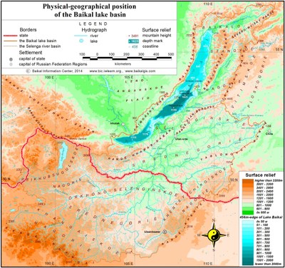
2.1 Surface and ground waters
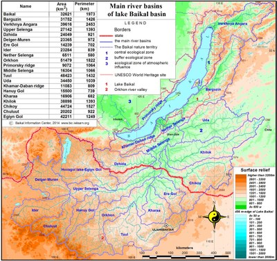
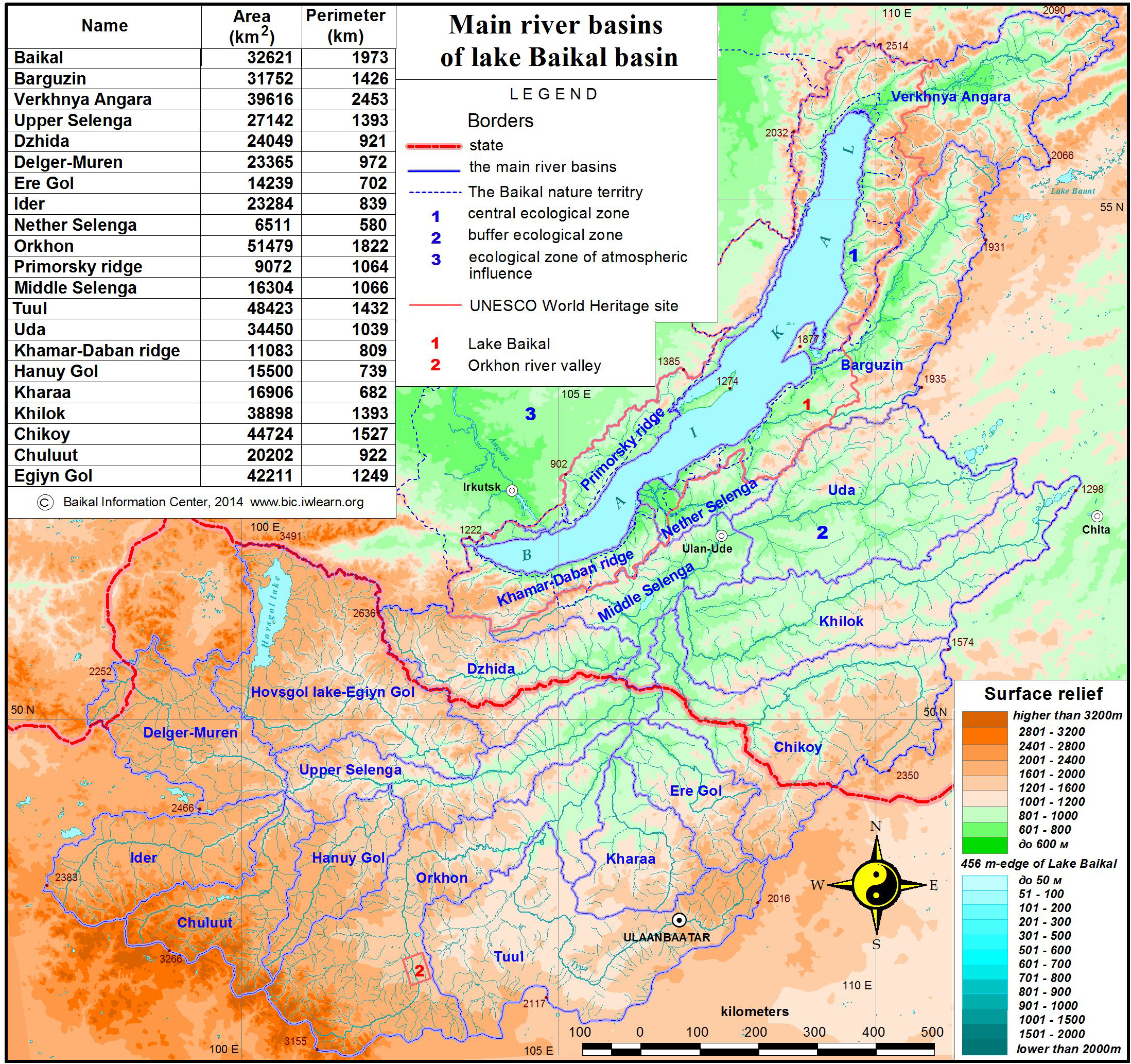
In the north of the Russian part of the basin, the biggest rivers are the rivers Angara, Barguzin and Turka. The middle part of the basin includes Selenga River with its major tributaries – the rivers Uda, Khilok, Chikoi and Dzhida. In the Mongolian part of the basin, the biggest rivers are the rivers Selenga, Ider, Chuluut, Khanui, Orkhon, Eruu, Kharaa, Tuul, Egiin-Gol, and Delgermurun.
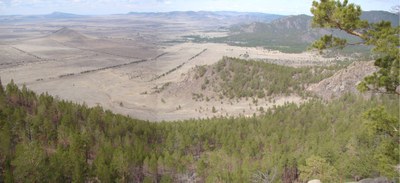
Differentiation of the river network density of the Lake Baikal basin has a clearly pronounced zonal nature: from 0.1 km/km2 at the south-eastern boundary to 0.9 km/km2 on the coastal ridges and in the northern territories [1]. A high river network density is characteristic of the taiga zone, especially of ridges and valleys immediately adjacent to the lake. In general, the northern part of the basin is characterized by favorable conditions of flow. Mountainous terrain, steep slopes and the presence of permafrost contribute to a rapid discharge of water into the main water streams, namely, the Upper Angara and the Barguzin, and to the development of the river network. The highest density is specific to the western slopes of the Barguzinsky (0.92 km/km2) and Khamar-Daban ridges (0.69 km/km2). Among the plain territories, the most watered areas are the Barguzinskaya valley (0.89 km/km2) and the area of the Selenga river delta (0.68 km/km2) (pic. 2.1.1).
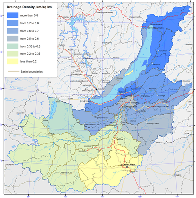
Open full size
Pic. 2.1.1 River network density [1]
The middle part of the basin represents a border of forest and steppe, and is characterized by the mid-mountain terrain and a high occurrence of sandy and sandy loam soils. The presence of these factors provides for the average river network density ranging from 0.35 km/km2 in the middle reaches of the Selenga River and 0.55 km/km2 for the Chikoi river basin to 0.61 km/km2 for the Khilok and Dzhida river basins.
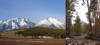
In physical and geographical terms, the south-western part of the basin, i.e. the area of Lake Khuvsgul, represents a forest-steppe with the high-mountain depression terrain, and is characterized by a lower river network density ranging from 0.32 km/km2 for the Delgermurun river basin to 0.34 km/km2 for the Egiin-Gol river basin. In the southern dry steppe part of the basin a low river network density is registered. This is especially typical for the Tuul and Kharaa river basins; here this index is below 0.2 km/km2.
Because of the disintegration of relief and a considerable contrast in the precipitation regime of the depressions and mountain ranges in the Russian part of basin, the average amount of annual runoff varies to a great extent – in the depressions it is seldom less than 2.5 l/s·km2, that is including some sites without an outflow, while the runoff on the range slopes exceeds 25 l/s·km2, averaging 5-10 l/s·km2 for the most part of the territory. The regime of most of the rivers is of Far East type with the maximum runoff in the rainy period and rain alimentation in the second half of summer. Many medium-sized rivers freeze in winter thereby contributing to the issue of winter water supply.
In the North of basin the Verkhnyaya Angara River flows from the southern slope of the Delun-Uransky mountain range and falls into Angarsky Sor bay, located in the northern part of Lake Baikal. The river forms a vast delta with a great number of river channels and lakes (pic. 2.1.2).
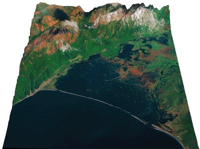
Pic. 2.1.2 The delta of Verkhnyaya Angara River (digital relief model, BINM SB RAS)
The length of the river is 438 km, water catchment area is 21400 km2, the general fall is 120 m. The total number of tributaries is 2291 with the overall length of 10363 km (0.45 km/km2). The average long-term water discharge is 265 m3/s (8.4 km3/year) [3,4].
The Barguzin River originates at the spurs of the South-Muysky mountain range; falls into the Bay of Barguzin of Lake Baikal. The length of the river is 480 km, water-catchment area is 21100 km2, the general fall is 1344 m (pic. 2.1.3). The number of rivers within the basin is 2544 with the total length of 10747 km (0.51 km/km2). During the high water period, the river is navigable at the extent of 250 km and has a great significance for fishing. The basin economy is based on agriculture, and in particular irrigational agriculture. The average long-term water discharge is 130 m3/s (4.1 km3/year) [3,4].
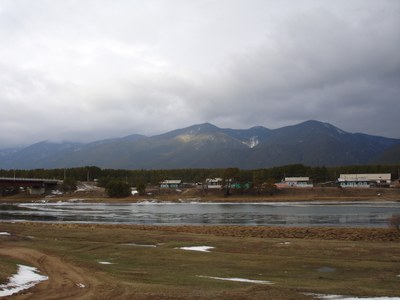
Pic. 2.1.3 The Barguzin River
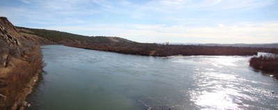
The Turka River originates in the southern slopes of Ikatsky range at the elevation of 1430 m and falls from the east into the middle part of Lake Baikal, 140 km to the north-east of the Selenga delta. The length of the river is 272 km, water-catchment area is 5870 km2, and general fall is 975 m. The lower part of the basin includes Lake Kotokelskoe with an area of 68.9 km2. The river has a great significance for fishing industry. The upper stream of the river is the center of exploration works for placer gold. The average long-term water discharge is 1.6 km3/year [3,4].
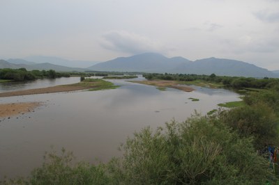
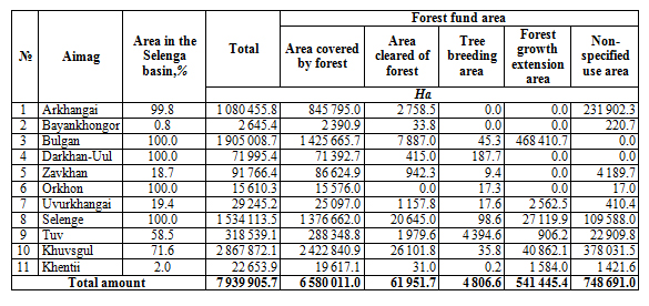
The Selenga River of Mongolian part takes its origin from the confluence point of the rivers Delgermurun and Ider. The total basin area of the Selenga river is 445 272 км2 km2, among this 67% is located in Mongolia. The Mongolian part of the Selenga river basin spans over 6 aimags - Bulgan (46.3%), Selenge (27.6%), Khuvsgul (25.3%), Arkhangai (0.7%) and Orkhon (0.04%) [2].
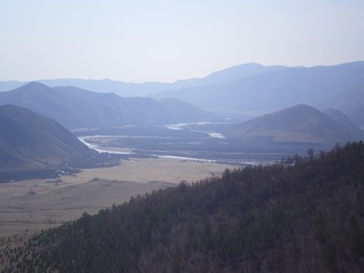
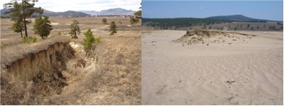
The Selenga River in the Russian part flows across the middle-mountain heavily indented location. The channel slope is 0.36 ‰. The width of the river valley varies from 2 to 25 km. In narrow places the river consists of one slightly meandering channel, in the wider parts the river channel divides into arms. The main channel and the river arms are meandering, at the abrupt turns the shores are intensely eroded (pic. 2.1.4). The width of the river in the low-water period is 100-150 m, depth at the river pool is 4-5 m, at the bar area is 0.5 – 1 m, at shallow places – 0.5 m. The velocity of current in the low-water period is 1 m/s, at disparate bars rising to 2-2.5 m/s. The bottom of the river is predominantly composed of pebble, or pebble and sand. The height of the shores is 1-2 m.
Pic. 2.1.4 The Selenga River
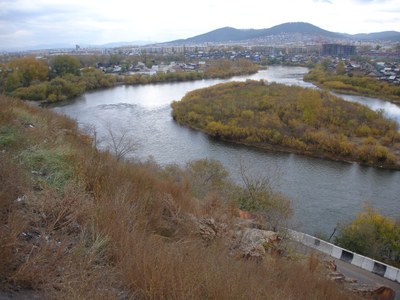
The Selenga has a delta with the area of about 1120 km2, made up of river channels and islands, formed of river sediment (pic. 2.1.5).
Pic. 2.1.5 The delta of Selenga river
Annually, the Selenga river discharges about 2.7 million of sediment load, increasing the area of the delta [3,4]. It is the delta area which has the shortest distance between the two shores of the lake – 26 km. The Selenga section of Lake Baikal is the area of accumulative shores, having the maximal length and consisting of the external part of the Selenga delta and bars, separating the lake from the bay: Bay of Proval, located to the north-east of the Selenga delta the bay of Sor Cherkalov, located to the south and south-west of it. Analysis of multi-temporal cartographic and space-image materials, fieldwork data suggest that the delta area grows disproportionately at its disparate parts. The maximal growth of the delta takes place in the north-eastern section, adjacent to the Bay of Proval, in particular, in the area of Lobanovsky water channel, reaching several tens of meters per year in some periods. The western sector of the Selenga delta, adjacent to the Bay of Sor Cherkalov protrudes with less velocity. Relatively stable in terms of growth is the northern section of the delta, located between the Srednyaya and Northen Ust’ channels [5].
The Dzhida River originates on the southern slope of the Khangarulsky mountain range. The upper part of the basin has an average absolute elevation of more than 1500 m, as the river flows through a ragged heavily indented location (pic. 2.1.6). The average slope of the river is 2.7 ‰, in the middle stream – 1 ‰, slopes - 200–300 ‰. The Dzhida river is the fourth largest tributary of the Selenga river (12.5 % of the Selenga river basin), the amount of the river runoff is 15 % of the overall amount within Russia [3,4]. The ratio of water influx from the area of 4920 km2 from Mongolia is 25 % (0.61 km3). The river is fed primarily through rains, the inundation stage does not exist, the ratio of winter runoff to underground alimentation is 6%. The upper, north-western part of the basin lies in the zone with episodic freezing, and the lower – with annual freezing. Some sections of the Dzhida River are characterized with karst rocks, but in general the impact of karst phenomena on the river flow is insignificant.
Pic. 2.1.6 The Dzida river
The Temnik River rises on the northern slope of the Khamar-Daban mountain range. The river basin is predominantly mountainous, since only the lower part of the basin has grassland landscapes. The average slope of the river is 3.6 ‰. The river is fed through rains, and inundations are observed from May to September. The specific runoff is 7 %, of the flow into the Selenga on the Russian territory. The ratio of winter runoff is 7 %, the river freezes in an episodic way, once in five years.
The Chikoi River is the biggest in terms of the basin area and the amount of water runoff among the Selenga tributaries, while its water catchment is about 10 % of the Selenga basin and 31 % of the catchment in Russia (pic. 2.1.7). About 25 % (2.14 km3) of the runoff comes from Mongolia. The average slope is 1.65 ‰, in the middle stream – 1.2 ‰ and lower stream – 0.58 ‰, mountain slopes - 200–300 ‰. The average river runoff, formed in Russia, accounts for 40 % of the water influx into the Selenga. The conditions of runoff formation in the upper and lower parts of the Chikoi basin as well as on the water catchment area of the left-bank and right-bank tributaries are quite different. The river alimentation comes from rains, inundation due to the spring snow melting is rare and constitutes no more than 20 % of the annual runoff, winter runoff – 6 %, on tributaries - 2 – 3 %. The upper part of the basin lies within the zone of non-freezing or rarely freezing rivers, the middle part in the zone of episodic freezing and the lower part within the zone of annual freezing. In terms of the specific runoff, the Chikoi river ranks second place among the major tributaries of the Selenga following the Temnik [3,4,6].
Pic. 2.1.7 The Chikoi river
The Khilok River originates from Lake Shakshinskoe to flow through the bottoms of prolonged intermountain depressions at the elevation of 500-800 m, between the chain of mountain ridges with flattened forms and absolute marks of 1300–1800 m. Slopes of the basin valleys are covered mainly with mountain and taiga vegetation, while the bottoms of the valleys tend to be taken up by grassland and forest-grassland sections. The average slope is 0.52 ‰. The area of the river basin is 26 % of the Selenga basin within Russia and the amount of water influx is 19 %. River alimentation is from rain, the stage of spring snow melting is weakly manifested and does not exceed 20% of the annual runoff. Winter runoff is less than 6 % for the mouth part, while in the upper and middle part of the Khilok River there is no runoff as a result of freezing. The specific runoff indicators are 1.5 times less than those for the Dzhida River, and more than 2 times less than for combined runoff for the Temnik and Dzhida rivers.
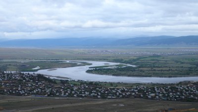
The Uda River originates in the south-western part of the Vitim plateau at the elevation of 1055 m, flows into the Selenga on the right side, 156 km off its mouth (pic. 2.1.8).
Pic. 2.1.8 The Uda river empties into the river Selenga (Google)
The length of the river is 467 km, water catchment area is 34800 km2, general fall of the river is 583 m. Average absolute elevation of the upper part of the Uda basin is 900 –1100 m. The average fall of the river is 1.2 ‰, in the lower stream – 0.7 ‰. The river basin is the third largest among the tributaries of the Selenga (23% of the water catchment area of the Selenga in Russia) and fourth largest in terms of the amount of water influx (13.4 %). The river network in the basin area is moderately developed, average value of density coefficient is equal to 0.39 km/km2. The upper part of the basin has vast spaces of wetlands as well as a great number of small lakes with the surface area of less than 1 km2) [4,7].
The modulus of flow is 2.0 l/s km2, the lowest as compared to other five largest tributaries of the Selenga. The river alienation is from rain, but as a result of spring snow melting water runoff reaches 30 % of the annual amount (pic. 2.1.9). The inundation stage manifests itself in the low-water years and the medium-water years. The ratio of the winter runoff of 10 – 12 %, formed due to the flow of non-freezing right-hand tributaries in the middle and lower parts of the basin. The tributaries of the upper part of the basin and the Uda itself in the middle stream freeze on the annual basis, while the left-bank tributaries in the middle and lower part of the basin freeze occasionally [2].
Pic. 2.1.9 The Uda river in Ulan-Ude
The Eruu River originates in the high reaches of the Khentii mountain range. The Sharlan River joins the Hongi River, and the Eruu River starts from the junction point of these two rivers (pic. 2.1.10). The river basin spans over four aimags, namely Selenge (69.1%), Tuv (23.8%), Khentii (7.0%), Darkhan-Uul (0.1%), and has a total area of 22 282 km2. The Eruu river basin authority is located in the center of Eruu soum in Selenge aimag.
Pic. 2.1.10 The Eruu river
The Bayan River takes its origin from the south-western branch of Khentii mountain range. The river’s confluence point with the Sognogor River is the source of the Kharaa River (pic. 2.1.11). The area of the Kharaa river basin is 17 667 km2 and extends over Tuv (41.5%), Selenge (36.6%), and Darkhan-Uul (17.2%) aimags and several districts of Ulaanbaatar city (4.8%) [8,9].
Pic. 2.1.11 The Kharaa River
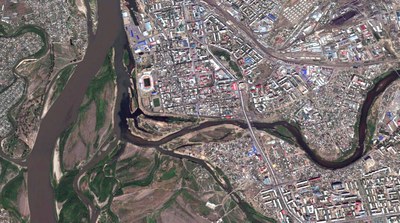
The Tuul River takes its origin at an elevation of 2 000 m above sea level at the Chisaalai mountain. The river source is the confluence point of the rivers Namya and Nergui. The total area of the Tuul river basin is 50 074 km2 and the basin spans over 5 aimags, i.e. Tuv (59.2%), Bulgan (20.5%), Uvurkhangai (7.3%), Arkhangai (5.0%), and Selenge (1.7%), as well as 7 districts of Ulaanbaatar city(6.3%). The capital city of Mongolia, Ulaanbaatar, is located in the river basin; the central part of the basin is, therefore, a densely populated urban area (pic. 2.1.12) [8,10].
Рис. 2.1.12 The river Tuul in Ulaanbaatar (Google)
The Orkhon River originates in the east-northern part of the Khangai mountain range and flows northward joining the Selenga river in Sukhbaatar city in Selenge aimag. The total basin area of the Orkhon River, including basin areas of its tributaries - Tuul, Kharaa and Eruu, is 143 479.3 km2, 48.0% of which is part of the Selenga River basin. The biggest waterfall of Mongolia – Ulaantsutgalan – is located in the upstream of the Orkhon river (pic. 2.1.13). The river basin spans over 8 aimags - Arkhangai (38.2%), Bulgan (21.9%), Selenge (18.5%), Uvurkhangai (15.9%), Tuv (1.9%), Bayankhongor (1.6%), Orkhon (1.6%) and Darkhan-Uul (0.4%) [8,11].
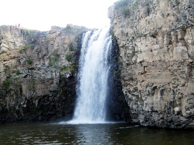
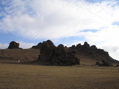
Pic. 2.1.13 The biggest waterfall of Mongolia – Ulaantsutgalan.
The Khanui River takes its source in the Khan-Undur mountains, which are in the central part of the Khangai mountain range. The river flows about 421 km towards the east-north before joining the Selenga River. The total area of the river basin is 15755 km2, which is divided between 3 aimags - Arkhangai (77.1%), Bulgan (22.7%) and Khuvsgul (0.1%) [8].
The Chuluut River originates in the western part of Gurvan-Angarkhai mountain in the Khangai mountain range. The Chuluut River flows 415 km till its confluence with the Ider river. The total river basin area is 20078 km2 that span over 4 aimags - Arkhangai (95.7%), Khuvsgul (3.8%), Bayankhongor (0.4%), and Zavkhan (0.2%) [8].
The Ider River takes its source at the north side of Otgontenger mountain in the Khangai mountain range. There are several small and big tributaries, including the rivers Suman and Chuluut. The length of the river is about 465 km from its source to the mouth – its confluence with the Selenge River. The total area of the river basin is 23061 km2, which covers parts of Zavkhan (65 %), Khuvsgul (32.1%) and Arkhangai (2.9%) aimags of Mongolia [8,12].
The Delgermurun originates in Ulaantaiga mountain in Khuvsgul aimag. The river flows about 445 km till its confluence with the Ider River, together forming the Selenga River. This river basin area is 23324 km2 extending over Khuvsgul (98.5%) and Zavkhan (1.5%) aimags of Mongolia [8].
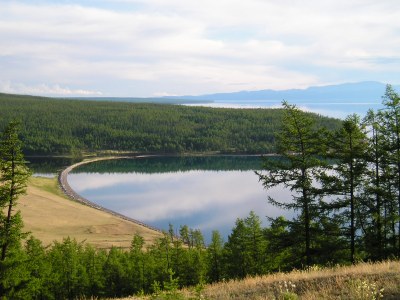
Lakes are distributed unevenly across the Selenga basin which is due to the diverse relief, climate and water alimentation. The greatest number of large natural water objects is concentrated in intermountain depressions. The Selenga river basin has 5549 lakes with a total area of 616 km2. The density of lakes in the basin is less than 1 %. The more prevalent are small water objects with an area of 0.5 km2, and only 17 lakes have the area from 1 to 10 km2 and 4 lakes with the area of more than 10 km2. The biggest lake in the Selenga river basin is Gusinoe with an area of 163 km2. The biggest lakes are Kotokel (pic. 2.1.14), Shakshinskoe and Arakhlei (with surface areas of 52.6 and 58.5 km2, respectively) located in the outlet of the Khilok River [3,4].
Pic. 2.1.14 The Lake Kotokel
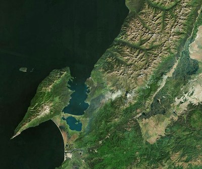
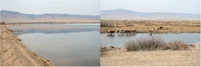
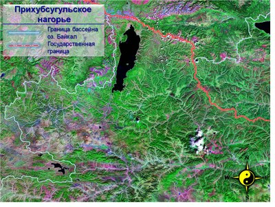
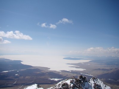
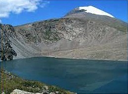
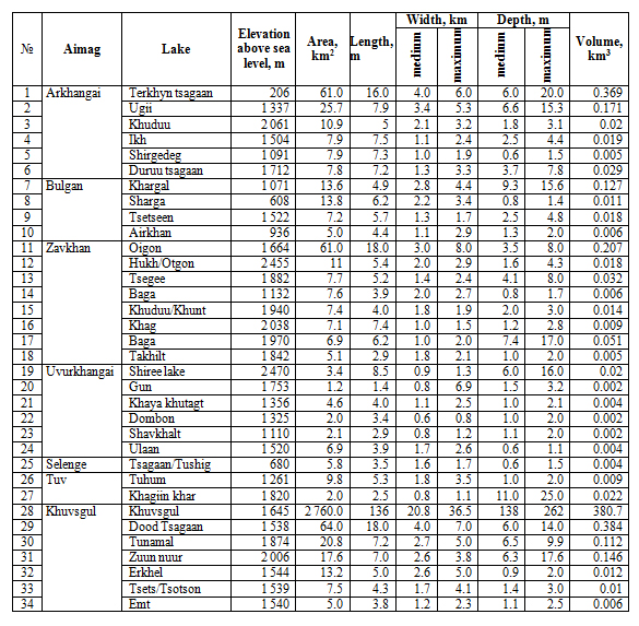
Lake Khuvsgul is the largest lake in Mongolia that contains 3/4 or 74.6% of the total surface water supply (380 km3) in Mongolia (pic. 2.1.15) [9,13].
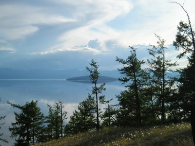
Рис. 2.1.15 The Lake Khuvsugul
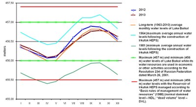
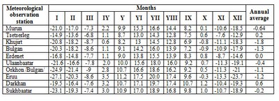
The water level in Lake Khuvsgul have increased by 1 m since 1963, the exact reason for which is unknown. However, it might be related to melting of permafrosts, increased precipitation, decreased outflow due to accumulation of sand an the bottom of the Eg river, water temperature decline and, thus, reduced evaporation from the lake surface, etc. In 1979 and 1995-1996, the water level in the lake declined significantly. It was attributed to the lower amount of precipitation during these years (table 2.1.1).
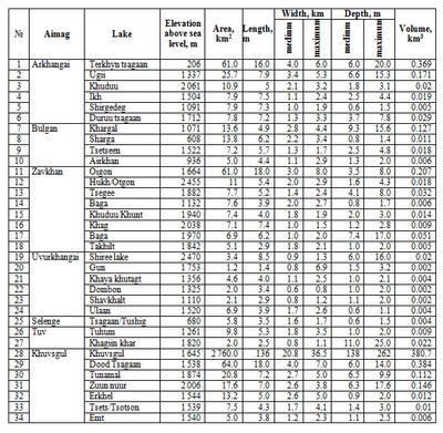
Table 2.1.1 Morphometric characteristics of lakes within the Mongolian part of Baikal basin [8,9].
Open full size
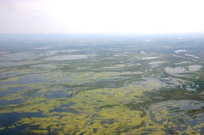
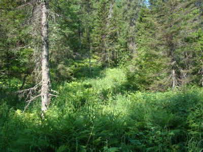
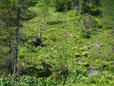
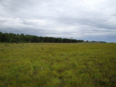
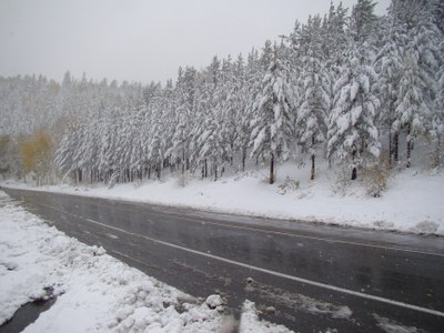
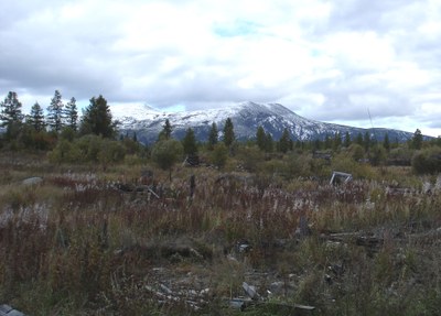
Wetlands in the Selenga river basin are comparatively rarely to be found. In most cases, wetlands are to be found in the river valleys and river mouths as well as on the shores of lakes. In the river valleys and river mouths, the most widely spread are sedge and moss types while the more drained parts have bushy wetlands. In the wetland depressions, located in the Khamar-Daban mountains (the Dzhida and Temnik river basins) there are some areas covered with sphagnum (pic. 2.1.16 ).
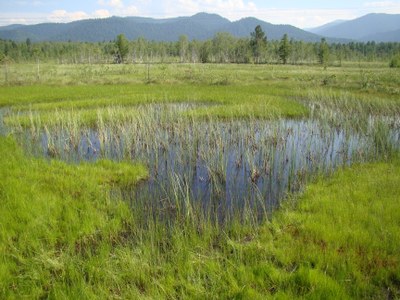
Pic. 2.1.16 The swamp on Khamar-Daban range
Large places of swampy valleys are found nearly everywhere in all the valleys. The density of wetlands varies within the range of 1 – 5 %. The most significant wetlands are found in the Khilok basin (about 10% of the catchment area) [5,14].
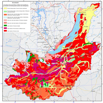
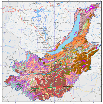
Ground waters are quite varied in terms of chemical composition and are subject to certain geochemical zonality. Artesian basins occupy intermountain depressions, composed of loose rocks of sedimentary cover and crystal rocks. They are characterized with porous zones of active water circulation. Hydrogeological massifs are composed of crystallic rocks of mountain-infolded framing and contain interstitial waters of exogenic fracture pattern. The capacity of active water exchange zone does not exceed 100-150 m. The most water-abundant are karstified carbonate rocks as well as zones of tectonic dislocations, cutting the basal complex or stretching alongside the contacts with sediment-metamorphic formations with erupted and metamorphic rocks. They are often traced by the rising water load of both cold and thermal waters. Fault waters of mountain ridges are ultra-fresh waters (with salinity of 0.003 to 0.005 g/l). In artesian basins of Baikal type (Barguzin, Verkhneangarsky), the water salinity does not exceed 0.5-1 g/l up to the depth of 2000 m, while the composition of water is mainly of hydrocarbonate-sodium and calcium-sodium type (pic. 2.1.17).
Open full size
Рис. 2.1.17 Groundwater of Lake Baikal basin [1]
The major way of ground water alimentation is through infiltration of atmospheric precipitation and melted waters. Permafrost plays a significant role in the formation of ground water reserves and their regime. The replenishment of reserves takes place in the warm season, when the amount of infiltration exceeds the amount of unloading. In the course of the cold period, their unloading happens and their water levels decrease in this period. The amplitude of fluctuations during the year does not exceed 1.5-2 m.
Ground alimentation of rivers relies on both the ground water and pressure artesian waters. Ground water flow on the considered territory is quite significant in scope. Deep compartmentalization of surface, dense river network, considerable gradients facilitate intensive ground flow (table 2.1.2).
Table 2.1.2 Groundwater reserves in the river basins Russian part of Baikal basin
Open full size
In terms of availability of ground water, three groups of regions can be distinguished in the territory: with good availability, medium availability and little availability. The first group includes ground waters of intermountain depressions of Baikal type with virtually unlimited reserves – up to 3-5 m3/s and more. The second group includes artesian basins of Transbaikalian type with the amount of fresh water sampling up to 1.0 m3/s. The third group includes ground fault-veined waters of mountain ranges with limited (up to 5-10 m3/s) exploitation resources [3,4].
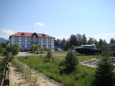
The territory of middle-sized and northern rivers of Lake Baikal has almost all the known types of curative mineral waters (thermal, cold carbon, hydrogen sulphide, radon, ferriferous). Thermal nitrogen-siliceous waters of Goryachinsk resort, located on the eastern shore of Lake Baikal, are used to treat the diseases of nervous system, skin diseases and other ailments (pic. 2.1.18).
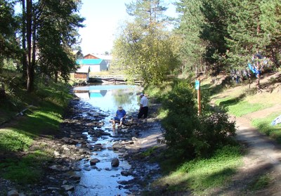
Pic. 2.1.18 The hot springs of resort Goryachinsk
Barguzin valley has a number of resorts of the local level, such as Garga, Alla and Kuchiger. High temperature of thermal waters makes it possible to use them for acquiring thermal and electric energy. Thus, waters with the temperature of 40-70ºС can be used for greenhouse planting and hot water supply. In terms of curative properties, these waters are fit for curing the diseases of the locomotor system, peripheral nervous system and other diseases [3,4].
In Mongolia, groundwater is the main source of drinking water and water used for domestic and industrial purposes. According to some estimates, 95% of the domestic and industrial water demand is supplied by groundwater (pic. 2.1.17).
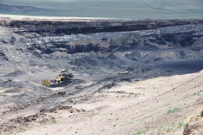
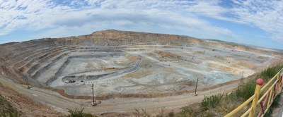
In the Selenga River basin, surface water mainly is used for irrigation but, in recent years, groundwater consumption has increased. In addition, most of mines and industries remove groundwater from exploration fields (during open pit and underground mining) to keep it dry. Industries located in cities usually use water from centralized water supply networks or own groundwater wells. Seosonal groundwater level decrease in Ulaanbaatar city is due to the fact that the rate of groundwater extraction is higher than the rate of its replenishment.
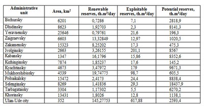
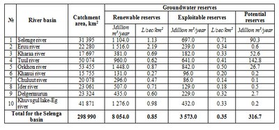
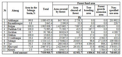
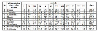
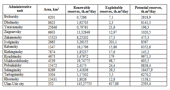
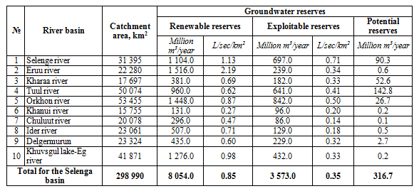
According to the Integrated Water Resource Management Plan of Mongolia [8], it is estimated that the renewable groundwater reserves are 8.1 million km3/year, the potential exploitable groundwater reserves are about 3.6 million km3/year and, in the Selenga River basin, the potential reserves are 316.7 million m3/year. However, these estimates should be treated as approximate. The groundwater reserves in each river basin were estimated based on hydrological data for the region, the type of geological formation in the area, estimates of groundwater recharge, regional field surveys (including test drilling), etc. (Table 2.1.3)
Table 2.1.3 Groundwater reserves in the river basins Mongolian part of Baikal basin
Open full size
]]>


