5.5 Environmental education
Environmental education and information dissemination raise public awareness and facilitate public participation in tackling the issues of biodiversity conservation, natural resource management and sustainable development of Baikal region and depend entirely on the educational level of the society in general [3].
Environmental education and awareness-raising campaigns are aimed at solving the following tasks:
- modification of study programs to include/enhance environmental education and publication of textbooks incorporating environmental education aspects;
- organization of extracurricular activities, summer schools and conferences;
- environmental awareness raising through mass media and publication of specialized journals;
- information dissemination and educational activities (for example, festive events during the World Environment Day, World Day of Water Resource Protection, International Birds Day and Day of Baikal);
- Training of teachers specializing in environment-related issues at the regional and municipal levels.
There are two UNESCO chairs in Baikal region (University Twinnings). The chair of water resources was set up according the agreement between the UN (UNESCO) and Irkutsk State University signed on March 30, 2001. This is the only chair for water resources in Russia. Savoy University of France acted as the foreign counterpart. Apart from the departments of Irkutsk State University, the chair cooperates with Buryat State University, Institute of Earth Crust SB RAS, Vinogradov Institute of Geochemistry SB RAS and Baikal Institute of Nature Management SB RAS (the head of the chair is Prof. Smirnov A.I.)
The research activities of the chair have the following directions:
- study of the qualitative and quantitative composition of natural waters within the research area;
- development of the theoretical and methodological basis for integrated management and rational use of water resources, research into the interconnectedness and interaction of the surface and underground layers of the hydrosphere;
- expansion of the geopolitical analysis of water resources, a field of expertise of Savoy University;
- creation of an open access database of water resources within the research area.
The international project «Water resource network» is considered one of the main ways of implementing the priority tasks. «Water resource network» has been established by Irkutsk State University and Savoy University with UNESCO support and now, besides the universities, includes Mongolian National University, several water resource departments in the Mediterranean region, Institute of Geochemistry SB RAS, Institute of Geography SB RAS, and Buryat State University. In 2009, an agreement on cooperation was signed by UNESCO and «Water resource network» within the frameworks of UNITWIN/UNESCO program.
In 2013, talks were held in Chambery city (France) regarding further development and expansion (both spatially and functionally) of «Water resource network». Furthermore, in August of 2013, Summer School was conducted at Biology station of Irkutsk State University in the village of Bolshie Koty, near Lake Baikal. During the event, meetings and talks took place over the future of the Network. A fundamental two-volume book «Baikalology» was prepared and published, which was among four best books in the field of natural sciences, technology and medicine at the All-Russian contest «Best books of 2012».
The UNESCO chair for environmental ethics at the East-Siberian State University for Technology and Management («VSGUTU») in Ulan-Ude (Republic of Buryatia) was set up in April 2006 by the decision of UNESCO General Conference (the chair head is Prof. Saktoev V.E., the University President).
By now, the chair has delivered the following research output:
- conceptual basis for the international UN-supported project «Baikal model territory of sustainable development»;
- conceptual basis for socio-economic development strategy for the Republic of Buryatia;
- Baikal declaration of environmental ethics;
- concept of «moral» economy aimed at conservation of Lake Baikal Natural Territory;
- conceptual basis for sustainable tourism development in Baikal region.
The research results are embedded into the educational process along the following directions:
- a masters’ program in the field of sustainable development and environmental ethics was developed based on the expertise of the chair personnel and personality-oriented teaching approach;
- the lecture course «Philosophy of sustainable development and science ethics in the information age» was developed to be taught to young scientists, Ph.D. and Master students of the East-Siberian State University for Technology and Management;
- the club “Millennium” continued its fruitful work with grade 1-9 secondary school students.
Irkutsk Oblast. Baikal Museum of the Siberian Branch of the Russian Academy of Sciences located in the village of Listvyanka receives about 90 thousand visitors per year. The number includes school and university students, teachers, representatives of Russian and foreign companies, governments, and state organizations, and forum/conference participants (pic. 5.5.1).
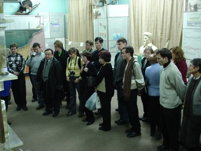
Pic. 5.5.1 An excursion at the Baikal Museum
Research and educational activities of the Museum rely on 8 expositions and include the following regular events: Oblast-wide ecological summer school on Baikal studies, Day of Knowledge, «Baikal connoisseurs» competition, and an international competition in Baikal studies. In 2012, the Museum hosted 6 thematic expositions.
Environmental education center of the Museum is equipped with a computer room and the «microscope-computer» system consisting of 21 computers connected into one network, which makes possible interactive classes in ecology and Baikal studies for school and university students as well as makes the Museum resources available to the wide audience.
In 2013, Baikal museum and the association «Baikal-EcoNetwork» published a workbook «Outline maps of Lake Baikal for grade 5-6 students» as a supplementary teaching resource for teaching Baikal studies.
Environmental education in the schools of Irkutsk Oblast is realized through the introduction of such disciplines as «Ecology» and «Baikal studies» into curriculum, as well as through organization of integrated classes and extracurricular activities. Additional environmental classes are given as part of the non-mandatory and elective courses, work of children’s environmental associations, hosting of large-scale ecological development-oriented events and the involvement of school children in the activities of ecological summer camps.
In 2013, more than 23 thousand students in Irkutsk region were enrolled in elective and special courses in ecology, Baikal studies and natural sciences. In municipal institutions of general education, 448 circles of ecological/biological sciences engaging about 7 500 students were functioning. In municipal institutions of additional education of Irkutsk region, 1 055 associations devoted to environmental/natural sciences and engaging about 14 500 teenagers were functioning. In Irkutsk region, 7 institutions of additional education devoted to environmental/natural sciences and engaging more than 10 thousand children were functioning.
In 2012, based on the intermediate results of a regional experiment on adapting educational resources to teaching Baikal studies, a new edition of the manual “Baikalology” (Live world of Lake Baikal. Man and Lake Baikal. 6 (7) grade) was published.
The most important activities included:
- a region-wide children’s environmental festival “Baikal kaleidoscope” (March 28-29, 2012);
- a region-wide convent of school forestry associations (June 22-26, 2012).
- the first international competition among school students in Baikal studies (June 5-8, 2012). Twenty four teams from the educational institutions of Irkutsk Oblast, the Republic of Buryatia, Zabaikalsky Krai and Mongolia took part in the competition. The competition was hosted by Baikal Museum of the Irkutsk Scientific Center SB RAS. Results of the competition were announced during the work of the «Baikal-Huvsgul» creative workshop.
- the second international competition in Baikal studies «Let’s save Baikal» (June 5-8, 2013) took place in Baikal Museum of the Irkutsk Scientific Center SB RAS. More than 100 school children from Irkutsk Oblast, Zabaikalsky Krai and the Republic of Buryatia participated in the competition. For the first time school children from Korea and China took part in the competition [4, 6] (рис. 5.5.2).
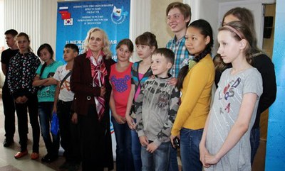
Pic. 5.5.2. The winners of the 2nd International contest among schoolchildren in Baikal studies
“Let’s save Baikal”.
Republic of Buryatia. Ministry of Natural Resources of the Republic of Buryatia came up with «Strategy for the Development of Continuous Environmental Education and Formation of Ecological Culture on the Territory of the Republic of Buryatia in 2012-2016» (approved by the resolution of the Government of the Republic of Buryatia № 682 of December 21, 2011). The Strategy is implemented by the public environmental council chaired by the Deputy Head of the Government.
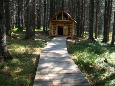
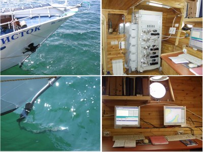
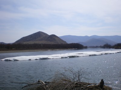
International ecological and educational center «Istomino» of Baikal Institute of Nature Management, located in the Selenga river delta (Republic of Buryatia, village of Istomino), is one of the biggest in Siberia (pic. 5.5.3).
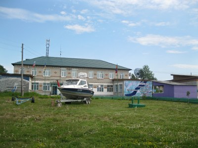
Pic. 5.5.3 The international ecological and educational center «Istomino»
Its major activities include:
- scientific and material/technical support to the fundamental research into Lake Baikal ecosystem and the Selenga river delta as the indicator of anthropogenic impact and natural changes in Lake Baikal basin;
- hosting scientific expeditions;
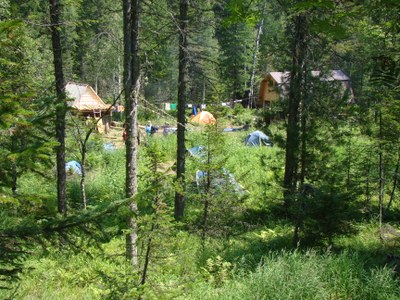
- hosting scientific meetings, conferences and workshops on the issues of sustainable development of Baikal region (pic. 5.5.4);
- organization of specialized practical courses for science students and summer schools for gifted children in environmental studies, chemistry, physics and mathematics;
- development of ecotourism; demonstration of organic farming and production of organic food with the use of renewable energy sources.
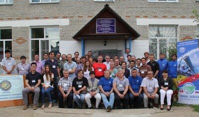
Pic. 5.5.4 Participants of the International conference
«Deltas: genesis, dynamics, modeling and sustainable development»
Activities:
- July 26 - August 10, 2012 – International dendroecological expedition in Western Zabaikalie (Republic of Buryatia) with the participation of researchers of the Siberian Federal University (Krasnoyarsk city) and the University of Arizona (USA) (pic. 5.5.5);
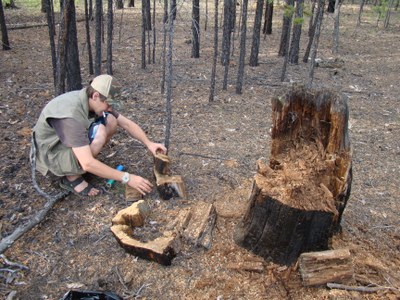
Pic. 5.5.5 A participant of the International dendroecological expedition
- July 27 – August 1, 2012 – International workshop with the participation of scientists from Mongolia (12 people) within the frameworks of the project «Study of the spatial-temporal trends in the interaction between landscape and natural-economic complexes in the northern Central Asia under conditions of the contemporary desertification processes»;
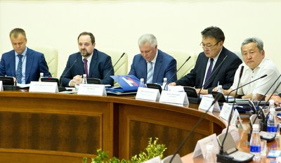
- April 18 – April 20, 2013 – Meeting of the heads of the municipal districts of Pribaikalie and the administration of specially protected natural territories within the frameworks of the Federal target program «Protection of Lake Baikal and socio-economic development of the natural territory in 2012-2020» under the support of the Ministry of Natural Resources of the Republic of Buryatia (pic. 5.5.6);
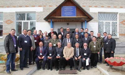
Pic. 5.5.6 Participants of the Meeting of the heads of the municipal districts of Pribaikalie and the administration of specially protected natural territories
- June 26 – June 30, 2013 – VII school-seminar of young scientists «The issues of sustainable development in Russian regions»;
- June 25 – August 08, 2013 – international expedition within frameworks of the project «Trans-Eurasian Flight Leman-Baikal» with the participation of scholars from France and Switzerland (pic. 5.5.7, pic. 5.5.8);
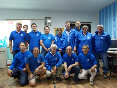
Pic. 5.5.7 Participants of the international expedition within frameworks of the project «Trans-Eurasian Flight Leman-Baikal»
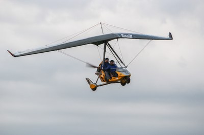
Pic. 5.5.8 An ultralight trike in the sky
- July 30 – August 2, 2013 – Workshop «Environmental issues within Lake Baikal basin and the role of «green economy» in their resolution» with the participation of specialists from Mongolia, including officials from the Ministry of Ecology, Green Development and Tourism, and Agency for civil supervision of police, and the Republic of Buryatia was represented by officials from Forest Agency and Burprirodnadzor.
The educational work of «Ecological and biological center of the Ministry of education and science of the Republic of Buryatia» was realized in 2012-2013 through the activities devoted to raising environmental awareness and reviving environment protection traditions of the people of the Republic – «Preserve forest for the future generations» campaign, ethno-ecological festival «Sagalgan», «Meet birds with love» campaign, «Ecological month» and «Young naturalist» ecological camp.
The traditional exhibition of children’s works «Live, the Earth» provides an opportunity to more than 500 gifted students from the Republic to display their works on the annual basis. The conference «Earth – our home» was meant to reveal and provide assistance to the talented and gifted children in their further career paths.
In 2012, as part of the established tradition, students participated in the following activities:
- an all-Russian scientific ecological-biological contest in the sphere of children’s additional education;
- the international all-Russian children’s ecological forum «Green planet»;
- the competition in memory of Vernadsky V.I.;
- the all-Russian forestry competition «Young Growth»;
- an all-Russian contest of water-related projects among senior school students;
- the all-Russian contest «My smaller homeland: nature, culture and ethnos»;
- an all-Russian contest of interdisciplinary projects and programs in environmental and local lore studies.
Orienteering Federation of the Republic of Buryatia (Chairman E.Y. Osipov, www.fso.sdep.ru) conducts significant educational work among the younger generation. In 2012-2013, the Federation held mass events in Ulan-Ude city, town of Gusinoozersk, in the village of Sagan-Nur and on Lake Schuschiye, attended by more than 600 schoolchildren (pic. 5.5.9).
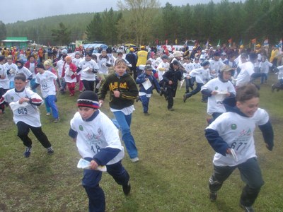
Fig. 5.5.9 All-Russia competitions in orienteering – «Russian azimuth»
Within the frameworks of celebrating «Year of forests» students organized «Preserve forests from fires» campaign. On May 12, the Day of National Forest Planting, the students of the Center together with the representatives of the Federal Forest Agency (Rosleskhoz), bodies of the executive and legislative power of the Republic of Buryatia planted about 960 pine trees in Izhir, not far from Todokhta village of Zaigraevsky district. In addition to that, within the framework of the international year of forests the roundtable «Promotion of school forest associations in the Republic of Buryatia» was organized by the city forestry association and secondary school № 49.
On September 27-29, 2013, the 9th interregional competition in Baikal studies was held in Ulan-Ude city. 20 teams from 11 districts of the Republic of Buryatia took part in the competition. The competition had 4 categories – «Baikal flora», «Baikal fauna», «Limnology» and «Environmental monitoring» (pic. 5.5.10). The finalists represented the Republic at the 1st All-Russian Youth Conference of the Russian Geographic Society held in Kaluzhskaya Oblast on November 2-6, 2013.
Pic. 5.5.10 Participants of the 9th interregional competition in Baikal studies
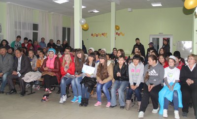
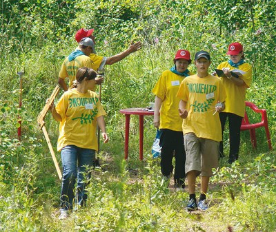
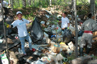
On September 27-28, 2013, the 5th Baikal educational forum of the environmental movement leaders devoted to the Year of Environmental Protection and the Year of Tourism was held in Ulan-Ude city by the school «ECOS» with the support from the Ministry of Natural Resources of the Republic of Buryatia. The forum participants were 8-11 grade students, school teachers and teachers of institutions of additional education of Ulan-Ude city. The following activities were conducted within the framework of the forum: an intellectual Internet-marathon, a photo vernissage «My Baikal», «Antiwaste» campaign (pic. 5.5.11), and «Environmental footprint on Earth» campaign.
Pic. 5.5.11 Participants of the «Antiwaste» campaign
Since 2004, the journal «World of Baikal» has been published under the aegis of the Ministry of Natural Resources and Baikal Institute of Nature Management SB RAS. Till the end of 2013, 40 issues of the journal have been published [8] (pic. 5.5.12).
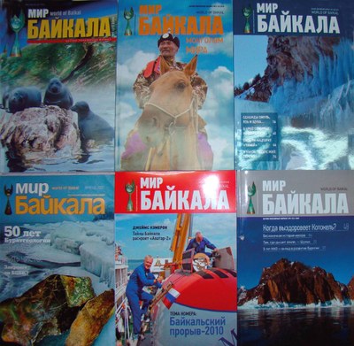
Pic. 5.5.12 Issues of the journal «World of Baikal»
Zabaikalsky Krai. In accordance with the regional action plan for implementation of the Strategy for developing the system of environmental education and formation of ecological culture in Zabaikalsly Krai in the period till 2020 approved by the Resolution of the Government of Zabaikalsky Krai № 673-r on October 20, 2009, the funding for activities related to environmental education and formation of «ecological» culture is allocated from municipal budgets. Diverse regional level environmental campaigns, competitions, meetings and expeditions were organized in 2012 – 2013.
As a way to fulfill the order of the Ministry of Education, Science and Youth Policies of Zabaikalsky Krai № 509а of June 21, 2012, the Center for education quality assessment introduced indicators of environmental education. These indicators will be considered while determining the efficiency ratings of municipal formations.
The laboratory of environmental education of Zabaikalsky State University in collaboration with pedagogues, education specialists and scientists of Zabaikalsky Krai and other regions of Russia provide scientific support to the system of environmental education, including the development of diverse teaching materials in electronic format, teaching manuals in accordance with the new state standard. The following materials were published: the workbook «My native Zabaikalie: I learn to ask questions» (authors – E.A. Igumnova, I.V. Barakhoeva), a practical manual for organizing independent work of students – «Regional ecology» (authors – E.A. Igumnova, O.V. Korsun), the manuals «Ecological excursions to the nature of Zabaikalie» (author – O.V. Korsun), and the popular science book «Basin of the Amur River in Zabaikalie» (edited by N.V. Pomazkova).
Annually, on April 22, educational and environmental institutions set up the environmental campaign «To protect nature means to love Homeland». In 2012, 140 organizations participated in the campaign.
The website «Nature of Zabaikalie» («Zabaikalie is splendid») has been maintained as an innovative information-sharing and educational Internet-resource in Russian and English languages [9].
The Krai-level ecological newspaper «Preserve the natural environment» is published with the circulation of 999 papers.
The chair for ecology and environmental education of Zabaikalsky State University, established jointly by the Chernyshevsky Zabaikalsky State Pedagogical University and the local institute of the Russian Academy of Sciences, is functioning in the region.
A team of secondary school students from Novaya Kuka village representing the club «Young Excursion Guide» took part in the 1st International Competition in Baikal studies (2012). The team of Zabaikalsky Krai was awarded the first prize for the project «Lake Kotokel – Gaff disease – Lake Baikal – Lake Kenon».
On April 18-19, 2013, the 3rd regional competition in Baikal studies «Baikal is in my heart» was held. 83 school students from 16 districts of Zabaikalsky Krai and students of the Ecology and Biology Center of Ulan-Ude city, the Republic of Buryatia took part in the competition
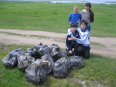
On May 23, 2013, a waste collection campaign was conducted in the Ivano-Arakhleisky natural landscape sanctuary. The campaign was timed to commemorate the international day of biodiversity. Students and teachers of secondary school № 33 of Chita city, staff of «Ecologiya» Ltd. and the sanctuary took part in the campaign.
In Mongolia, several trainings in environmental protection, environmental awareness raising and dissemination of information were organized during 2012-2014 [10]. The Institute of Teachers’ Professional Development and Mongolian Education Alliance organized the training course «Sustainable development – Eco school on November 18-19, 2013. The activity was funded by Swiss Development Agency. 20 teachers learned the methods of incorporating environmental studies into various academic subjects. In addition, «Participating community - Eco school» training course to prepare teachers for module training was held on January 27-28, 2014, and it also focused on reflecting the idea of «sustainable development» in each lesson.
The Institute of Teachers’ Professional Development organized «Professional training for the chemistry teachers who are in their first year of teaching» during February 4-13, 2014 and «Professional training for the biology teachers who are in their fifth or sixth year of teaching» on May 2-9, 2014. The 115 teachers who participated in the above trainings have also participated in an outdoor training course organized by the freshwater resource agency of the Ministry of Environment and Green development (MEGD) and have listened to lectures and have seen documentary films and museum expositions devoted to environmental pollution and proper utilization of water resources. As a result of these training courses the teachers were introduced to the concepts of sustainable development and environmental education, learned instruction techniques adjusted to children’s age, and learned new teaching approaches overall. The institute conducted 21 training sessions attended by 1270 teachers during 2013-2014.
In December 2012, UN general assembly announced 2013 as a «Year of Global Water Partnership». Within the framework of the year celebrations, the Ministry of Environment and Green Development focused its attention on water supply services, distribution of water, increasing water demand and usage, and organized awareness raising and advertising campaigns in order to expand international and inter-sectorial partnership and enhance comprehensive cooperation for addressing water management challenges. Moreover, the meeting «Water policy-integrated action» was held on January 29, 2013 in Ulaanbaatar city with the purpose of facilitating information exchange, enhancing transboundary cooperation over water management issues, defining national and international legal frameworks and consistency with the Millennium Development Goals. Totally, 95 representatives from government and non-governmental institutions participated.
The seminar «The multi-stake-holder council for improving social involvement in addressing environmental challenges and promoting cooperation by collective decision-making» was held on March 29, 2013 with the objectives of intensifying the work of the multilateral council, promoting the rational and responsible use of natural resources, promoting the overall idea if environmental protection. More than 100 people participated in this seminar and exchanged their opinions.
The environmental law package adopted during the spring session of State Great Khural in 2012 created the legal framework for implementing Integrated Water Resource Management. 29 river basin authorities were established all over the country. Therefore, the training on «Legal framework for implementing Integrated Water Resource Management in river basins» was organized on April 25, 2013 in Darkhan-Uul aimag. The purpose of the training was to deliver information on specific provisions of the laws and to enhance legal awareness of the local decision makers, water users, and law enforcement agencies. Totally, there were 72 participants, who were mainly officials of the Environment and Tourism Agencies of Orkhon, Selenge, Tuv, and Bulgan aimags and officials of the basin councils for the rivers Eruu and Selenga in Selenge aimag.
The seminar «Environmental and economic assessment of natural resource and ecosystem services to support the development of an ecosystem based adaptation strategy» was held on October 4, 2012 and was attended by 64 participants from various organizations, including national consultant teams, project implementation units, science institutions, NGOs, universities and project implementation aimags. The purpose of the seminar was consultations over the draft methodology of economic evaluation of climate change-related multilateral arrangements, improving the capacity of national consultant team who will carry out the economic assessment through collecting knowledge and information on best practices in economical assessment model development.
The seminar «Reformation of rules and regulations following the adoption of a package of environmental laws» was organized on November 28-29, 2012, and was attended by about 100 people. The purpose of the seminar was the discussion of the required changes in laws and regulations for harmonizing the whole body of legislation and implementation of the adopted law package.
]]>
