018. The average monthly temperature in July map
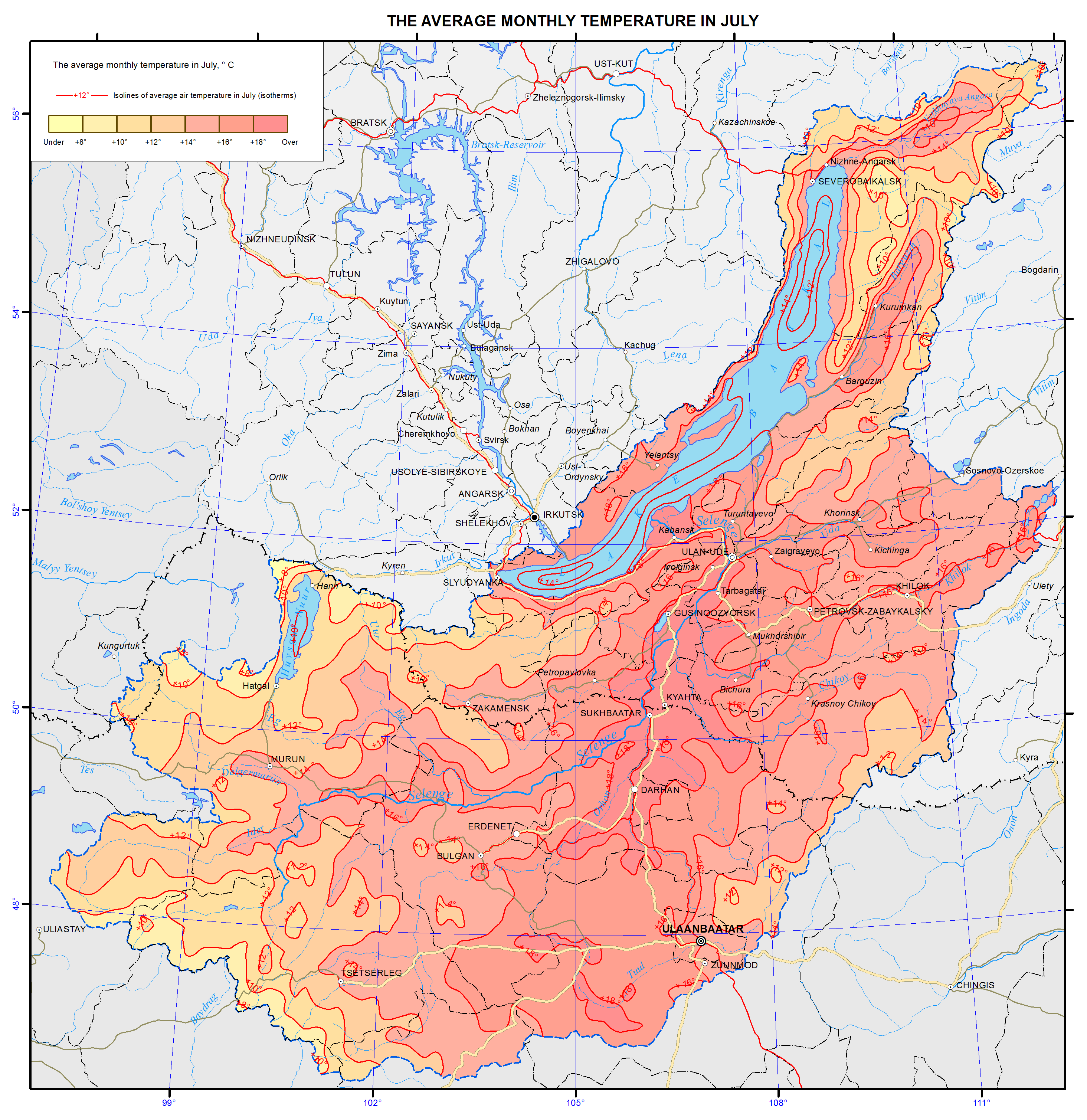
018. The average monthly temperature in July map
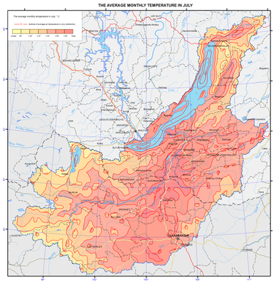
Air temperature
Lake Baikal influences the climate of the surrounding area within the Baikal hollow. The climate of inland areas of Irkutsk oblast, Republic of Buryatia, Zabaikalsky krai, and Mongolia may be called sharply continental, and the climate of the shore of Lake Baikal is close to the coastal one. Winter month’s temperature on the shores of southern Baikal is on average 5°C higher than in the central areas, and summer month’s temperature is lower at the same rate. In summer temperature inversions are observed over the cold lake surface that impedes upward motions. The set of radiation and circulating factors and local conditions determine the features of the thermal regime.
In winter, due to the predominance of anticyclonic weather, the air temperature depends mainly on the radiation conditions, and the air cools over the underlying surface. In summer, radiation factors also play a dominant role in the temperature regime formation.
Long-term mean annual temperature is almost everywhere negative. At stations located on the shores of Lake Baikal, air temperature is higher than on the continental stations located at the same latitudes. The coldest month is January, and the warmest one is July.
