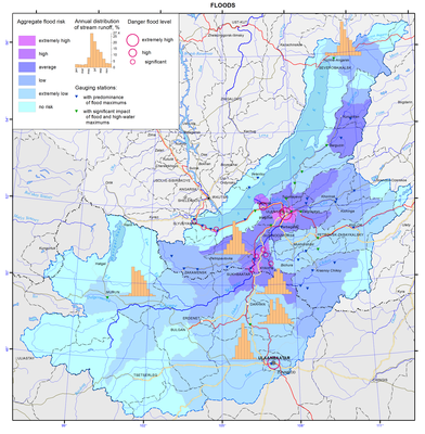
029. Floods map
Floods map
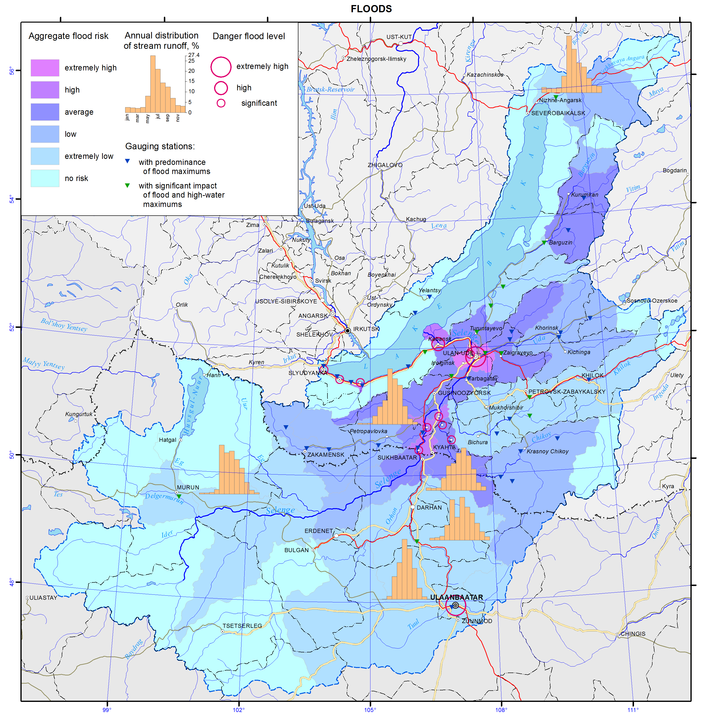
Floods
The aim of the flood map is to give an insight into distribution of flooding risk on the territory, and level of its danger to human activity and facilities of national economy. The map was compiled on the basis of reference materials of the national water resource inventory [Long-term…, 1986; Resources …, 1973], data on the flooding damage, and archival and cartographic materials.
Flood hazard is characterized by their genesis, recurrence, impact, damage, possibility and appropriateness of forecasting a dangerous situation. T.A. Borisova determined the integral risk of floods from the territorial assessment of risk caused by floods [Borisova, 2013] using private maps of disturbances of land of different categories and population (based on the estimation of physical, economic and social risks). Flood danger for the rivers of Southern Baikal flowing from the Khamar-Daban Ridge is determined through an expertise as there are no appropriate calculated data.
Severe floods take place at the Selenga, Khilok, Uda, Upper Angara, and Barguzin rivers. The depth of floodplain inundation does not exceed 0.5-1 m during common floods and reaches 1.8-3 m during severe floods. The height of the water layer increases downstream the rivers: for example, its height at the Selenga river near the settlement of Ust-Kyakhta is 1 m and near the city of Ulan-Ude increases up to 3 m. The longest floods (30-90 days) are observed in the valley of the Selenga river and downstream the river. Shorter floods (up to 25 days) are recorded in the basins of the Barguzin, Upper Angara, Uda, Dzhida, and other rivers. The duration of floods at small rivers, flowing directly to Lake Baikal, is, as a rule, 3-7 days.
The increase of water levels and flow rates in the rivers under study are observed during spring floods caused by thawing of snow cover and glaciers and during summer rain floods. High water floods are not characteristic of rivers located in the southern part. Spring floods are observed in the rivers of the Selenga basin, as well as in the streams running from the Khamar-Daban and Primorsky Ridges. The rivers with spring-summer floods are located in the northern part of the territory (Upper Angara, Barguzin, Turka, Tyya, Rel, Goudzhekit, and others).
Breakup of the ice is often accompanied by ice jams resulting in sharp short-term water level increases. Such local floods are confined to certain areas of narrowing riverbeds or river oxbows. Areas where ice jams are most likely to occur are noted on the Selenga River (Omulyovka Mountain – village of Voznesenovka – Mostovoy sidetrack – settlement of Reid, etc.).
Rain floods usually start from the decrease of spring flood and are observed during the entire summer period. The highest water levels are usually recorded in July-August. The highest intensity of the water level increase is registered at the rivers of the Selenga basin. For instance, during the highest flood in 70 years on the Dzhida River (19/1) it was 4.5 m per day (Khamney level gauge) and 2.79 m per day (Dzhida level gauge). Besides, rapid water level increases of a number of mountain stream tributaries (Khamney, Kurba, Ona, etc.) are associated with their location in the permafrost zone which considerably decreases the infiltration capacity of the soils. Fluctuations of water levels in the Selenga river and in the lower reaches of its tributaries are smoother, which is attributed to the spreading of floods and regulatory influence of the plains. However, the damage from the floods in this area is the most severe as the floodplains are the deepest and flooding is the longest. Moreover, this territory is highly developed economically and densely populated.
Maxima of rain floods on the territory under study significantly prevail over the maxima of spring floods in both absolute value and their number of the total annual maxima [Kichigina, 2000]. The first ones are the most dangerous for the flood formation. The exception is some rivers in the northern regions (Upper Angara, Barguzin, Rel, and Tyya) where the spring flood is the main water regime phase. The map represents the distribution of cross-sections with the dominance of rain flood maxima and with comparable contribution of spring and rain flood maxima. Rain floods cause huge damage as they are widely spread, repeat many times and have a high rate of formation. They can flood both separate small basins and vast territories. Their timely and precise forecast is, as a rule, low. For example, the destructive rain flood that happened in July of 1966 caused a 3 m water increase in the Tuul river, and for several hours the city of Ulaanbaatar submerged and 130 people drowned. Only for the Republic of Buryatia the damages in the Selenga river basin amounted to about 1.4 billion roubles in 1971, 0.7 billion roubles in 1973 and 40 billion roubles in 1993 (based on current prices). In Mongolia the damages are considerably lower due to the specific settlement patterns and the unique features of the economic use of alluvial lands.
On the southern coast of Lake Baikal (from the Mysovka River mouth to the Angara River outlet), on the south-eastern slope of the Baikal Ridge and in a number of the Selenga River tributaries, floods are often aggravated by mud flows [Makarov, 2012]. Mud floods are caused by heavy rains at the sites with significant slope steepness and easily washed-away loose soil. Mud flow processes mostly develop in the near-mouth areas of the rivers of the northern slope of the Khamar-Daban Ridge and along the Circum-Baikal railway. Mud flows have very destructive force, and they are able to cause significant damages. The increase of water level in such small rivers as the Pokhabikha, Tiganchikha and others can be caused by thawing of ice crust formed as a result of freezing of their river beds.
In general the rivers in the Baikal basin are related to high flood probability ones. Small floods on certain rivers are registered almost annually. Recurrence of severe floods over the period from 1936 to 2012 amounts to 5-12%. According to statistics the most severe last century’s floods were registered in 1932, 1936, 1971, 1973, 1993 and 1998.
The height of the water level on the floodplain and the duration of high water stand are important characteristics. The height depends on both severity of a flood and hydrological and morphological properties of a river. During floods on the Selenga river near the village of Ust’-Kyakhta is comes to 1-2 meters; in the conditions of a narrowing valley and a sufficient stream supply by the Dzhida and Chikoy rivers near the village of Novoselenginsk it sharply rises and may exceed 4 meters. By the city of Ulan-Ude it drops down to 2.2 meters and to 1 meter in the vast delta.
The duration of high water stand varies. Long-term water floods on a floodplain (25-40 days) are observed in the valley of the Selenga river and in the lower course of the Chikoy river. Shorter-term floods (up to 25 days) are registered in the basins of the Barguzin, Upper Angara, Uda and Dzhida and other rivers. On small mountain streams floods usually do not exceed 3-7 days.
3 to 5% of the basin’s territory is exposed to recurrent floods. However, these are largely the most developed and settled lands. For instance, within the Russian part of the Selenga river basin about 4.000 sq km of inundated landscapes may be exposed to flooding; 231.600 hectares or 9.5% are agricultural lands. On the rivers of the northern part (the Barguzin, the Upper Angara) almost 2.000 sq km are flooded, a quarter of them agricultural lands.
The list of settlements on the territory of the Baikal basin, which are at risk of flooding, was compiled using summarized archival and reference data. In total, 75 settlements were included into the flood zone. The settlements with the highest risk of flooding are marked on the map.
References
Borisova, T.A. (2013). Natural-anthropogenic risks in the Lake Baikal basin. Chief Ed. A. Tulokhonov, Novosibirsk: Akad. Izd-vo “Geo”, 2013, 126 p.
Kichigina, N.V. (2000). Genetic and statistic analysis of maximal flow of rivers in South-East Siberia. In: Natural and socio-economic conditions of Siberian regions. Novosibirsk: Izd-vo SO RAN, pp. 19-22.
Makarov, S.A. (2012). Mud flows in Cisbaikalia. Irkutsk: Izd-vo Instituta geografii im. V.B. Sochavy SO RAN, 111 p.
Long-term data on regime and resources of surface land waters. (1986). Leningrad: Gidrometeoizdat, issue 13, 346 p.; issue 14, 282 p.
Surface water resources of the USSR. (1973). Leningrad: Gidrometeoizdat, 1972, vol. 16, issue 2, 586 p.; vol. 16, issue 3, 400 p.
